
With the first fortnight of October coming to an end the seasonal Northeast Monsoon tally is now at 123.9 mm against the Long Period Average of 68.2 mm. Tenkasi, Virudhunagar & Thoothukudi are the only districts currently showing negative anomaly, while Virudhunagar at -30% & Thoothukudi at -63% are indeed in deficit Tenkasi at -4% is just short off having normal rainfall for the first fortnight of Northeast Monsoon 2021. This also indicates the rains have been spread out around the state though few places indeed have got almost daily rains in certain spells. In particular the stretch between Chengalpattu & Cuddalore dts has seen a very good couple of weeks with many places in these areas already getting more than 30 cms of rains even though we are still to see Southwest Monsoon withdraw completely.
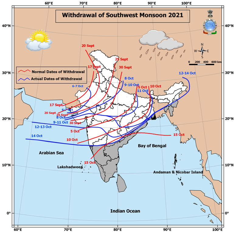
On the subject of Southwest Monsoon withdrawal yesterday IMD announced withdrawal of SWM from further areas with now only a small patch of Northeast India, parts of Coastal Odisha & Goa being the only places left out that does not belong to the South Peninsular India homogenous zone as per the IMD Classification. The traditional date of complete withdrawal of Southwest Monsoon is 15th October post which it is only those zones which fall under the influence of Northeast Monsoon effectively, as things stand most of the areas have come under withdrawal zone with only parts of Telangana, North Karnataka left out in addition to the above areas which do not belong to SPI.
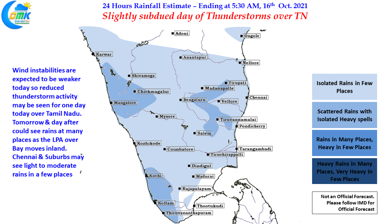

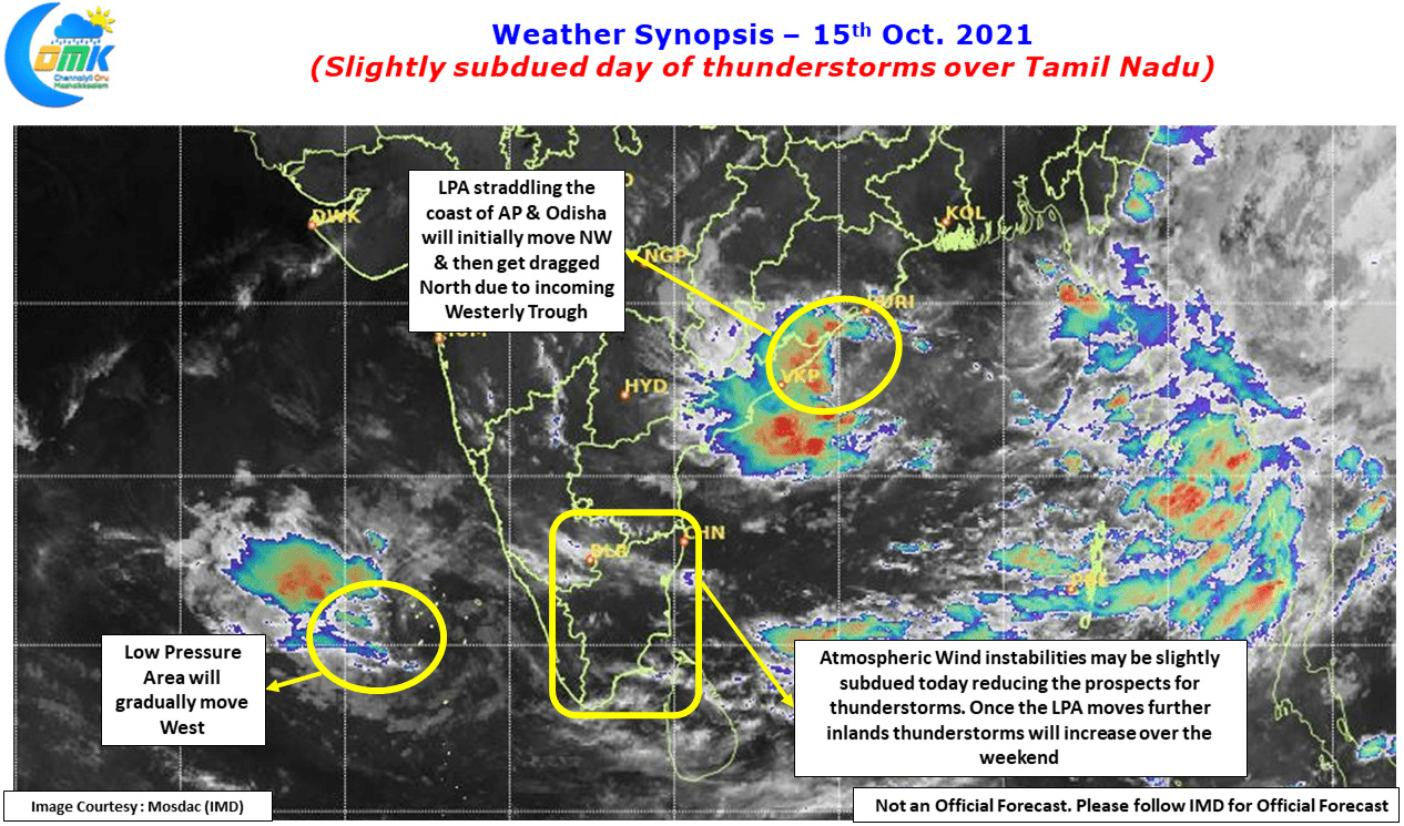
In the meanwhile today we could possibly see a slightly subdued day of thunderstorms over Tamil Nadu due to weaker atmospheric instabilities. With two Low Pressures prevailing over Arabian Sea & Bay of Bengal the interplay between the two is taking precedence in the overall atmospheric condition over Peninsular India. Tomorrow the Bay Low is expected to move inland tomorrow & day after we might see favorable wind convergence to trigger thunderstorms once again while strengthening westerlies also will bring some rains over the Ghats as well.
In all this one should not miss out on the fact we are amidst the transition season & possibly we are due a spell of dry weather as winds change from West to East. It will be that period where Westerlies may not help us with thunderstorms while Easterlies are not moist enough to bring rains from the Bay. The upcoming week could be that phase of dry weather which might be also needed for many farmers who had sown late & are expecting their harvest as well.