

Yesterday much to the relief of many rains started slowing down along the West Coast & in the Ghats. In a much needed development this would allow the disaster management teams to focus on relief & rescue operations in places that have been seeing floods & landslides with many reported in the High Ranges of Kerala. Most of the rivers saw heavy inflow both in Kerala & South TN under the influence of the extreme rains that happened between Friday late night & Saturday late night. While rains continued yesterday also they were much lesser & possible not as extreme in its intensity as on Saturday where places like Peermed recorded around 10 cms of rainfall rates.
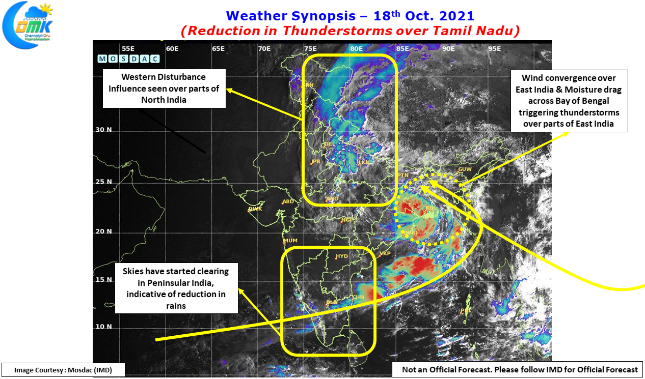
Satellite image over Peninsular India does indicate the absence of deep convective clouding over most parts of Peninsular India with generally clear to cloudy skies seen probably confirming the reduction of rains & thunderstorms overall. While there will be a reduction in overall rains & thunderstorms we will not see a complete cessation of rains as we are in the midst of a seasonal transition so there will continue to be wind induced instabilities on most days, few days it may be too weak to trigger meaningful activities while on some other occasion it may be so strong that a day of widespread thunderstorms may happen.
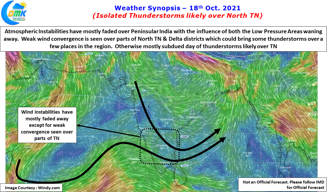
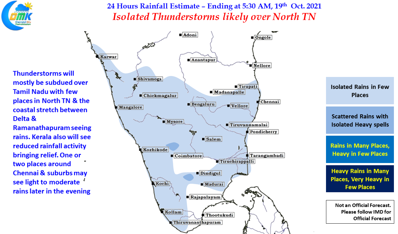
Today a few places in North interior TN & a few places along the coastal stretch between Delta dts & Ramanathapuram could see light to moderate rains under the influence of weak wind convergence shown by weather models. Over the next few days until we get a clear indication on the possible Northeast Monsoon onset window we will see thunderstorms here & there though the widespread thunderstorms from the West like last week is pretty much done for the year. Chennai & suburbs could also see one or two places come under light to moderate rains when thunderstorms pop up later in the evening due to low level wind convergence.