
Since the start of the statistical Northeast Monsoon season on 1st of October yesterday was only the second instance of the daily realized rainfall over Tamil Nadu & Pondicherry falling lower than the daily average rainfall for second straight day in a row. On 7th & 8th of October the realized rainfall was lower than the long term daily average rainfall prior to Thursday & Friday. It will be interesting to watch how next week will pan out after what could be fairly good couple of days over the weekend.
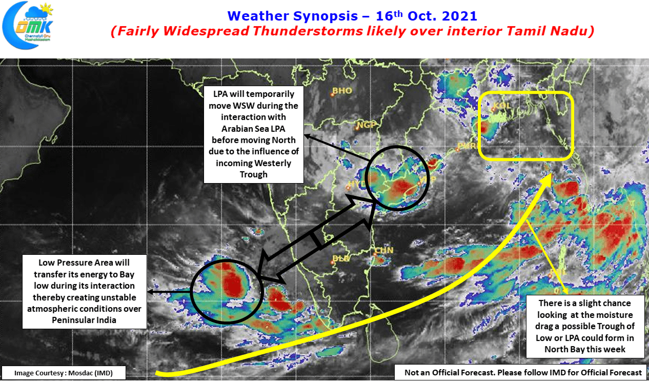
With two Low Pressure Areas in the vicinity of Peninsular India & possibly a third disturbance trying to muddle the Bay waters over North Bay the atmospheric conditions are fairly fluid over the Indian Sub Continent. Interestingly it is the fluid dynamics that is triggering its own version of atmospheric instability making it conducive for thunderstorms to develop over parts of Peninsular India. We are also likely to see in a way energy transfer between two Lows in the process trigger thunderstorms over many places.
Weather models have been struggling with the Arabian Sea pulse initially expecting it to come into West Coast and move into Peninsular India, but the pulse stayed West to model estimates & now in all probability instead of a formal Coast interaction the pulse may transfer its energy to the Bay of Bengal Pulse which now currently lies over AP / Chhattisgarh / Telangana & Odisha. As though moving forward to handshake this pulse is expect to move WSW today to connect with the Arabian Sea pulse accepting gratefully its energy before a third member comes to the party from the Middle East. An incoming Westerly trough is expected to then take control of the Low and push it towards parts of Central & North India triggering rains over these places which does not happen often during the second fortnight of October.

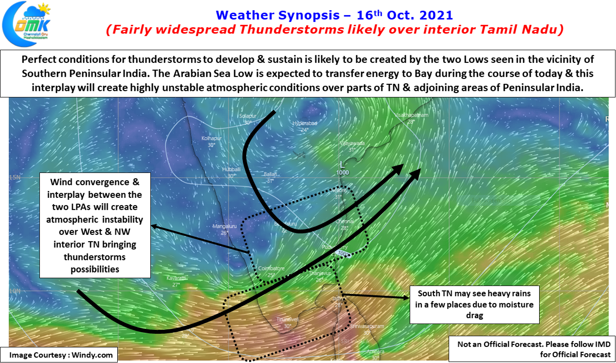
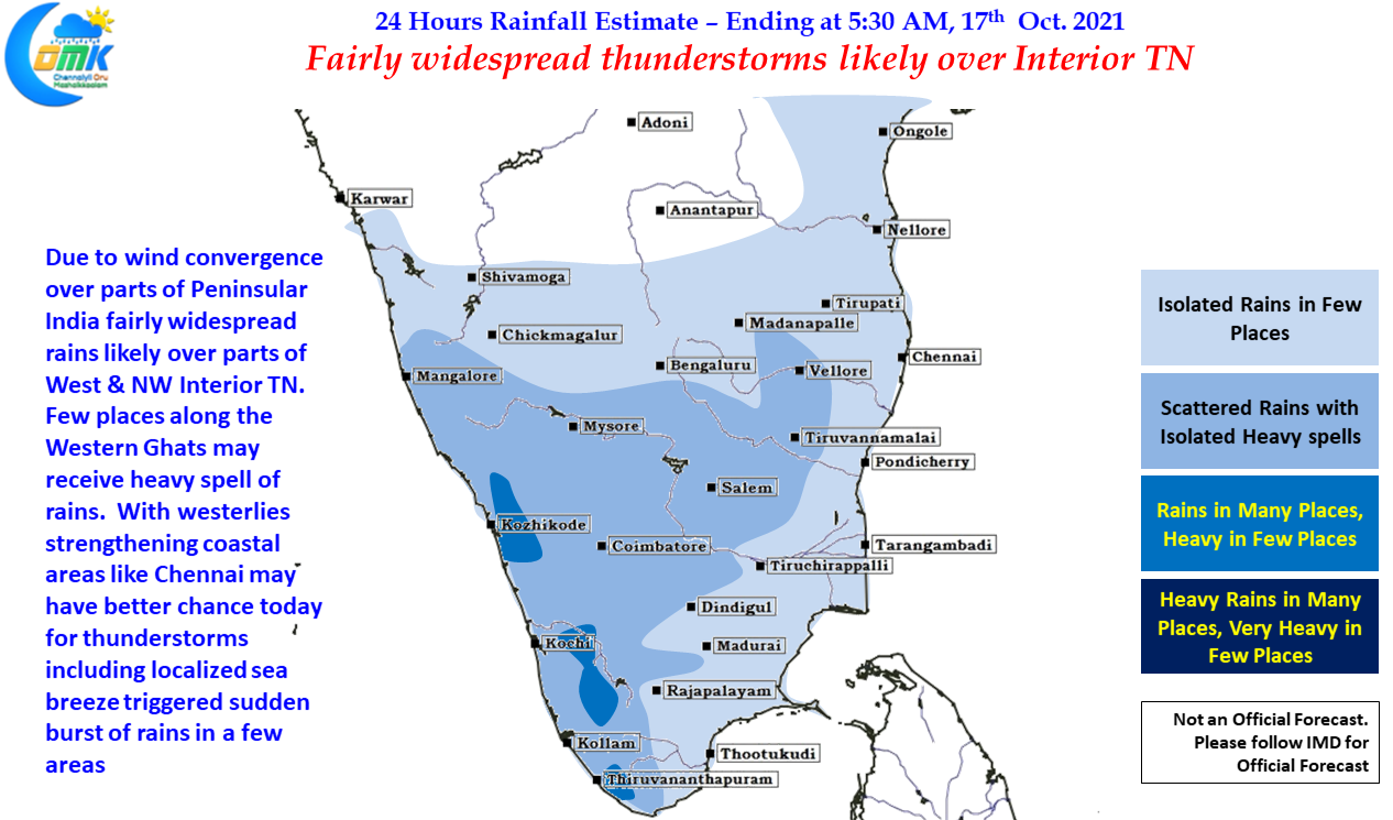
In the meanwhile today & tomorrow looks fairly good for thunderstorms over the interior parts of Tamil Nadu, particularly over West & NW Interior TN. Along with this parts of West Coast & places along the Western Ghats will also come under good spell of rains while the remnant low moves in a NW direction. With westerlies expected to be better today compared to the past few days we might see coastal areas benefitting from some of the interior thunderstorms crossing coast in addition to localized thunderstorm development triggered by sea breeze in places like Chennai