Southwest Monsoon 2022 without doubts has been very good for most of Tamil Nadu with almost all the districts seeing above normal rains so far. As a matter of fact districts like Theni has recorded nearly 3 times the average rains with 15 districts overall recording twice the average rains in the state as of…
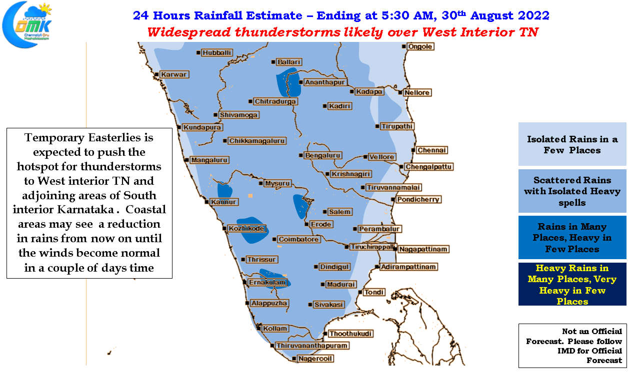
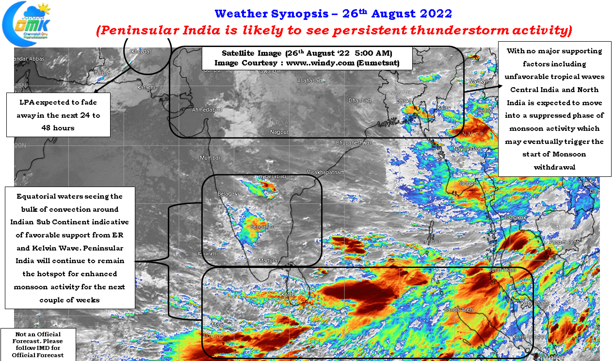
Peninsular India to see sustained thunderstorm activity
As we get closer to September we get to a stage where one starts to think of the window for Southwest Monsoon to start its withdrawal. Just like how the onset of monsoon is spread out over a few weeks the withdrawal is also spread over weeks with Northwest India the last point for monsoon…
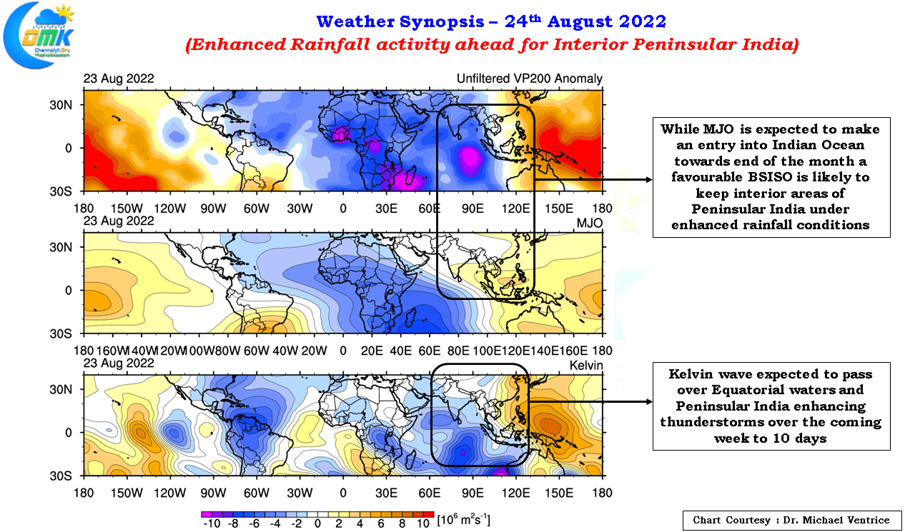
Enhanced Rainfall Activity over Interior Peninsular India
Sunday night and the early hours of Monday saw fairly widespread thunderstorms around Chennai and suburbs with some very intense groundstrikes happening over parts of the city. Subsequently we have seen thunderstorm activity persist over the KTCC region with city areas getting an intense spell during the early morning hours of Wednesday. With Monsoon dynamics…
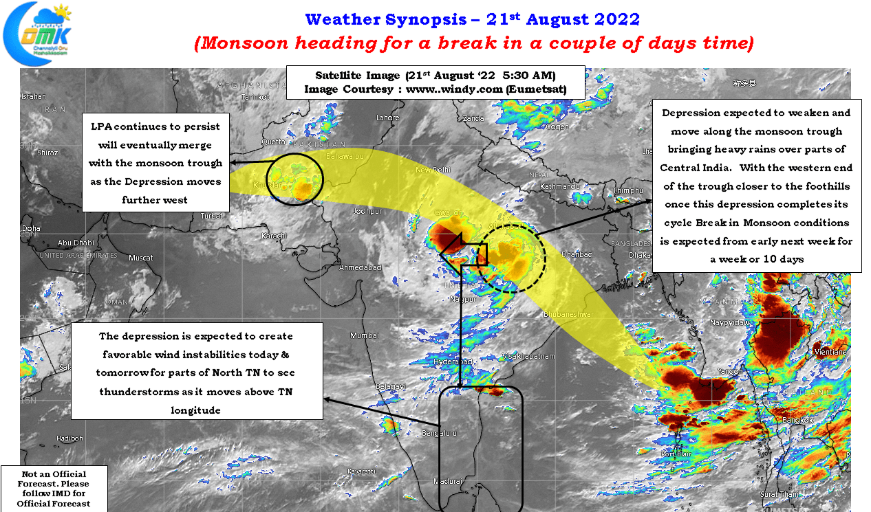
Monsoon heading for a break in couple of days time
The last time the IMD observatory at Chennai Nungambakkam crossed 1 cms was for 24 hours ending 8:30 AM on July 17th ’22. In this intervening period the IMD observatory at Chennai Airport though did record 19 mm and 31 mm on 17th & 18th August ’22, ironically the 17th August spell was nearly a…
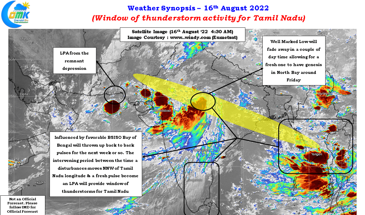
Window of Thunderstorm activity for Tamil Nadu
It is often remarked as far as weather goes you are never in isolation. Events that happene many thousands of kms away tend to influence weather at your place. Southwest Monsoon obviously is a classic example of how events from afar can trigger large scale weather phenomenons. Similarly even a mesoscale event like convective thunderstorms…