
“The illiterate of the future are not those who can’t read or write but those who cannot learn, unlearn, and relearn”
Alvin Toffler
Every disaster provides new learnings allowing not only disaster managers but also to public. A disaster resilient society would identify the mistakes during such disasters, take on board the learnings, put in place a system that would ensure such mistakes are not repeated. At this point it becomes essential to remind famous quote often mistakenly attributed to Albert Einstein “Insanity is doing the same thing over and over again and expecting different results.”
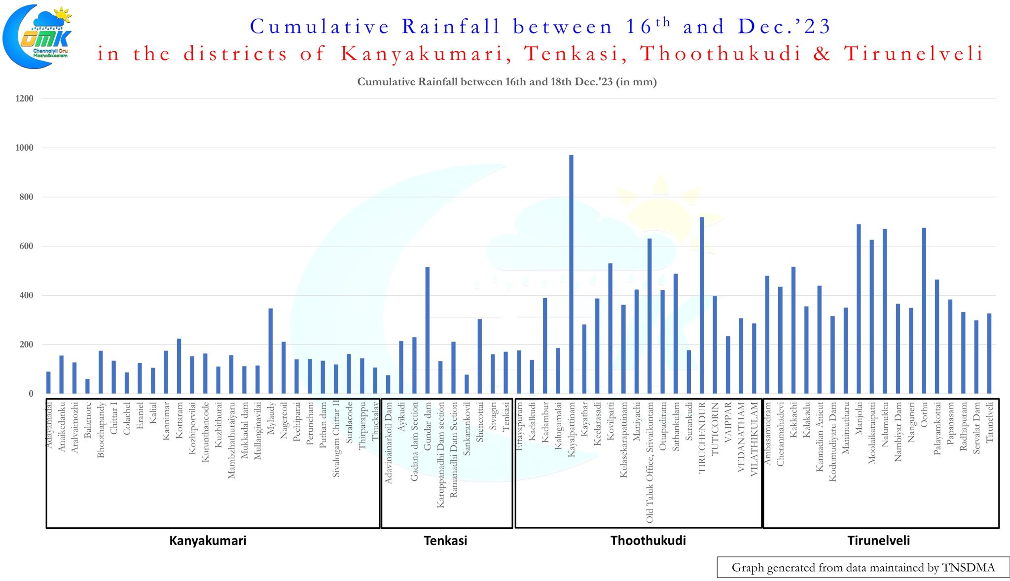
The last couple of days have seen parts of South Tamil Nadu receive unimaginable rains in the districts of Tirunelveli and Thoothukudi. While our formal record keeping may be only a couple of century old the rains that fell between Sunday and Monday morning were off the scale by every means. Kayalpattinam, the coastal town in Thoothukudi district recorded 946 mm for 24 hours ending Monday morning breaking the highest recorded rainfall in the plains of Tamil Nadu by a fair margin. Vandavasi in Tiruvannamalai district recorded 709 mm on 5th August, 1965 which was for long the highest 24 hour rainfall recorded in the plains of Tamil Nadu though places in the Western Ghats like Kakkachi, Avalanche and Ketti have recorded much higher rains.
Over the past couple of weeks the experiences from Cyclone Michaung and the floods of South TamilNadu subsequently on the one hand we can certainly be happy about how weather forecasts were able to pick both these extreme events, in the case of South TN with a much shorter lead time compared to Cyclone Michaung, providing a good starting point to put in place a clear template for disaster preparedness in the state. The recent events also indicate “Preparing for the Worst case scenario” may be the way forward though it will require a lot of education to make the community wise to understand and accept preparations for worst case scenario would mean often the actual event may be of much lesser magnitude than the scale of preparations in place.

It is always difficult to pick the point when a Monsoon season could come to an end considering weather model forecasts are mostly good only for a few days in advance. But with Ensemble sub seasonal forecasts we could possibly make a reasonable estimate of what to expect and based on that whether Monsoon may continue to remain active of wind down. There seem to be fair indications as far as Northeast Monsoon season goes the second peak which normally happens 40 days after onset has possibly been achieved. Going by the very detailed paper published by IMD in 2022 about Northeast Monsoon we could possibly expect monsoon withdrawal to happen roughly 10 days from the second peak which happens 40 days after the onset.
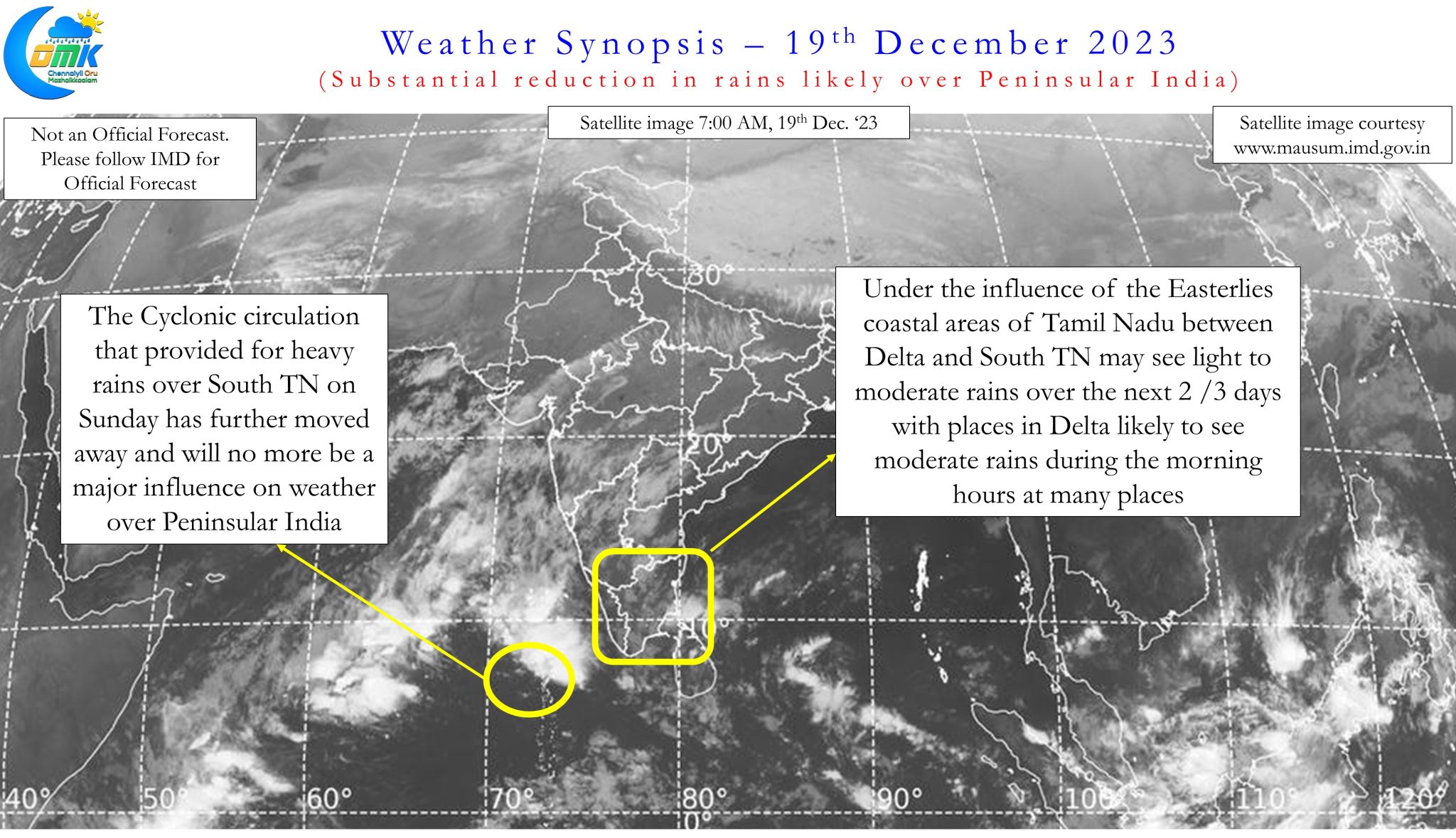
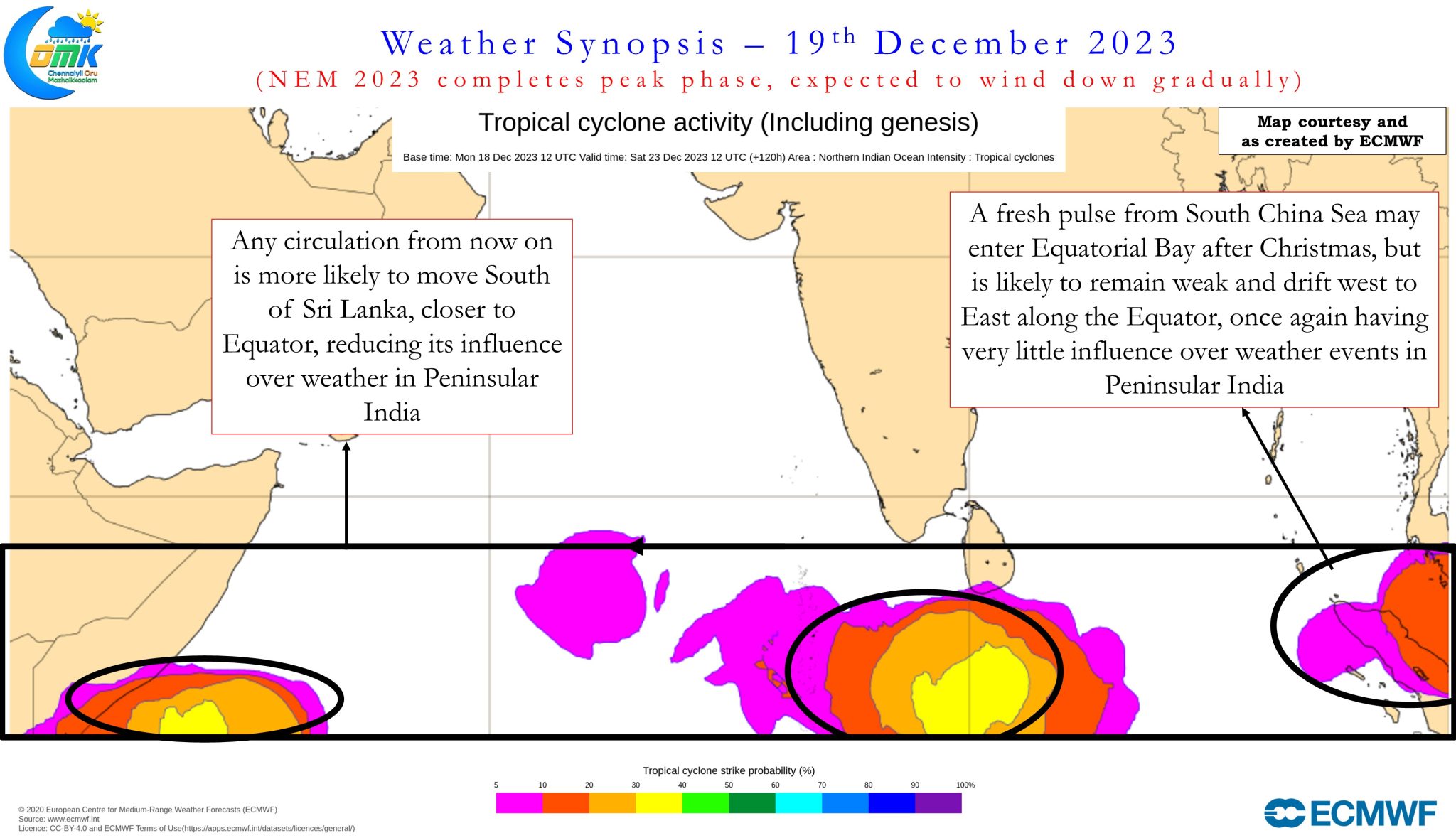
Ensemble weather models are showing increasing consistency about not only substantial reduction in rains over the coming days for Tamil Nadu but also indicate reducing possibilities of disturbances / circulations making an impact over Peninsular India with most circulations expected to move into Bay of Bengal making an East to West journey along the Equator well south of Sri Lanka. With MJO likely to reach a point where it may influence weather over Peninsular India only after Christmas over the next few days we may see the ITCZ make its journey towards Equator, initially straddling the Equator with a dual ITCZ next week and subsequently moving south of Equator reducing the possibility of North Indian Ocean benefiting from the fresh MJO pulse travelling across the Eastern Indian Ocean and Maritime Continent. By first week of January the ITCZ will be firmly south of Equator which could mean Southern Indian Ocean may spin a cyclone or two as the MJO travels through Indian Ocean during that period.
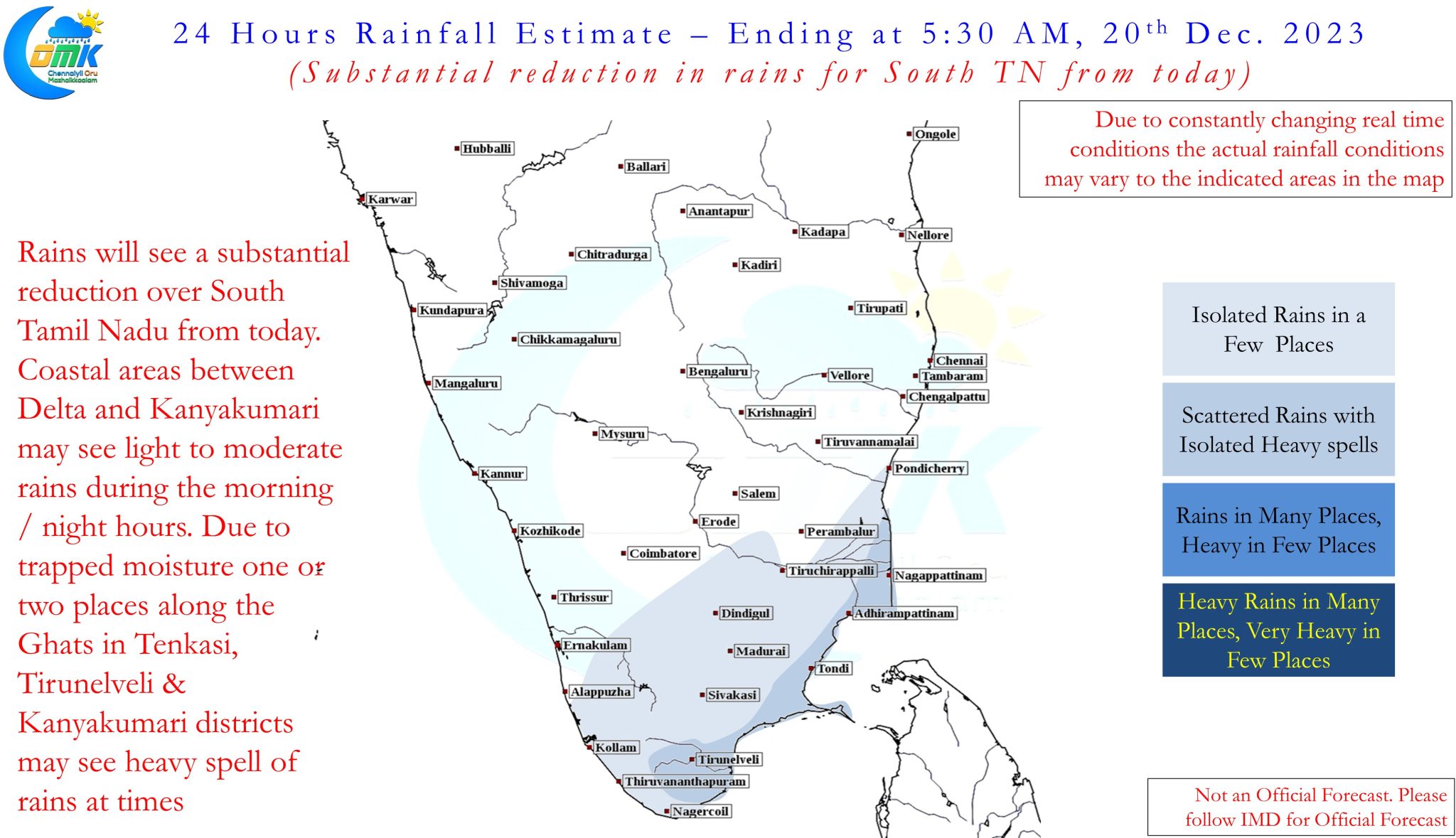
While there could be light to moderate rains over the next few days between Delta and South TN and also during the remaining days when isolated rains may continue there is a fair degree of confidence the chance for Northeast Monsoon throwing up another disturbance like a depression / cyclone or another widespread heavy rainfall episode is very minimal from now on. In short Northeast Monsoon is expected to gradually wind down over the next couple of weeks.
Just to confirm if Northeast Monsoon is expected to wind down gradually it would mean rains would also reduce over North TN places like Chennai.