
Cyclone Nivar in 2020, Cyclone Nilam in 2012 are some of the recent cyclones that made landfall close to Mahabalipuram / Marakkanam. In addition to having landfall close to Mahabalipuram / Marakkanam these cyclones shared two other characteristics as well, both of these moved from south bay area in a SE to NW direction going along the coast and both were strongly affected by wind shear during their last phase of their life cycle. In a way wind shear affects the cyclones moving in from south Bay towards North TN coast on more occasions than cyclones that move in a more East to West direction like Gaja, Thane & Vardah.
After tracking WNW until yesterday morning Mandous started to take more pronounced NW direction since yesterday morning. This phase also coincided with a bout of intensification as well pushing it to a Severe Cyclonic Storm by evening. Severe Cyclonic storm Mandous currently is estimated to be about 325 kms to the SE of Chennai and is expected to continue its movement towards North TN coast for a possible landfall later tonight around the vicinity of Marakkanam / Mahabalipuram as a cyclonic storm. IMD has indicated Mandous is expected to weaken into a cyclonic storm sometime today morning as it moves further north towards landfall.
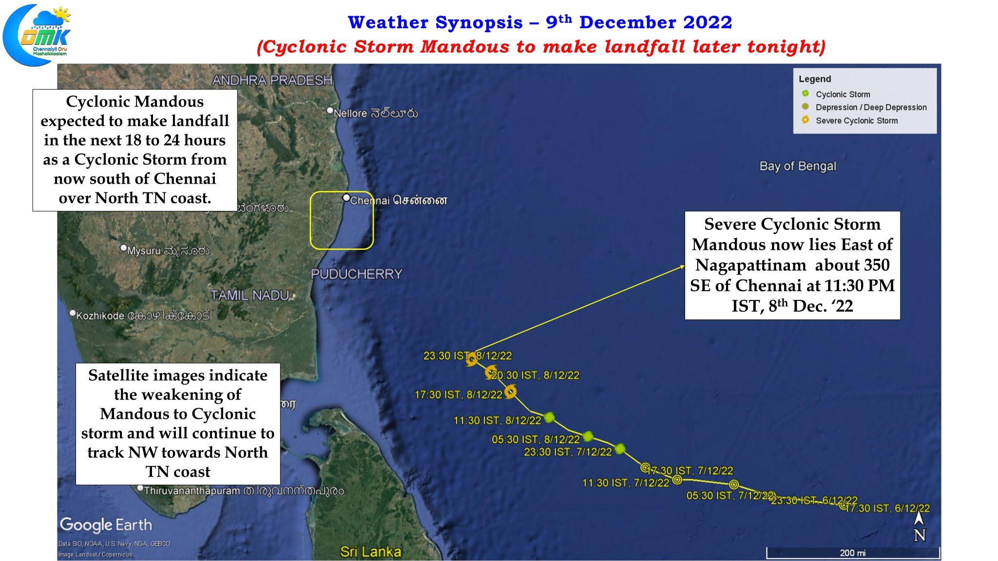
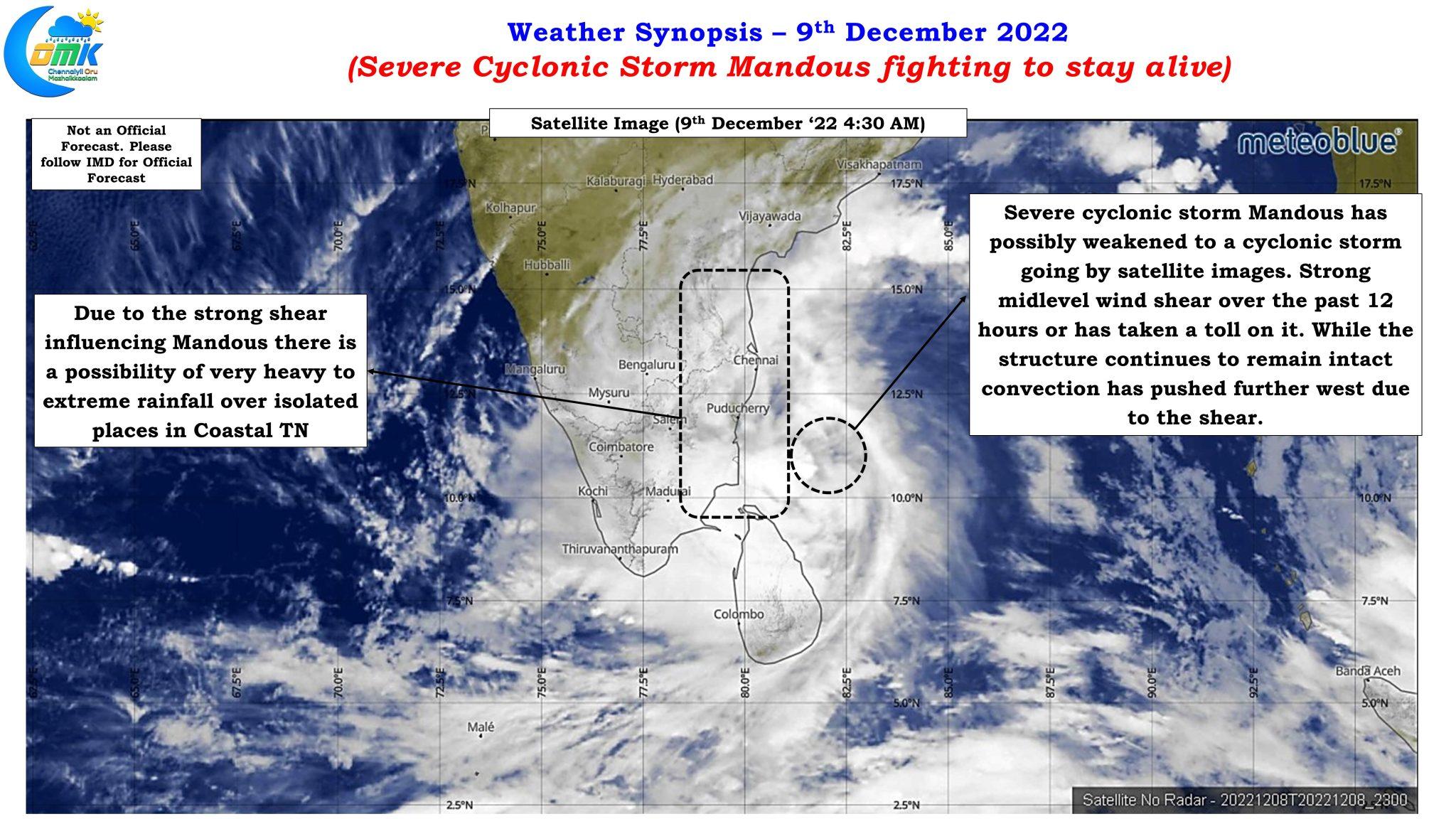
One might wonder why the title of today’s post talks about Mandous trying to stay alive when last evening it intensified into a Severe Cyclonic Storm contrary to expectations. As a matter of fact some of the most aggressive model forecasts for Mandous started to come from yesterday’s 00Z outputs with almost all the weather models estimating intensification in the last leg before landfall with no weakening shown by weather models. Satellite images though has been showing a different story with strong mid level shear playing havoc with Mandous though the core continues to remain intact which could possibly keep this continue as a cyclone until landfall later tonight. Yesterday morning also Mandous bore the scars of heavy overnight shear impact, with shear relenting during the day it picked up pace once again to intensify into a severe cyclonic storm later in the evening.
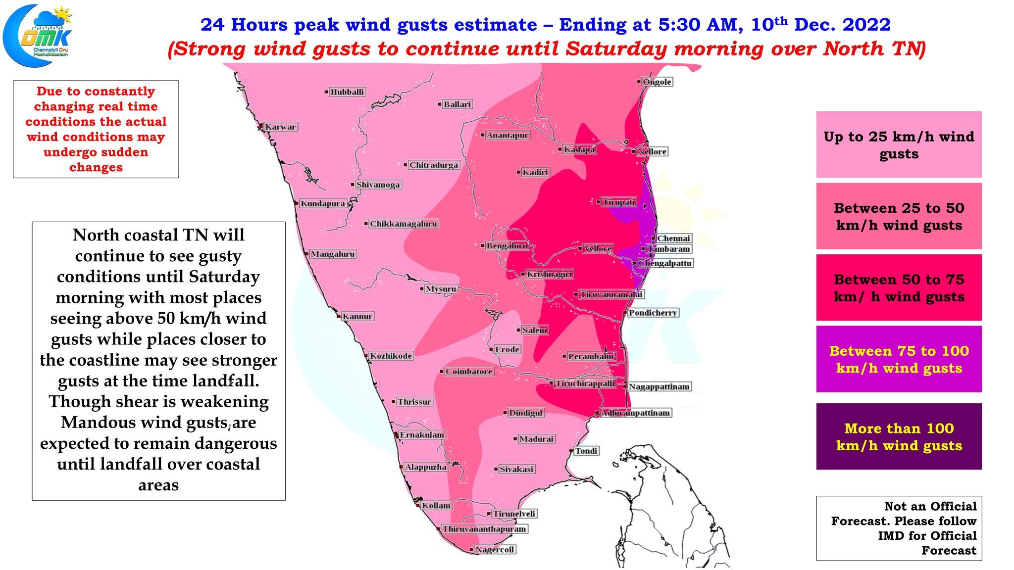
IMD expects Severe cyclonic storm Mandous to weaken into a cyclonic storm in the next 6 hours as per the 5:30 AM update. Important point to note here is weather models continue to show Mandous to move as a severe cyclonic storm close to North TN and make landfall as a fairly strong cyclone with gusts up to 100 km/h during landfall. Chennai and rest of the coastal areas of Tamil Nadu all the way from delta districts are experiencing gusty conditions since last evening and winds are expected to remain high right through the next 24 hours or so until landfall with places along the coast line between Marakkanam and Pulicat experiencing maximum wind gusts exceeding 75 km/h during this 24 hour period. Places in delta will continue to experience wind gusts during the morning hours as the cyclone remains east of Nagapattinam at the time of the post and wind speeds will slow down later in the day as the cyclone moves further up. Only real time tracking will confirm us whether the weakening trend seen in satellite images will continue during the course of the day or weather models get it right in terms of the expected intensity at the time of landfall.
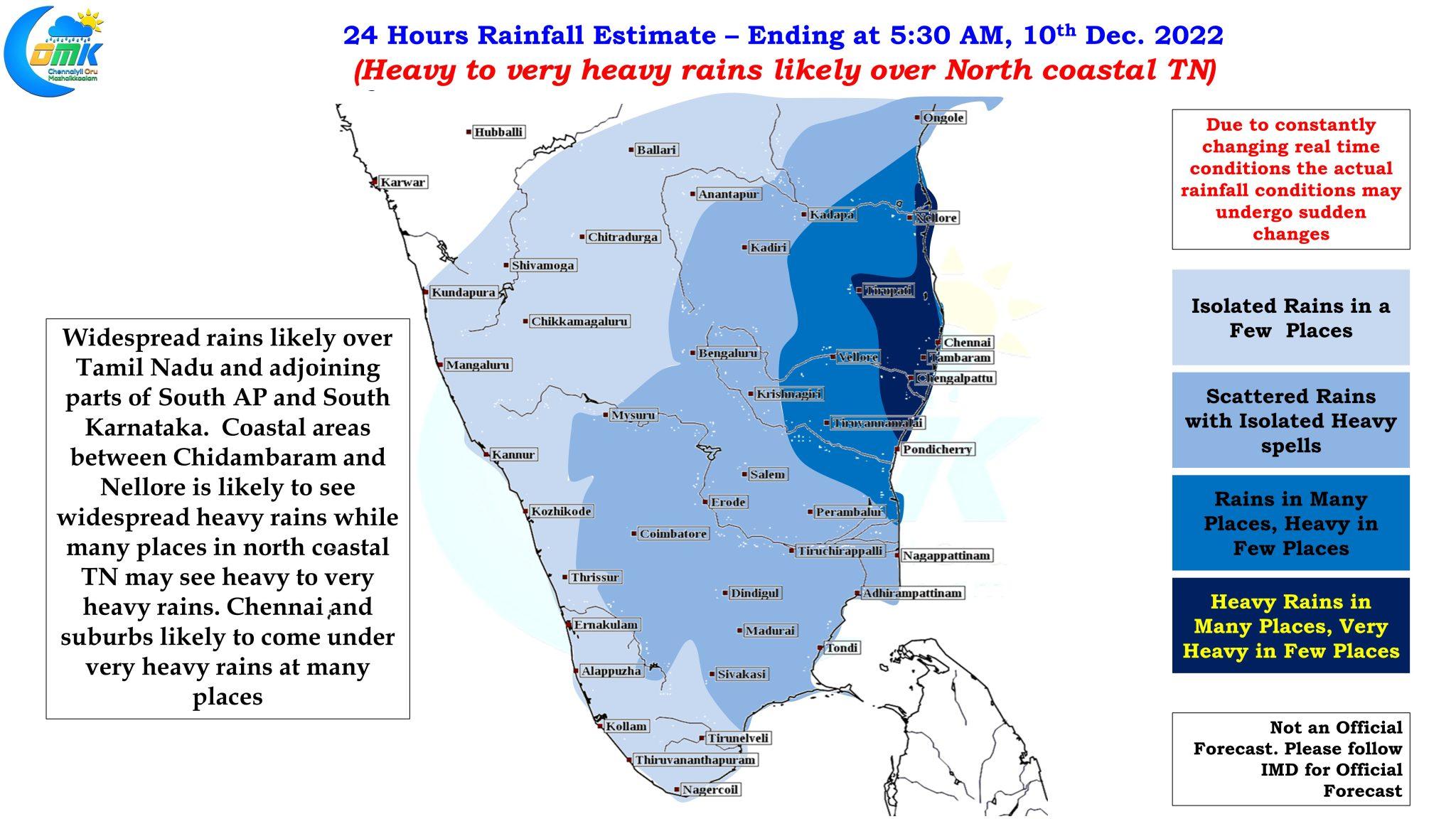
In the meanwhile a sheared cyclone is a forecaster’s nightmare in terms of rainfall estimates with convection getting offset from the center changing the rainfall dynamics drastically. In the interest of preparedness and safety today’s rainfall estimate maps have been created. Heavy to very heavy rainfall is likely along the coast of Tamil Nadu and Pondicherry particularly between Pondicherry and Chennai. Isolated places in this stretch is likely to see extreme rains as sheared convection gets washed ashore before the center completes its landfall.
Chennai and suburbs likely to see on and off rains with varying intensities until tomorrow morning before rains could subside. Localized inundation may happen in a few areas due to heavier spell of rains at times.