
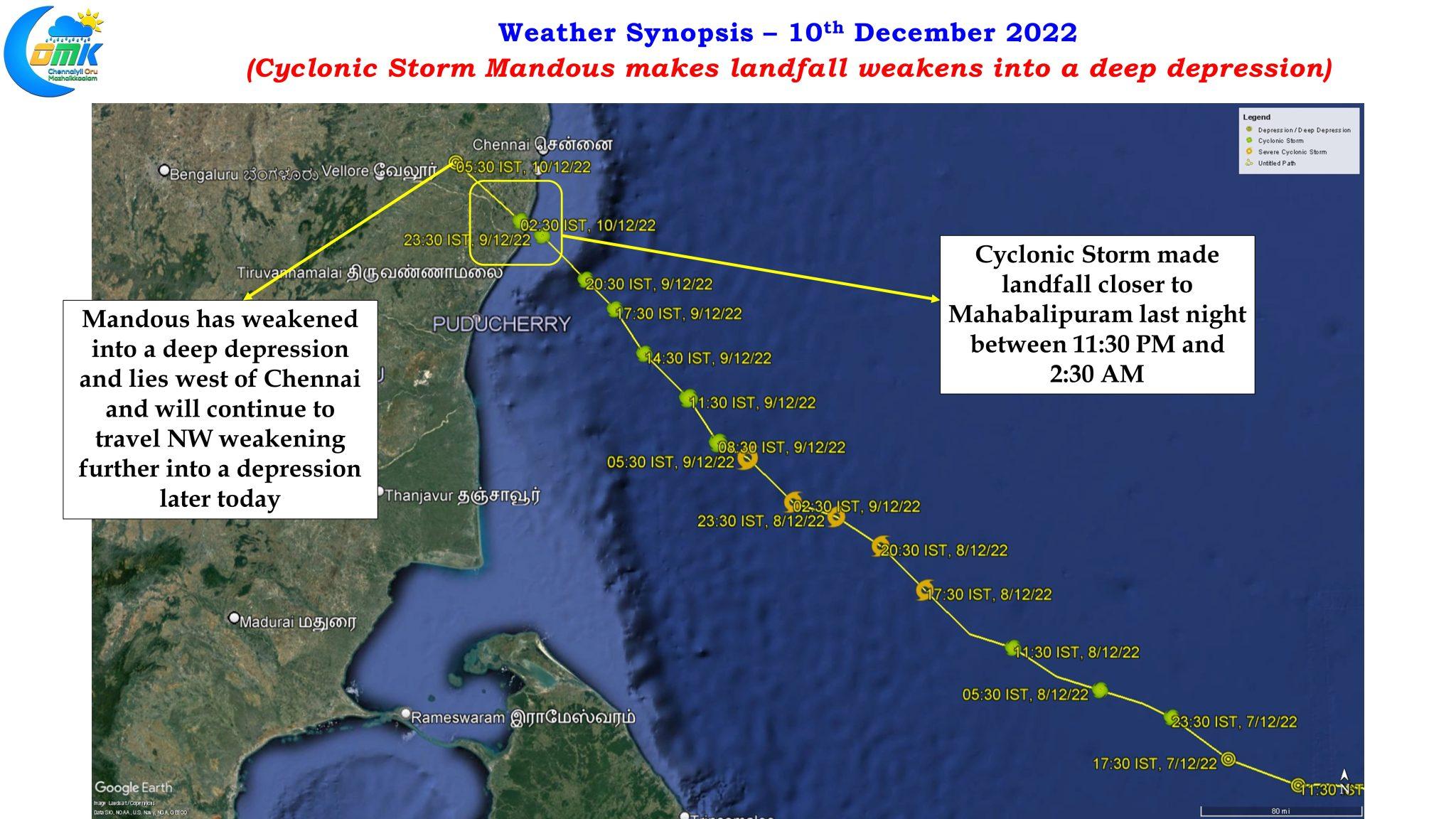
A few days back when weather models slowly started to align about a potential disturbance heading towards North TN coast there was a lot chatter among weather bloggers on whether the disturbance would head in the direction of North TN or would there be last minute twists and turns. As always the case cyclones in Bay of Bengal is never without twists and turns including Cyclonic Storm Mandous which made landfall yesterday near Mahabalipuram between 11:30 PM. Intensifying into a severe cyclonic storm for a period of about 12 hours and then weakening back into a Cyclonic storm under relentless shear it reserved the final punch just before landfall by developing fresh convection from noon until landfall bringing very heavy rains over north coastal TN and making landfall as a fairly strong cyclone.
With Mandous now weakening into a deep depression at the time of writing this post and moving further NW into the interior parts of peninsular India the battered north coastal TN areas can heave a sigh of relief from a reduction in rains which are expected to shift further west into the interior parts of Tamil Nadu, Karnataka and Andhra Pradesh. In a case of “Unseasonal Rains” some places in these areas may see very heavy rains which might catch many people off guard. Mandous is expected to weaken into a depression and move further towards Arabian sea though it remains to be seen if it would once again regenerate as a fresh LPA over the Arabian sea.
Nevertheless as the remnant circulation moves over interior areas of Peninsular India isolated places in the trijunction area of TN/KA/AP may see very heavy rains potentially triggering localized flooding in one or two places. Additionally interior areas may also see wind gusts reaching up to 40 km/h in many places which could reach up to 50 km/h in a few areas. With some parts of greater Bengaluru urban agglomeration likely to come under wind gusts exceeding 50 km/h at times we may see some impact in terms of tree branches etc falling.
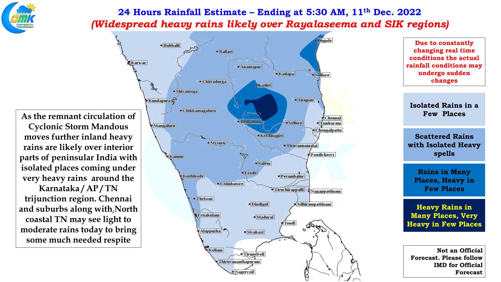
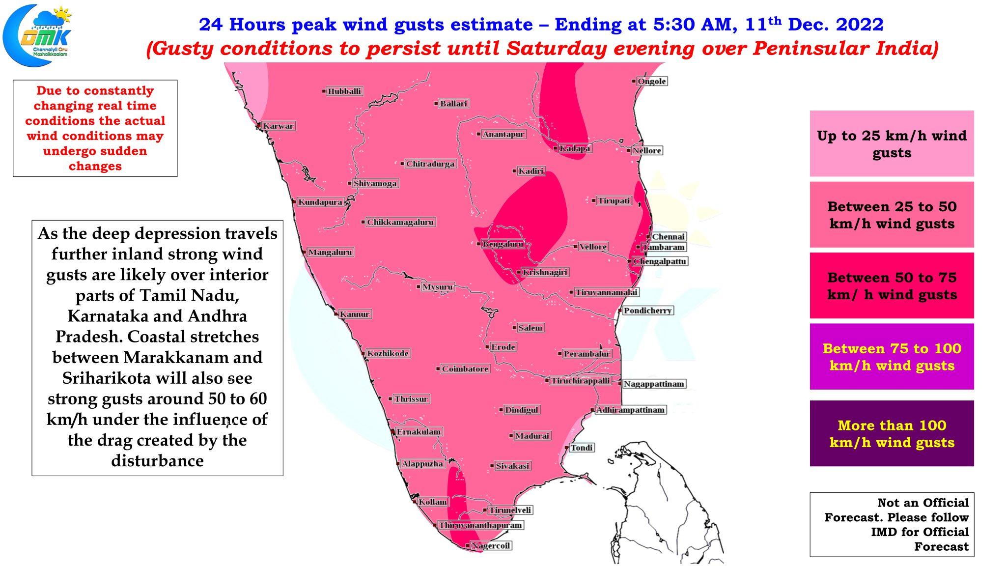
Coastal areas of North TN between Marakkanam and Sriharikota will need to remain cautious as wind gusts due to drag created by the circulation will continue to bring strong gusts until today evening. On the rain front as mentioned above widespread heavy rains is likely during the next 24 hours over the interior parts of Peninsular India while one or two places may also see very heavy rains as the circulation moves slowly. Coastal areas of Tamil Nadu may see light to moderate rains which will be a much needed relief for the disaster managers of KTCC district to quickly bring back life back to normal.
Chennai and suburbs may see light to moderate spell of rains but the heaviest rains are behind us