

After a few days of fairly active thunderstorm activity over the leeward areas of Tamil Nadu yesterday saw a relatively quiet evening with extremely isolated thunderstorms seen over parts of Chennai & suburbs while rest of the state also did not see much activity. The strengthening Westerlies to an extent meant thunderstorm possibilities reduced though some of the places around Chennai got rains as remnant moisture from the West developed into thunderstorms due to land / sea friction.
The Monsoon Low that was seen off the coast of Odisha / North AP now has moved WNW & is seen over South Odisha & adjoining parts of Chhattisgarh. Weather models indicate like the previous one this Low also is likely to become less marked soon & drift as a circulation along the northern fringes of Peninsular India bringing heavy rains to these places as it moves across. Due to this increased Westerly strength thunderstorms will remain subdued over the leeward areas of Tamil Nadu for the next 2 / 3 days though isolated localized thunderstorms may develop at times later in the evening depending on factors at mesoscale level.
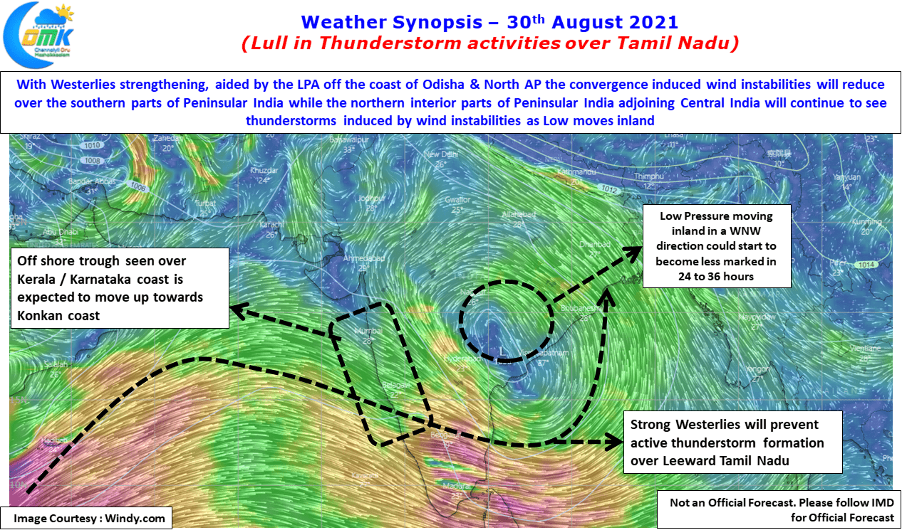
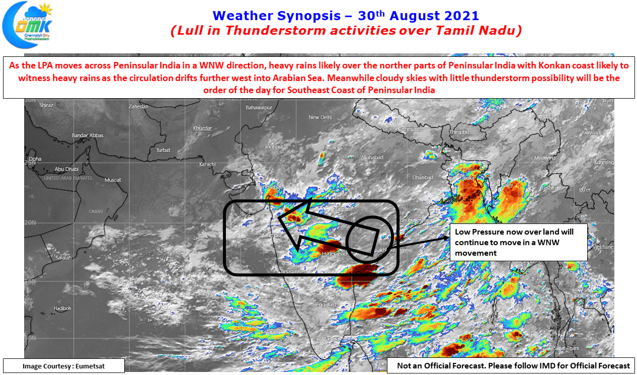
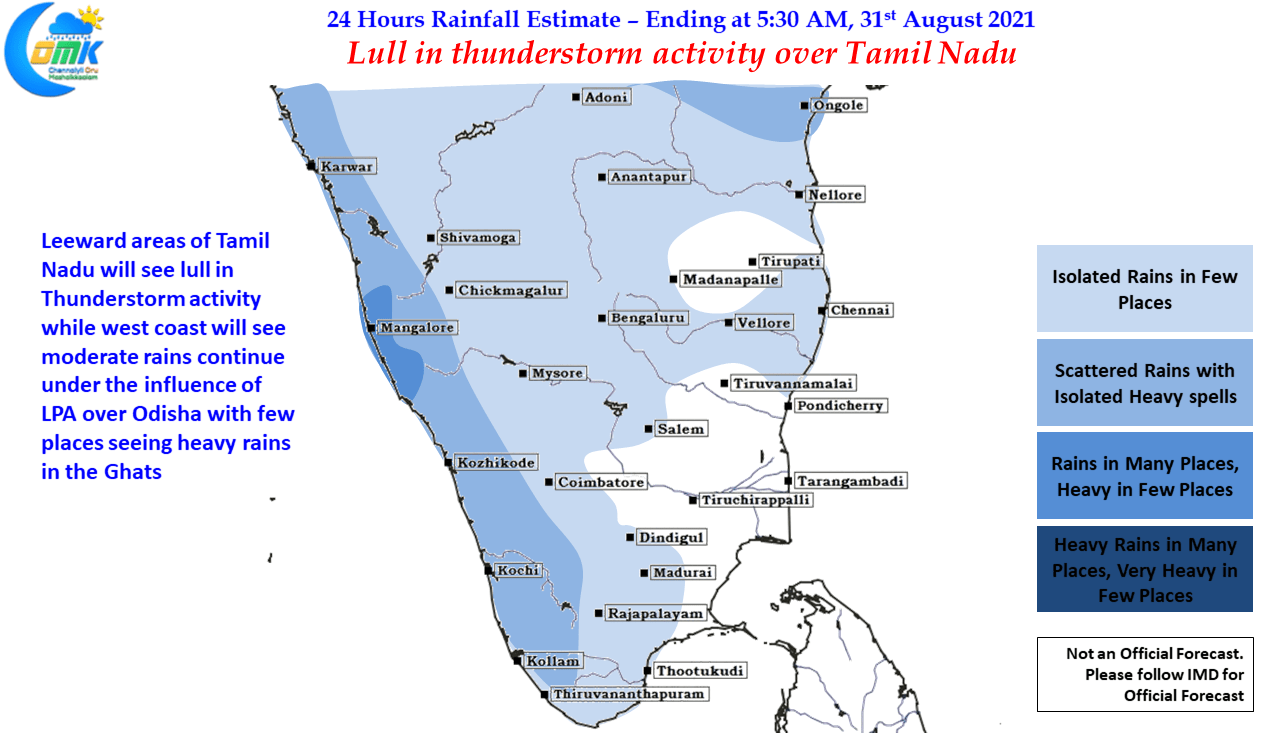
Meanwhile west coast will continue to receive moderate to heavy spell of rains under the influence of the above mentioned Low / Circulation for the next 3 / 4 days with the off shore trough seen over Konkan also enhancing rainfall possibilities for the Konkan coast & adjoining areas of the Shahyadris as well. But overall it looks like while the current phase of Monsoon Low surely has brought back some life to Monsoon dynamics it is unlikely to bring forth an active phase of Monsoon by the look of it. The last active phase of Monsoon over core Monsoon zone was during mid June, it remains to be seen if the current phase will turn out into an active phase even if it is short lived.