

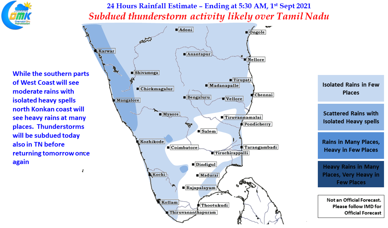
Monday was another quiet day for thunderstorms across Tamil Nadu as early morning muggy weather gave way to partially cloudy skies & then a bit of moderate sunshine. Later in the night we saw some sudden burst of thunderstorms around Chennai & suburbs, particularly to the southern areas as remnant moisture from the west developed into thunderstorms close to the coast. These gave light to moderate rains as it moved fast across towards the sea intensifying over the sea into robust thunderstorms.
This is typically the pattern when drier atmospheric conditions prevail over the leeward areas of Peninsular India, the remnant moisture derives strength through moisture & warmth from the ocean surface as it crosses coast, with the land / sea friction already providing the necessary instability for thunderstorms to develop. Westerlies are already showing signs of weakening today over the southern parts of Peninsular India, tomorrow with a east west shear zone type of conditions seen evolving over parts of TN at Mid Tropospheric Levels we can see thunderstorms return again over the leeward areas from tomorrow if not today, though today we could once again see sudden burst of rains over the coastal areas near Chennai like yesterday.
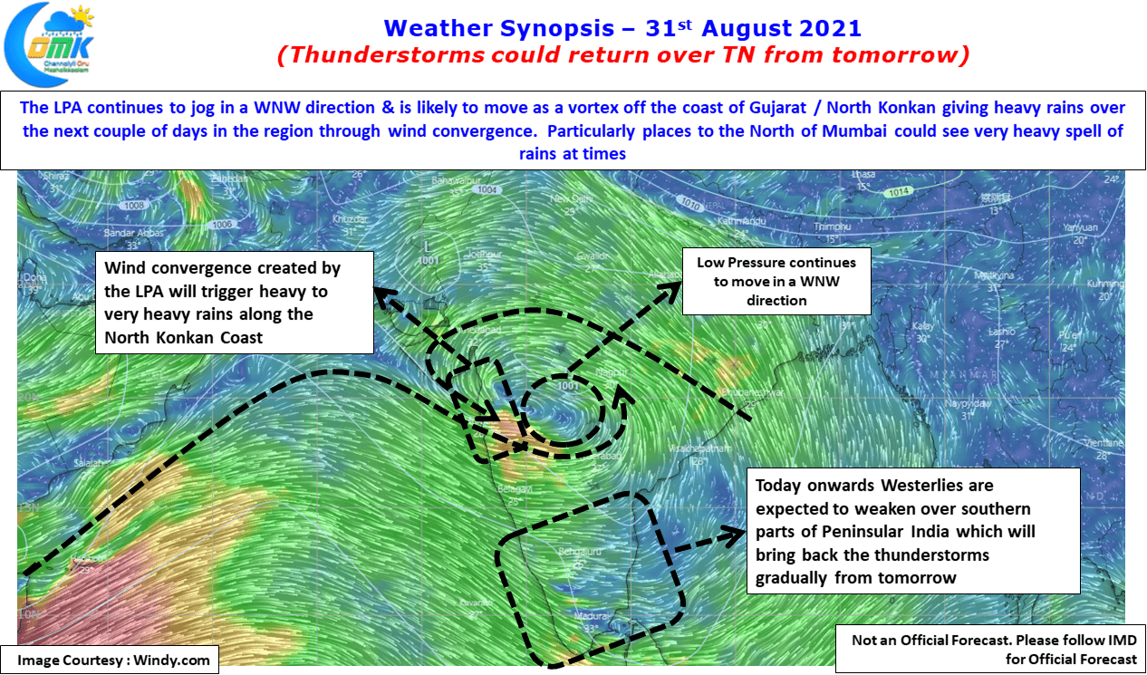
In the meanwhile today due to the convergence of winds created by the LPA to the ENE of Konkan Coast heavy to very heavy rains are likely over the places North of Mumbai. This is likely to be the pattern tomorrow. As the circulation moves further WNW parts of Gujarat will see moderate to heavy rains before gradually moving into Arabian Sea & fading away in its influence.