
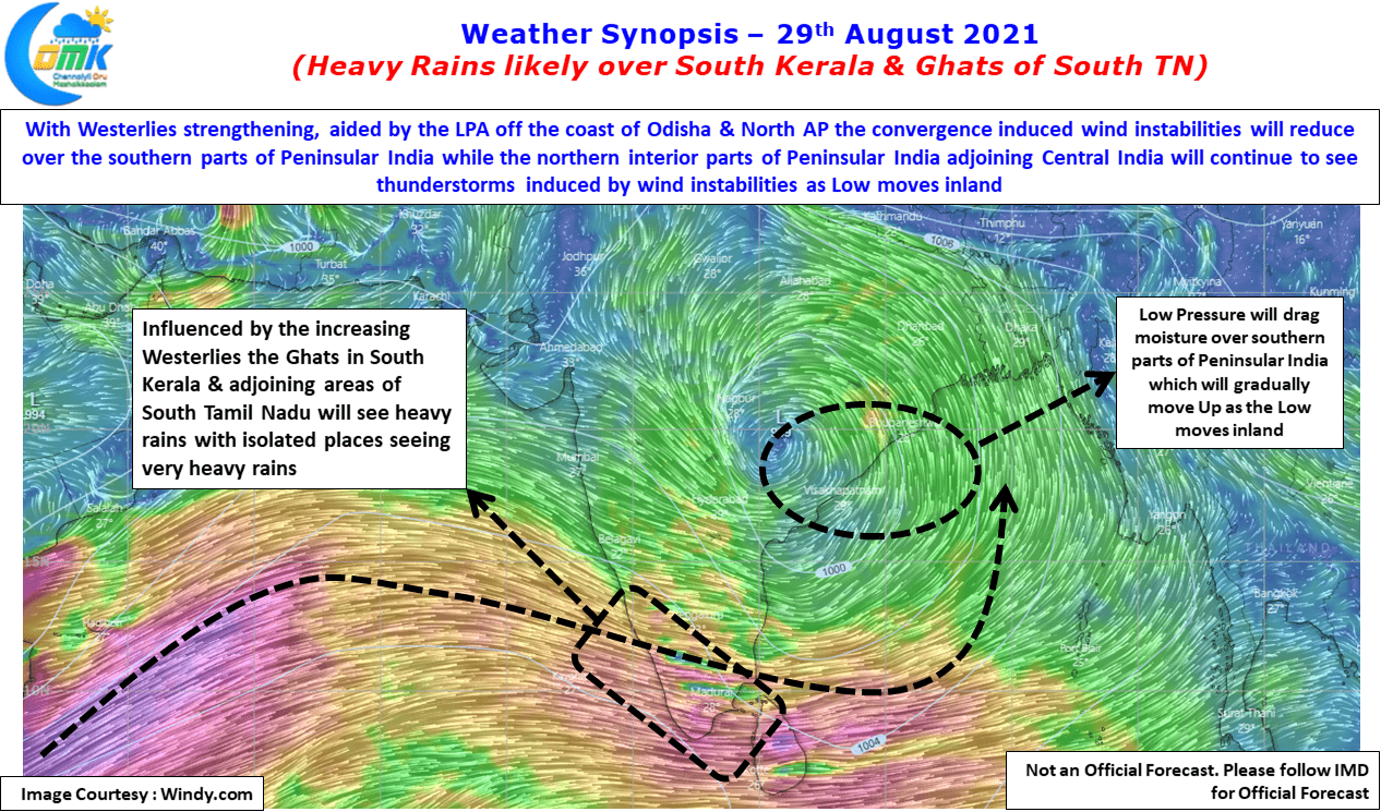
After a few days of good action over the leeward side of Tamil Nadu through Veppa Salanam thunderstorms the action now shifts back to the West Coast for what is likely to be a defining spell of rains for most parts of Kerala which has seen sub par Southwest Monsoon so far. The Monsoon low that has formed yesterday off Odisha / North AP coast will swing the pendulum back to monsoon dynamics from thunderstorm dynamics that benefitted places like Chennai through near daily rains for the past few days.
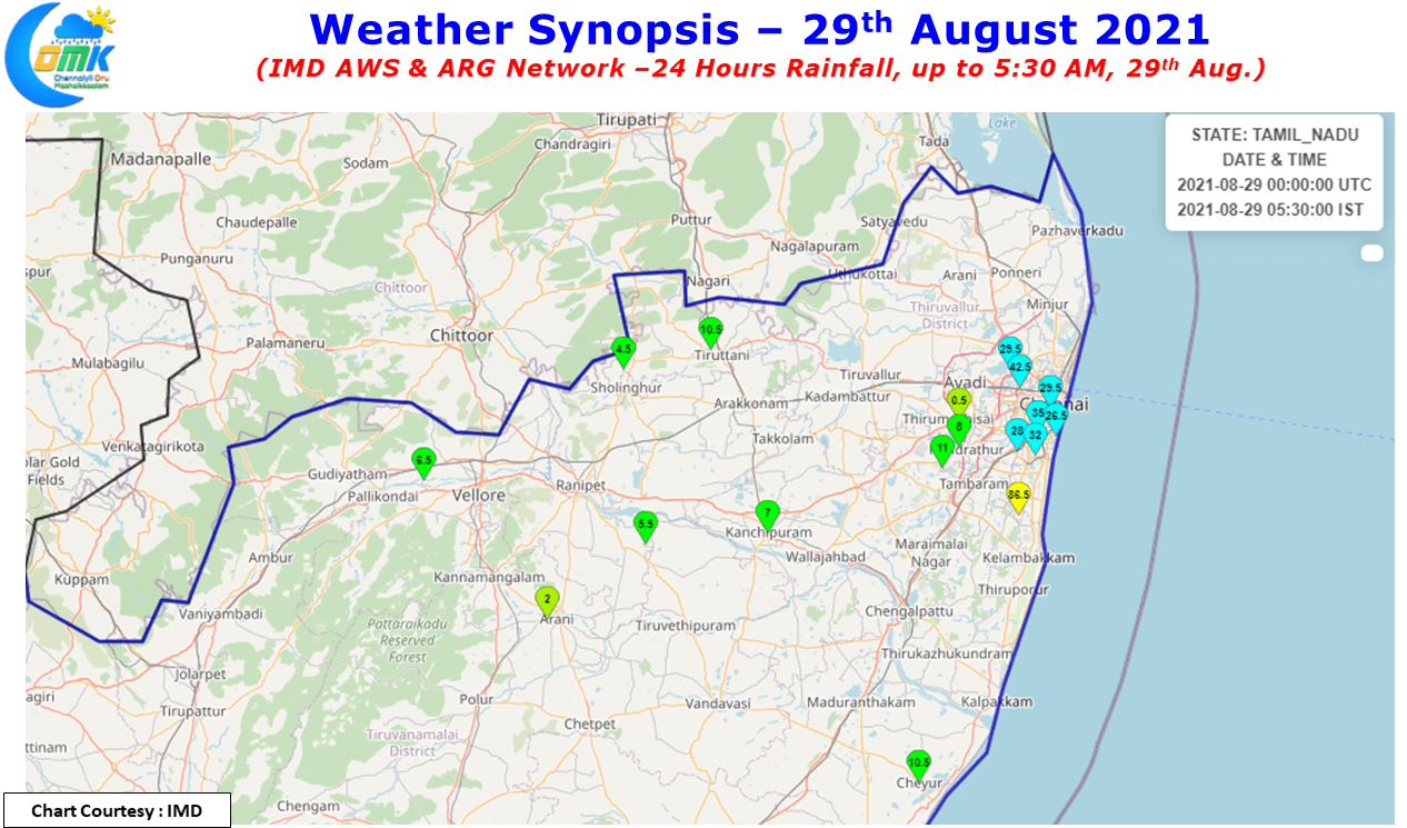
Yesterday saw late evening thunderstorms develop close to Chennai & Suburbs just as one was wondering if the formation of LPA has spoilt the chances for one last spell of intense thunderstorms for us. The late afternoon & Evening hours was relatively quiet with just parts of Cuddalore dt enjoying a fairly intense thunderstorm cluster move across the dt after forming over the Eastern Ghats of Kalvarayan Hills. After dusk as many thought nothing much is likely to happen remnant moisture coming in from the west in the form of weak rain bands started intensifying closer to the coast triggering one intense spell of thunderstorms which saw many private weather stations record 5 to 7 cms of rains. The IMD AWS at Sathyabhama University in Kelambakkam recorded 75 mm as some of the southern areas came under intense thunderstorms.

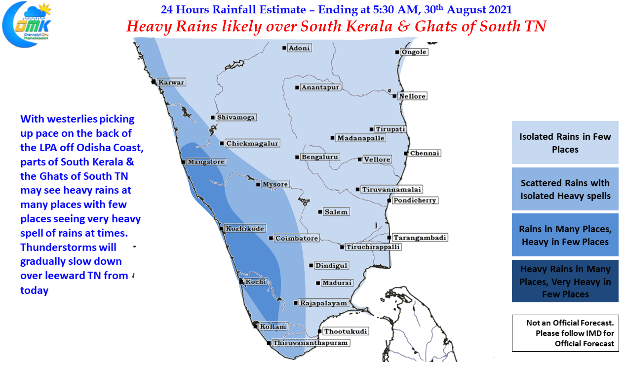
The next few days though is going to be West Coast time, already the last couple of days have seen moisture increase along the coast & isolated places record heavy rains in Kerala, today & tomorrow is likely to see many parts of the state record good rains. As the LPA now off the coast of Odisha starts moving inland in a WNW direction the monsoon convection will start moving up. Like the previous low about 10 days back this one also is likely to be weak & less influential once it moves inland becoming a Cyclonic Circulation soon. Nevertheless it is likely to provide enough rains over the northern parts of Peninsular India & adjoining Konkan ghats as it moves across Central India.
In the meanwhile the leeward areas of Tamil Nadu will see gradual reduction in rains though today some parts of North Coastal TN may see isolated thunderstorms due to weak wind convergence that could spill over into the region later in the night. But overall most of this week we may see reduced rains over the East coast of TN while places along the Ghats & South TN could see better rainfall prospects.