
Indian Meteorological Department in its All India Weather Inference had indicated the possible genesis of a Low Pressure Area over the Equatorial Indian Ocean and adjoining areas of Southeast Bay of Bengal on 27th January. While it may be a surprise to see a tropical development at this time of the year considering only 26 disturbances (Depression or stronger) have formed over North Indian Ocean in the last 130 odd years since IMD started recording tropical disturbances in the past La Nina years like 1955, 1975, 1985, 1999, 2006, 2011 etc have seen disturbances formed during January / February indicating the probability of tropical disturbances during La Nina years does exist even during January & February months.
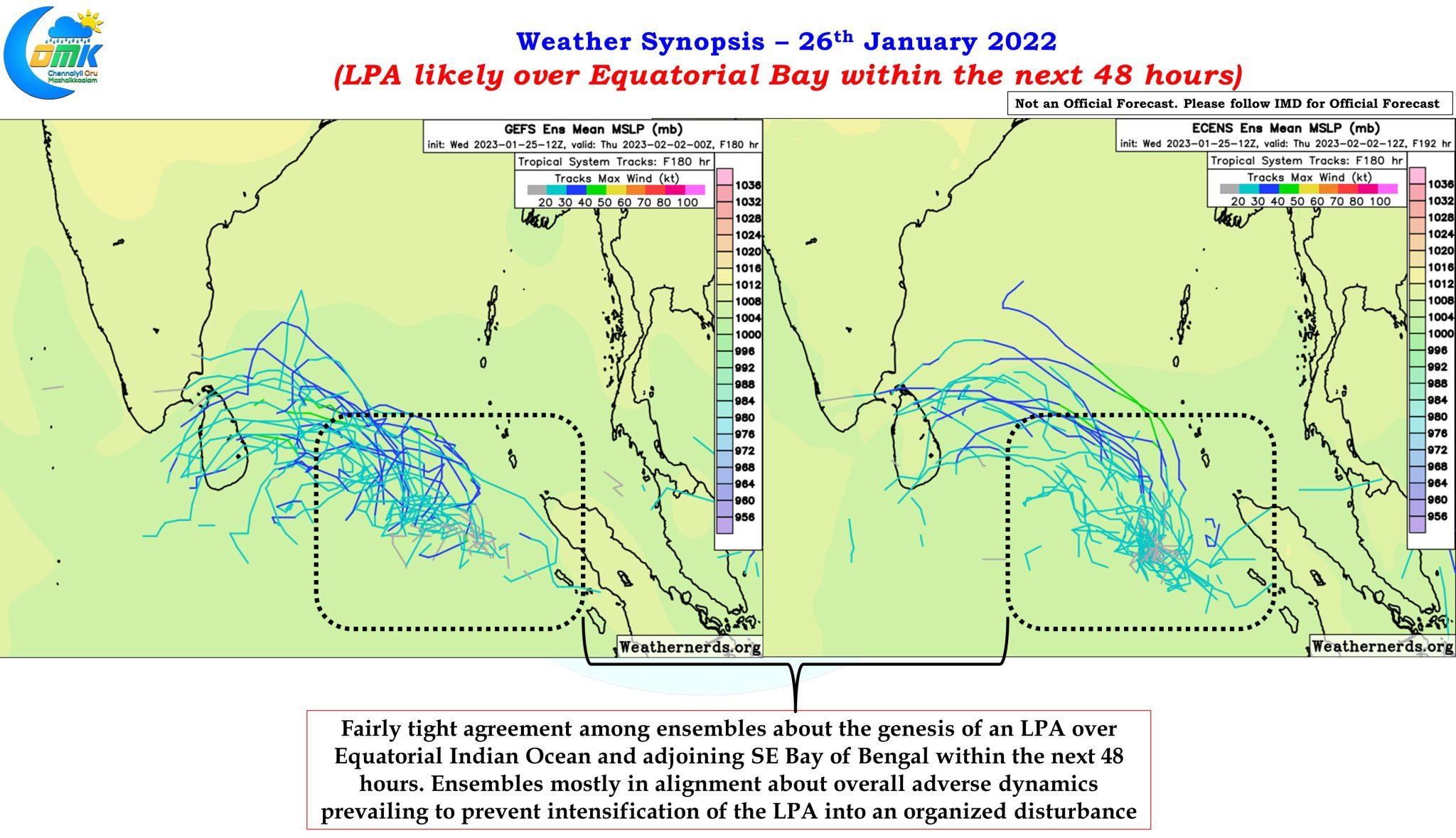
Ensembles of both ECMWF and GFS are fairly consistent about the genesis of the LPA over equatorial waters within the next 48 hours or so and drift along the equatorial waters towards southeast coast of Sri Lanka. The ensembles are also fairly consistent about the overall atmospheric dynamics being adverse for this LPA to strengthen into an organized tropical disturbance over the course of next week or so. The WSW track indicated by a lot of members later in the life cycle of this disturbance is indicative of the overall weakening trend as well.
Considering tropical disturbance during Jan / Feb is not exactly unexpected during La Nina years the most critical question that arises is “Would it trigger a heavy rainfall episode?” Does the presence of MJO over Indian Ocean guarantee a heavy rainfall episode? To answer these questions it becomes essential to quote Thiruvalluvar once again.
எப்பொருள் யார்யார்வாய்க் கேட்பினும் அப்பொருள்
குறள் 423 – அறிவுடைமை
மெய்ப்பொருள் காண்ப தறிவு
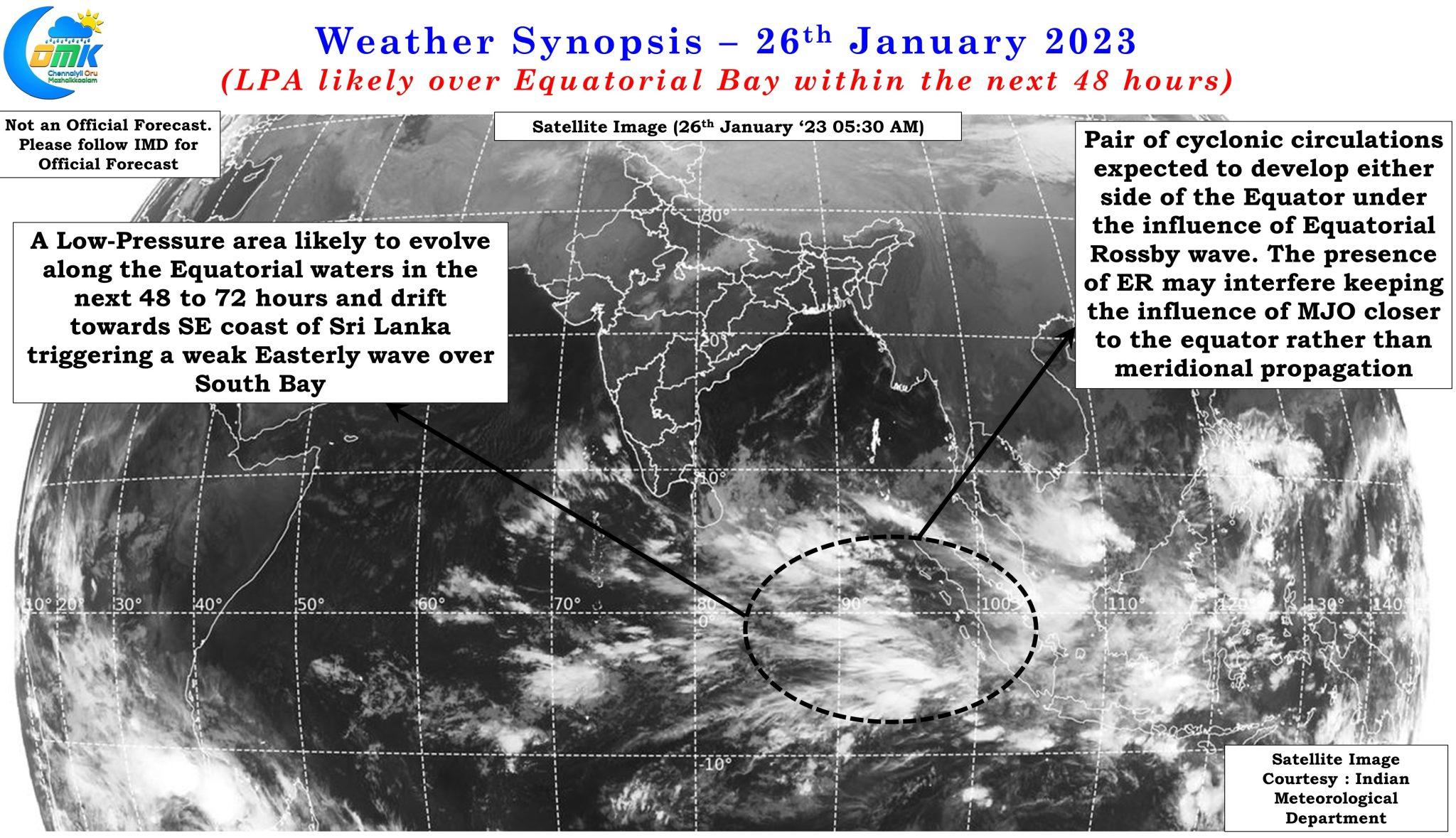
If one were to look at the satellite image it is fairly clear Indian Ocean is presently under the influence of multiple tropical waves and not just MJO. The influence of Equatorial Rossby wave is seen in a pair of circulations that seem to be developing along the equatorial waters over Eastern Indian Ocean. The presence of ER wave is not only playing a role in the genesis of an LPA over Equatorial Bay but it is likely to interfere and modulate the influence of MJO as well preventing meridional propagation of MJO’s influence thereby restricting its strongest influence to the equatorial waters. This could potentially mean while the LPA is expected to influence a fair bit over the equatorial waters its influence may not be strong enough to bring about a heavy rainfall episode over Peninsular India.
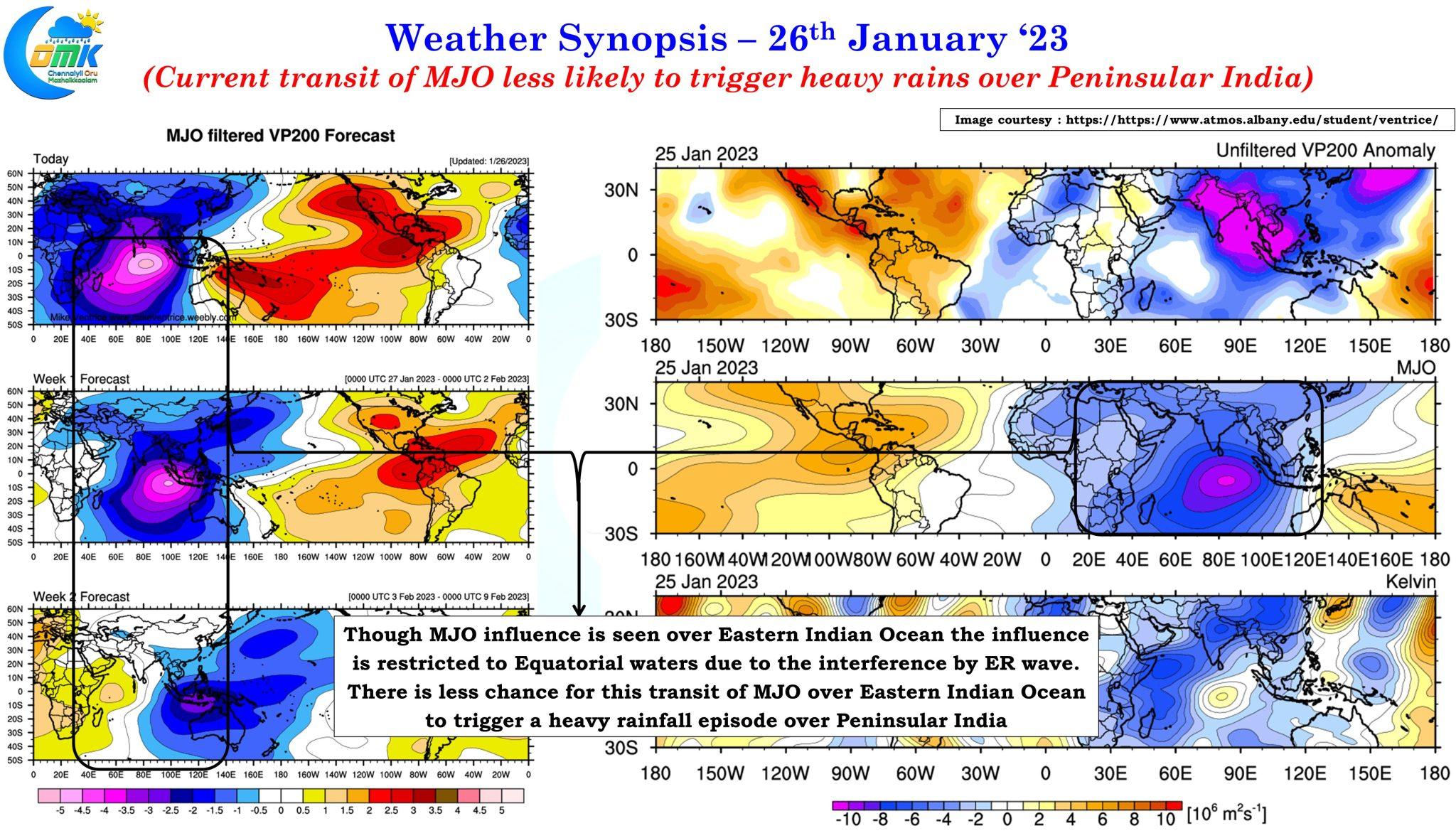
The filtered MJO forecast for the next two weeks also indicate the spatial influence of MJO may be seen mostly over the equatorial waters with places to the south of equator enjoying a better share of MJO influence compared to places north of equator. A few days back we had posted about how delta farmers need to be wary about rains during the last week of January & first week of February due to the arrival of a weak Easterly wave with an embedded circulation. COMK continues to advice delta farmers to be prepared for rains during this period and advance their harvest of paddy crops if possible so that they could harvest & store the crops safely before the rains arrive.
The COMK take on the current state of things is the arrival of MJO does not guarantee a heavy rainfall episode over Peninsular India and the chance for a heavy rainfall episode on account of this developing LPA is less. But the alert given through our earlier post still remains valid and farmers are advised to be alert.