

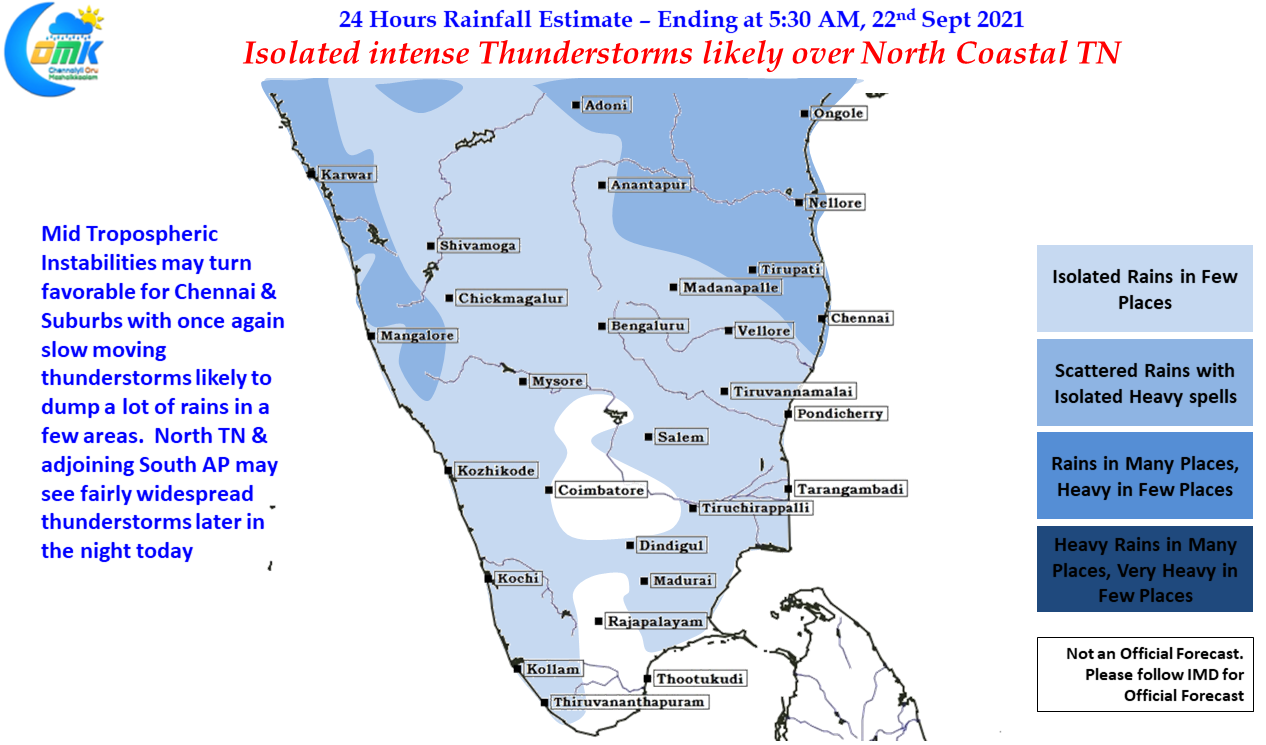
Monday once again saw classic September thunderstorms in action over many parts of the state, with places in North TN slowly coming into groove. Parts of Villuppuram, Tiruvannamalai & Cuddalore dts saw some very intense thunderstorms last night. Kalasapakkam in Tiruvannamalai district which had already crossed 100 cms rainfall for the year a couple of days back recorded nearly 16 cms yesterday taking its overall total to nearly 1300 mm for the year with more than 3 months of the year left including the Northeast Monsoon Season. The IMD AWS in Tirukkoilur recorded more than 11 cms for 24 hours ending today morning. Not far away the TNSDMA RG at Manampoondi recorded more than 16 cms for the same time.
Looking at the wind charts there are a couple of interesting developments which might keep the weather bloggers in a constant state of excitement. While on the one hand most weather models & possibly bloggers as well expect a never ending Southwest Monsoon, if one were to look deeper at the overall Monsoon Trough structure & possibly the wind pattern in the coming days it indicates what we would call as an atmospheric state of flux a precursor to seasonal wind change. There is likely to be a string of pulses that is going to come into Indian Ocean along the Monsoon Trough under the influence of the weak MJO pulse that is struggling to get going, for the umpteenth time this year on a global circuit, of which one or two may end up as a possible LPA.
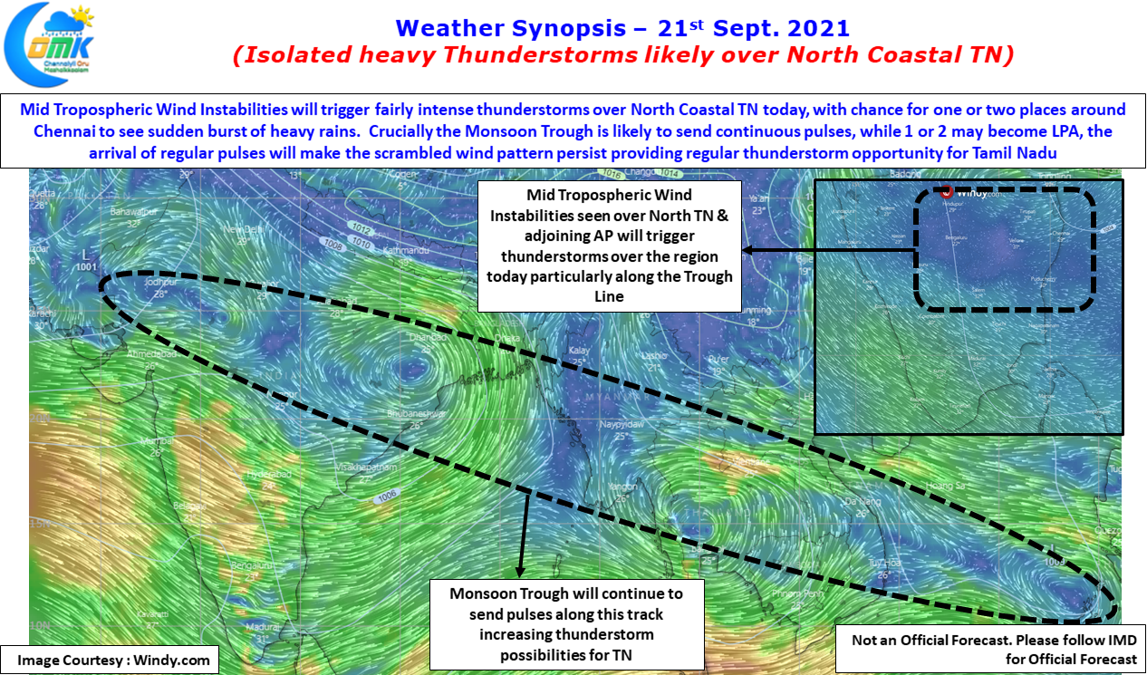
But crucially it will continue to create scrambled wind pattern / atmospheric wind instabilities for Peninsular India & Tamil Nadu to see thunderstorms during the process. Also one has to keep in mind with September Equinox nearing it will be tough for the Monsoon Trough to sustain itself over North India for long so despite what models show in terms of extended Southwest Monsoon / Late Withdrawal etc it will be a matter of only a couple of low intensity pulses that will flip the conditions or possibly MJO moving into the Eastern Side of Maritime Continent is enough to accelerate the withdrawal from Northwest India.
While Chennai saw moderate to fairly intense thunderstorms in some of the southern suburbs & southwest suburbs things look better today with the Mid Tropospheric Wind Instabilities favorably placed for North Coastal Tamil Nadu. As has been the case for the past couple of days the thunderstorms are expected to be slow moving dumping a lot of rains during the process. There is also a faint chance that some of the thunderstorms while coming closer to the coast may undergo sudden intensification bringing a few places in Chennai & Suburbs under extreme spell of rains later in the night.