
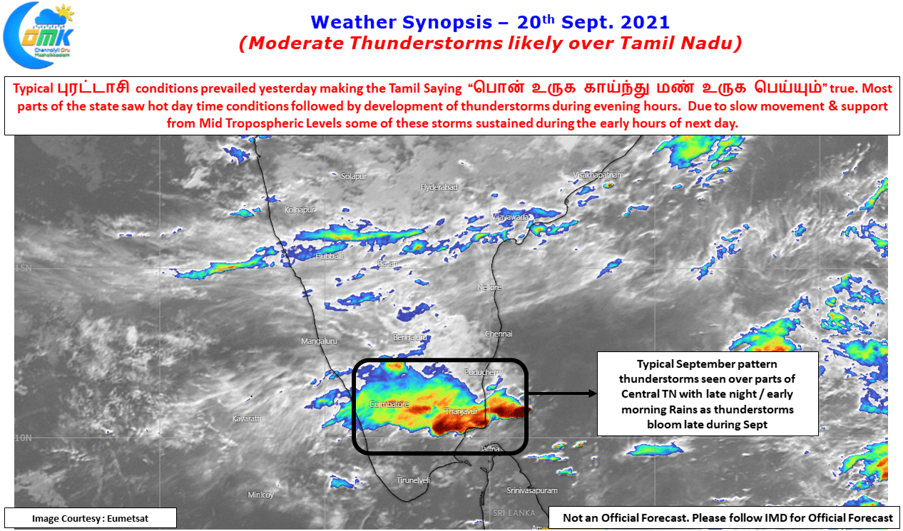
Yesterday & today morning showed up perfect September thunderstorms indicative of the famous Tamil Saying about the Tamil Month “பொன் உருக காயும், மண் உருக பெய்யும்”. There is a reason why September sees increase in temperatures even though it is a monsoon month. The angle of Sun’s rays starts shifting down towards the Southern Hemisphere as things churn towards summer in Southern Hemisphere. It is pertinent to point out here that September 23rd is the day of Southward Equinox, so in a couple of days time Sun’s angle of rays will stop falling over Northern Hemisphere which will continue for the next 6 months until around March 20th when it once again touches the Equator.
September storms are a precursor to the transition thunderstorms as Monsoon withdrawals start happening. In a way they mirror the pre Monsoon thunderstorms of March / April that are known to stay longer, bloom late in the night & carry on till the next day morning hours. Parts of Central Tamil Nadu, particularly around Trichy saw thunderstorm activity just as the day broke today. Yesterday turned out to be a day of fairly widespread thunderstorms except for possibly the coastal stretch between Chennai & Delta and pockets of South TN around Virudhunagar dt. The prevalence of Mid Tropospheric Instabilities are a big factor in such a widespread thunderstorm day.


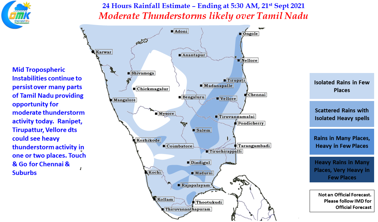
With Mid Tropospheric instabilities continuing to persist today also things look good for some moderate thunderstorm activity to continue today also over Tamil Nadu. While it is always a case of 50:50 the day after such widespread thunderstorms a couple of things give an indication that today may not be an exactly quiet day of thunderstorms for TN. Mid Tropospheric instabilities normally ensure even after a fairly widespread day of thunderstorms conducive conditions are created plus the hot afternoons due to the September effect could mean sufficient energy is made available during the day for convective process to get triggered. While it may not be right to expect a repeat of yesterday’s widespread thunderstorm activity today could nevertheless provide for a decent day of rains.
Another important development worth pointing out is the Northward shift seen in the Mid Tropospheric Instabilities which could mean starting today North TN & adjoining areas of South AP & South Interior Karnataka may see better thunderstorm possibilities compared to South TN. This also improves the chance for Chennai as well. While today looks touch & go for Chennai, it may be a surprise if both the IMD observatories do not record at least 7 to 10 cms of rains by the time the weekend approaches. Here is hoping for an active spell of thunderstorms over Chennai this week.