
What a night of Thunderstorms it turned out yesterday for Chennai & Suburbs. While some parts of the city got light to moderate showers around 10 PM, it turned out to be only a precursor to the sound & light show that happened after midnight & continued till the wee hours of Wednesday. Though the origins of the thunderstorms could be traced to the cells from the interior areas West & Southwest of Chennai the storms intensified closer to the coast and in few cases bloomed right along the coast line, indicated by the nearly 90 mm/hr rainfall rate that was received in some of the places along the shoreline.
In all this carnage that happened around Chennai and suburbs few places got completely missed out like Kelambakkam which recorded just 3 mm while western suburbs like Ambattur & Ayapakkam recorded around 2 cms when places a few kms to the East of theses locations like Anna Nagar recorded 7 cms of rains. Not only Chennai & surroundings got good rains but also parts of Tiruvannamalai & adjoining Kanchipuram dt also got good rains with Kalasapakkam once again recording 13 cms of rains.
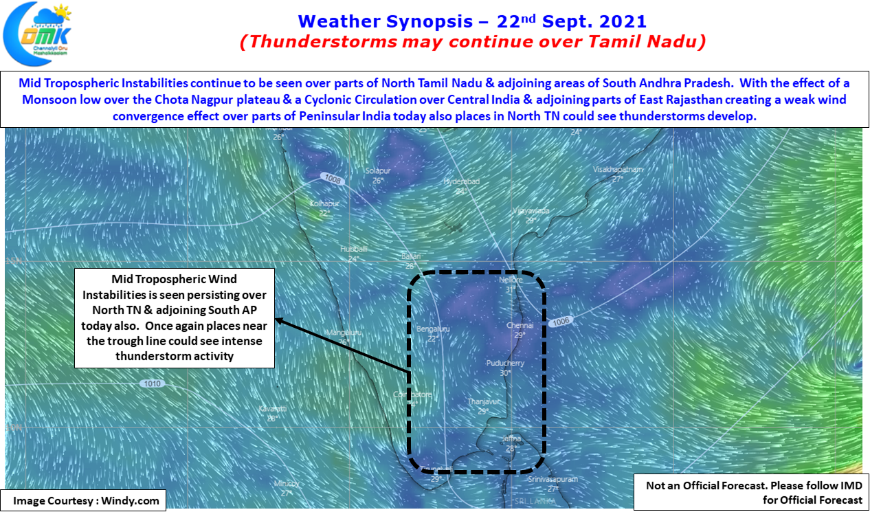

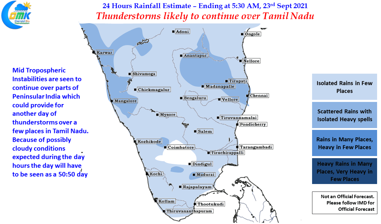
It is always a tough day to give weather inference when thunderstorms happen up to the early morning hours followed by what could be a cloudy day for most part of the day time hours. While Mid Tropospheric wind conditions continue to be seen in an unstable nature over parts of Peninsular India which in theory could give another decent day of thunderstorms for Tamil Nadu we may have to go with a 50:50 call because the coin could flip either ways due to unfavorable early conditions.
Nevertheless considering it is September, known for late night thunderstorms, don’t be surprised if Chennai & suburbs see another day of intense thunderstorms in one or two places & the city clocks another 3 to 5 cms spell of rains in many places.