
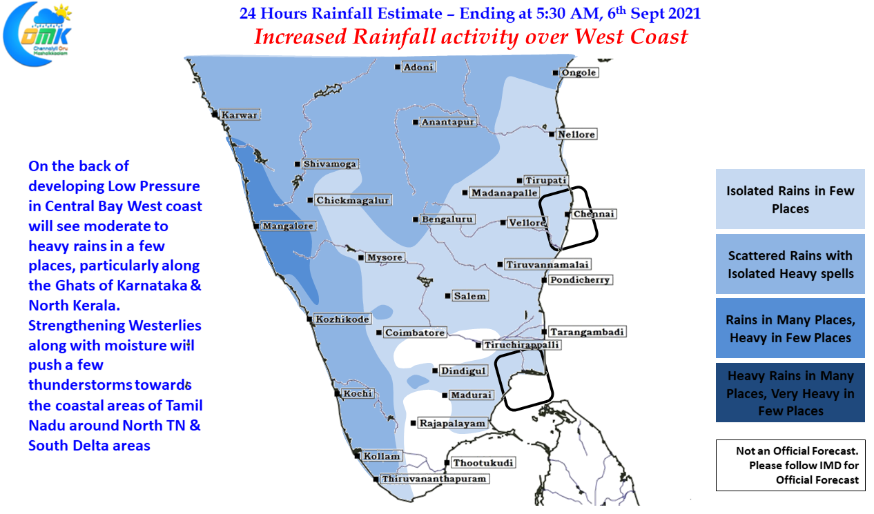
The much anticipated Low Pressure over Central Bay area is likely to develop within the next 24 hours or so bringing back some mojo back into monsoon dynamics which is currently at 9% lesser than long term average with less than 4 weeks left for the statistical Southwest Monsoon season to end. While the upcoming low may help the rain fed regions of Central India, the Northern parts of Peninsular India, Shayadris etc there is still a bit of uncertainty on how much southern parts of Western Ghats over Kerala & adjoining parts of Tamil Nadu & South Karnataka will benefit from the revival of monsoon dynamics. Nevertheless there is likely to be an increased rainfall activity over the West Coast starting from today due to strengthening westerlies aided by the developing LPA.
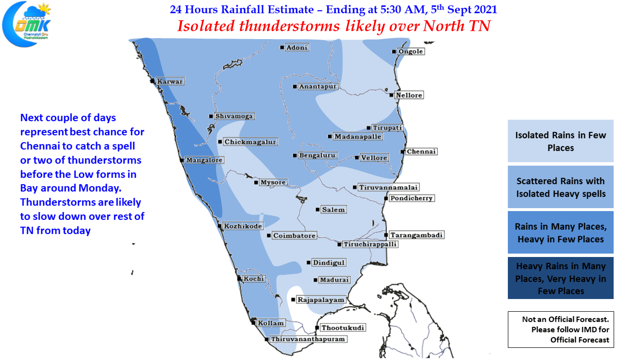
In the meanwhile on the thunderstorm front for leeward areas we will see a gradual reduction in rains as West coast picks up pace. Yesterday we saw some very intense thunderstorms over South Coastal TN between Delta dts & Ramanathapuram dt. particularly around the Pattukottai dt which has been seeing almost daily thunderstorms & fairly intense ones too on a regular basis. Interior areas also saw isolated thunderstorms but the bulk of action was over the coastal areas possibly sea breeze induced being the reason.
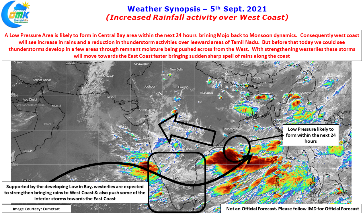
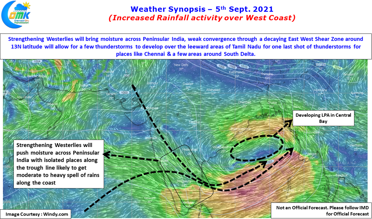
With Low Pressure Area expected to form we might see a reduction in the effect of sea breeze for the next couple of days. But there is going to be an incidental benefit on account of strengthening Westerlies due to LPA. We might see more moisture being pushed across Peninsular India plus the increased westerly strength will allow for the thunderstorms to reach the coastal areas unlike the earlier days when mostly weak steering was the bane for coastal places like Chennai.
So next 12 to 36 hours could be a good opportunity to keep tabs on possible triggers from the West for a spell or two of rains over Chennai & Suburbs