
Models Propose & Nature Disposes is a phrase regular weather watchers around Chennai can relate very well. For the past few days Chennai & surrounding areas received moderate to heavy rains on paper, as estimated by models, but yesterday when most models expected a much quieter day southern suburbs of Chennai & adjoining areas of Chengalpattu dt received moderate to heavy spell of rains at many places to the order of 3 to 5 cms overall. While city areas of Chennai, particularly North Of T.Nagar did not record any rains and remained a spectator right through the evening southern areas of Chennai & suburbs did enjoy a good spell. Not only Chennai & adjoining dts but also parts of Villuppuram, Cuddalore, Ariyalur, Thanjavur & Pudukkottai also recorded good rains while few places around Salem & Erode dts were witness to sudden burst of heavy duty rains.

Interestingly over time the weather bloggers of Chennai have come to realize as far as thunderstorms for Chennai & suburbs during Southwest Monsoon period the golden period is the 24 to 36 hours just prior to the Monsoon Low deepening in Bay of Bengal. Yesterday’s events once again confirms with the right type of human intervention in the form of unique patterns picked up through hours & hours of observation season after season one can effectively enhance the output of weather models through careful prognosis like a Dr. who out of years of practice starts realising his his human touch & interaction with patients can only enhance the output of technological tools available to him in making the right decision.
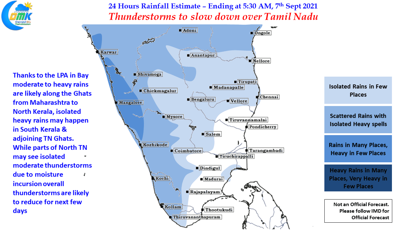
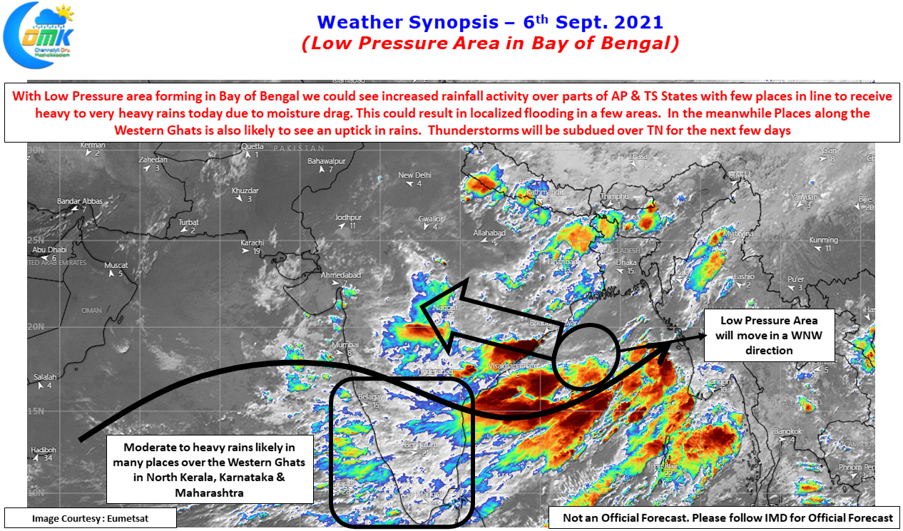
In the meanwhile with Low in Bay of Bengal we can possibly look forward to some increased rains over the Western Ghats from Maharashtra to North Kerala while South Kerala still remains a question mark, any spillover rains from these monsoon systems are a bonus & will help in reducing the deficit overall. Thunderstorms will fade over the leeward areas of Tamil Nadu though parts of North TN could see isolated light to moderate thunderstorm activity today also as moisture gets pushed across from West.
It is tough to say which of the places could benefit but which ever place it is, the spells will be a sudden burst of sharp spell of rains influenced by strong Westerlies.