
It is often remarked the Tropics are a much more difficult proposition to give out accurate weather forecasting not only in the long term but even in the short term. A few days back there was a lot of talk on the supposedly Red Alert given by IMD for Tiruppur district. While the color coded alerts by IMD is aimed at disaster managers the Red Alert has not become synonymous with failed alerts at least for Tamil Nadu thanks to a different perspective being provided by mainstream media. The last few days days have seen similar conditions exist as far as rains around Chennai as well with the city and suburbs mostly missing the spells either through weak steering winds or the genesis of thunderstorms formed at locations which were unfavorable for Chennai.
In the same context as bloggers most of us go by what weather models infer and is often the reason why bloggers have to always be magnanimous in accepting accolades for successful inferences as a lot of credit has to also go to weather models which picked up the patterns. There is a very popular phrase in Tamil “ஊருக்கு இளைத்தவன் பிள்ளையார் கோவில் ஆண்டி” it is certainly unfair to blame only failures to poor performance of weather models while appropriating successful weather inferences to human inferences.

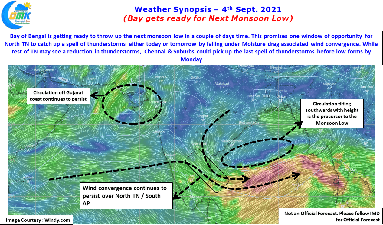
The Bay of Bengal is getting ready to throw up the next Monsoon Low in a couple of days with the last few days seeing circulation off the coast of Tamil Nadu & Andhra Pradesh gradually climbing up the latitude. Possibly on Monday we might see the Low pressure form off North AP / South Odisha Coast to give a few days momentum to Southwest Monsoon which needs all the support to claw back the nearly 24% deficit it faced during the month of August, particularly the southwest coast of Peninsular India which also is a key catchment area of Cauvery Basin.
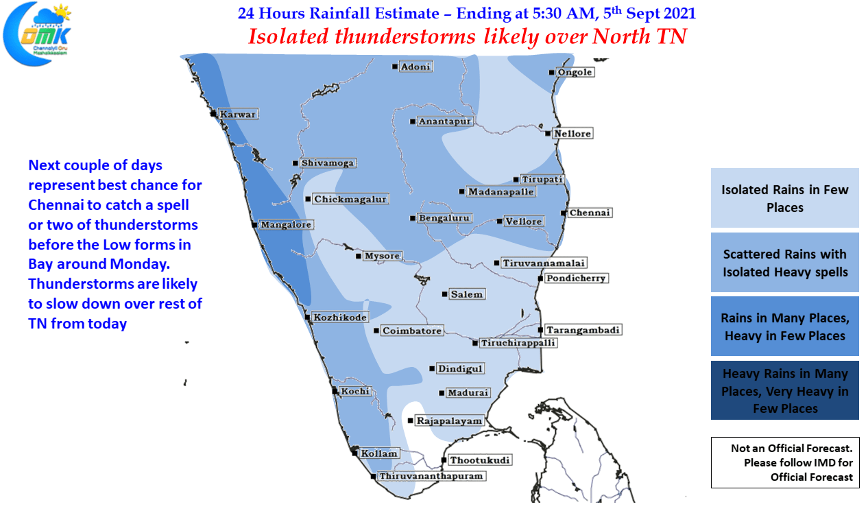
This intervening couple of days is now likely to provide a window of opportunity for North Tamil Nadu to catch up a spell or two of thunderstorms as favorable wind convergence is likely to fall over South AP & North TN areas. It is worth reminding that Chennai typically catches the last spells of rains before the LPA firms up over Bay during Monsoon months, with thunderstorms expected to slow down over rest of Tamil Nadu from today, weekend is looking a good bet for some Chennai Rains. But as usual Models Propose Nature disposes so lets keep our fingers crossed.