
As we get to the second half of February most parts of Peninsular India will gradually see both day and night time temperatures increase. Though nights may still remain cool and pleasant the cold nights over the interior areas will be a thing of past. Days that were fairly pleasant during the early days of the year will also gradually become a distant memory as places along the west coast and adjoining interior areas of Peninsular India start to see temperatures increase during the afternoon time. As many know by this time the worst time for coastal places of Tamil Nadu like Chennai is when the Westerlies strengthen and bring the land heat from the interiors to the coast.
February to late March or even early April in many cases coincide with a similar period for the places along the West coast when the dry Easterlies bring the land heat from interior places to the coast. It is during this period some of the places around Palghat gap and to the west of Palghat gap in Kerala see their hottest period. With West Interior TN sharing a much more closer relationship in terms of weather and climate to the west coast rather than the East coast the summer peaks early here as well compared to the rest of the state. Once the seasonal winds change from East to West the temperatures also start dropping with pleasant conditions establishing when the Westerlies start to carry more moisture as a precursor to the arrival of Southwest Monsoon.
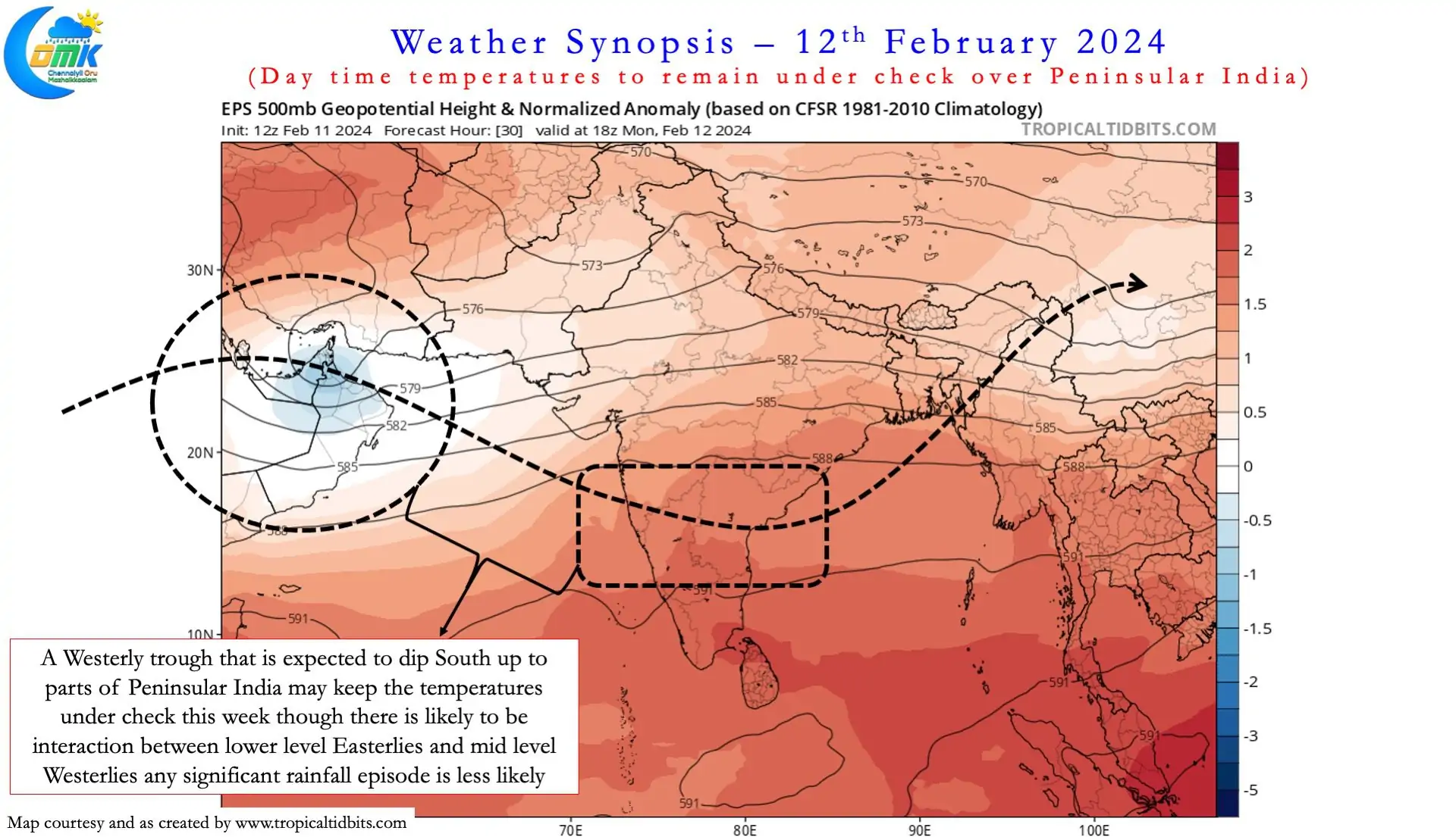
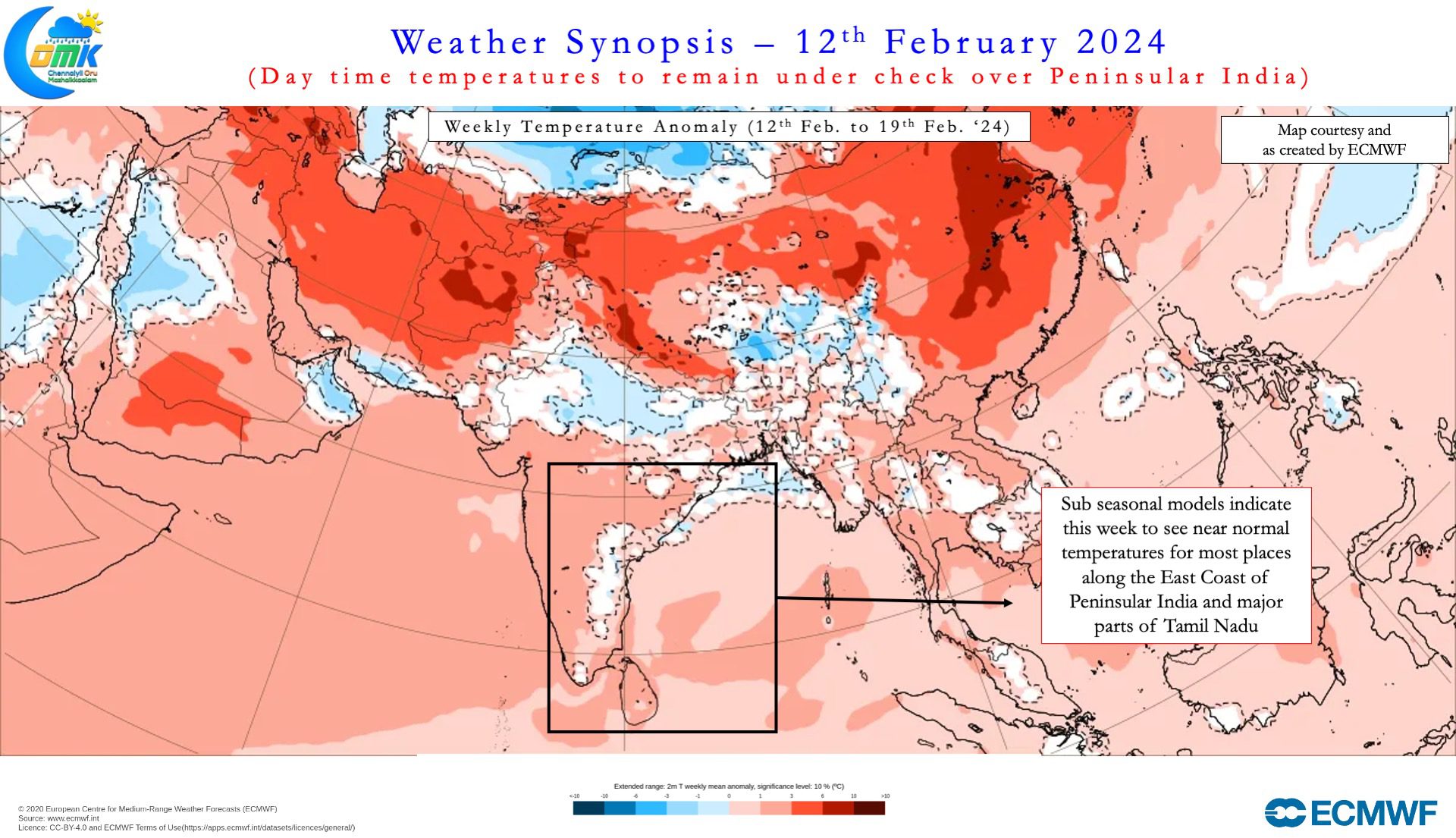
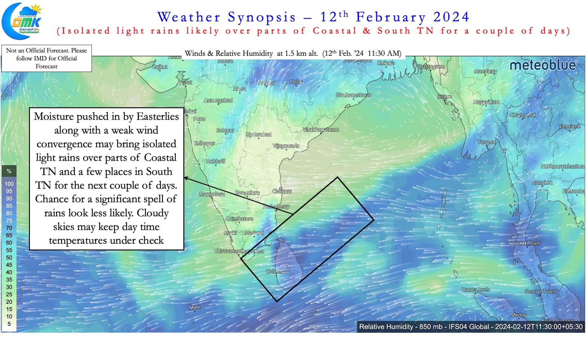
Time to time we might have a case where Easterlies with weak moisture or other associated instabilities may bring cloudy skies and even light rains in some cases along the coast during this period. On such occasions the temperatures in the interior areas may see some reduction thought nights may become warmer under cloudy skies. Weather models indicate the next couple of days parts of coastal Tamil Nadu and a few places in South TN may see some light rainfall activity under the influence of Easterlies. Additionally there could be some weak interaction between a mid level Westerly trough that may dip well south to parts of Peninsular India. This interaction is unlikely to bring any significant rainfall activity as of now but certainly may play a role in keeping temperatures under check this week over most parts of Peninsular India.
As of now the LWD induced thunderstorms are a few weeks away so major rainfall activity is unlikely over Peninsular India until possibly second week of March.