
The Blue Marble is one of the most iconic satellite images taken ever. It is the photo of the earth taken in December 1972 nearly 30000 kms away. This image pretty much visually explains why the Earth is called the Blue Planet. Nearly 71% of the earth’s surface is covered by water so the planet looks blue from the outer space. With more than 2/3rd of the earth’s surface are oceans it is no wonder oceans are one of the biggest factors of how weather pattern evolves and long term climatic changes.
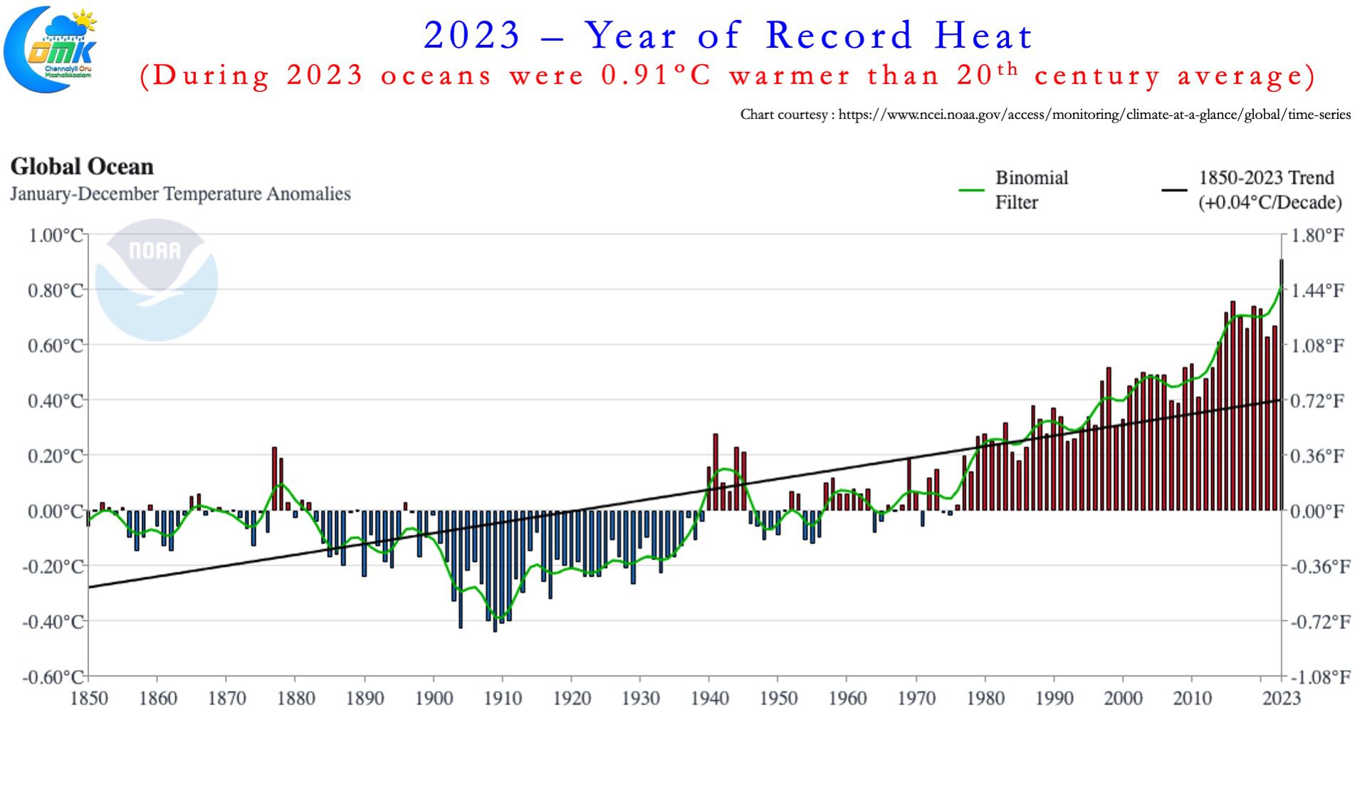
It is in this context it becomes important to understand how ocean warming has been gradually impacting weather patterns. While a lot of talk is on about El Nino and La Nina and its associated warmer than normal / cooler than normal sea surface temperatures over the Pacific what one should not forget is the oceans overall across the globe are warmer than ever before. The past decade has seen the 10 warmest years as far as Ocean temperatures go. It is very pertinent to point out here 2015 the last strong El Nino year is now only the 5th warmest year as far as ocean temperatures go.
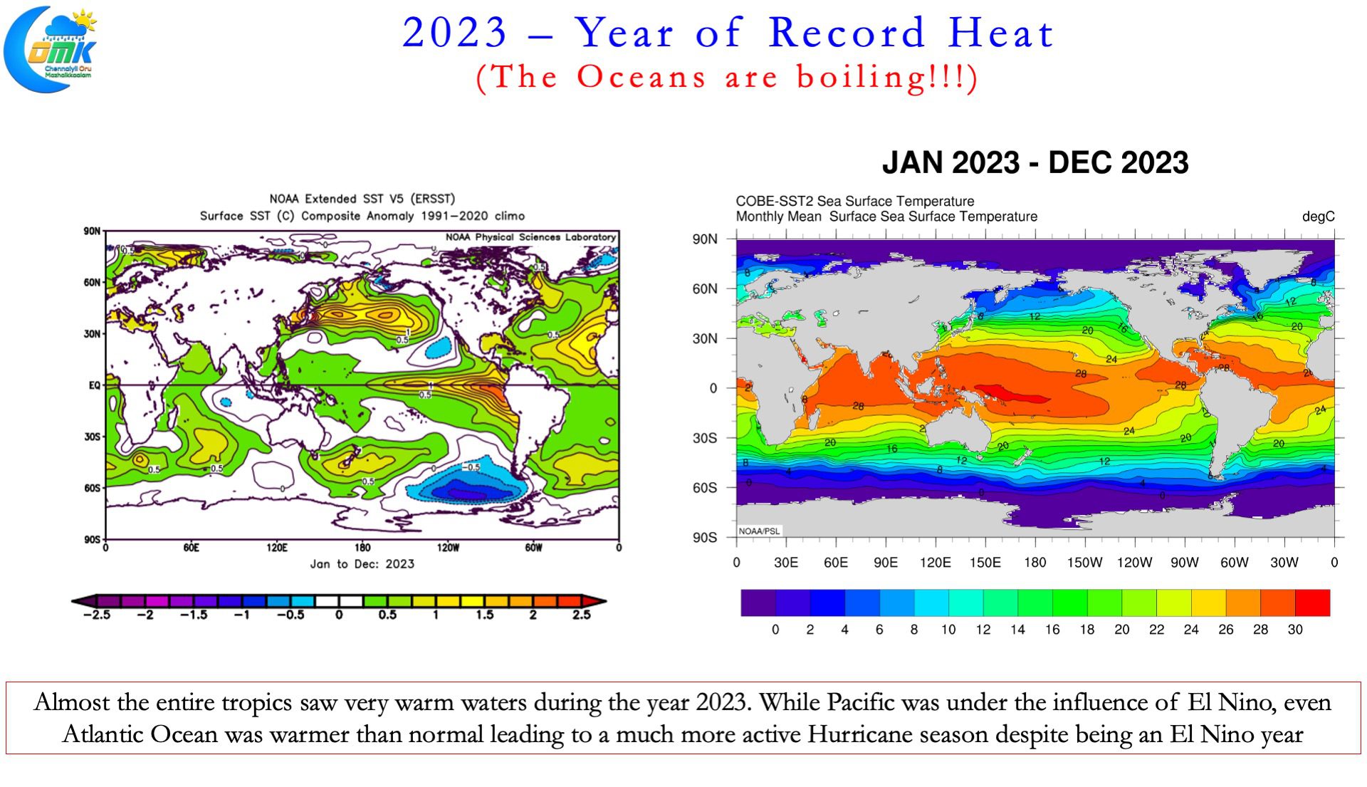
In 2023 the average annual ocean temperature was nearly 1°C warmer than the 20th century average. The usual inference to this abnormal warming is the presence of a moderately strong El Nino. But if one looks deeper even basins Tropical Atlantic was abnormally warm leading to an active Hurricane year. As a matter of fact in terms of number of named storms 2023 was the 4th highest. Typically during El Nino years often we see Atlantic Ocean see less activity compared to La Nina years when the Pacific is cooler and allows Atlantic to be the driver of weather events. In a way the rapid warming of the ocean is throwing away text book weather correlations and historical patterns that we have seen so far.
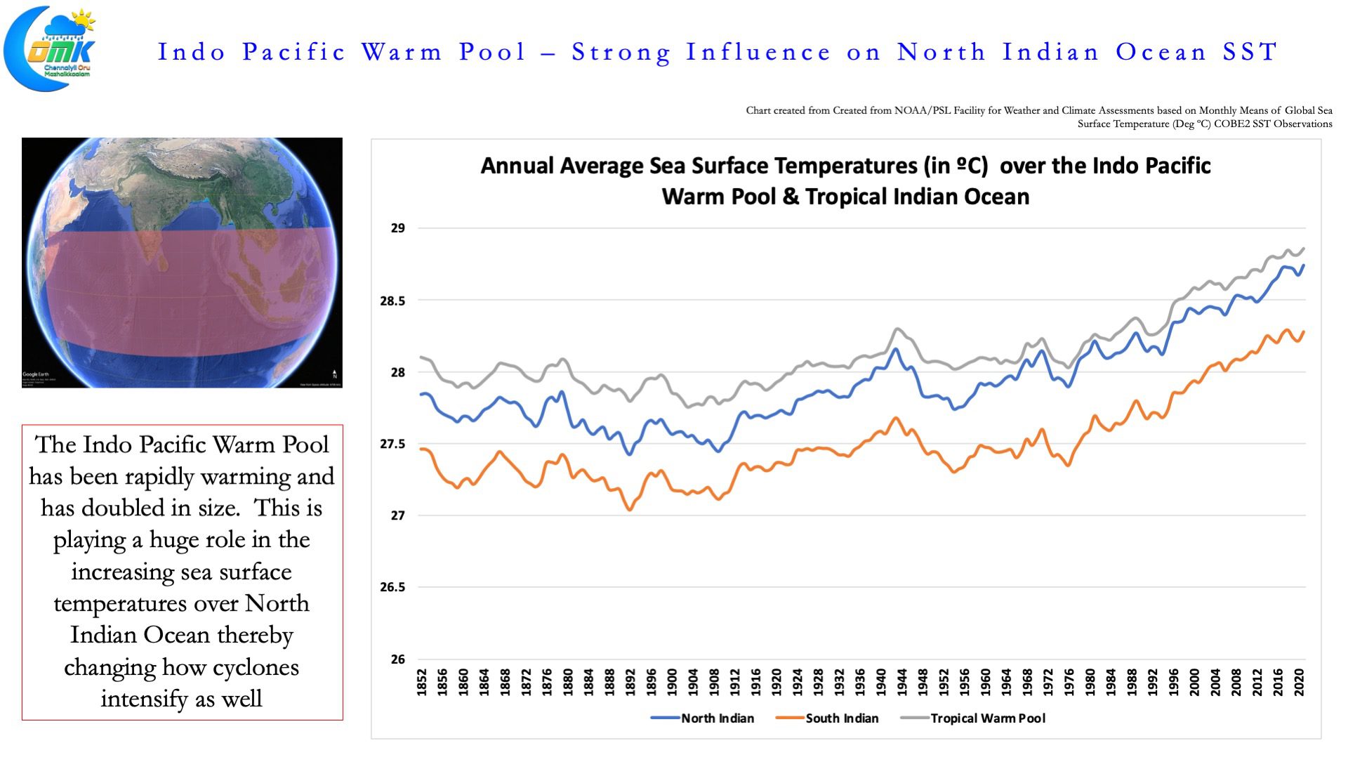
Closer home the Indo Pacific Warm Pool, one of the warmest tropical ocean region, is warming at an alarming pace. Over the past 100 years or so it has warmed by more than 1°C thereby playing a crucial role in how weather events shape up over Asia but globally as well. The warm pool has also been expanding, doubling in size during 1980-2018 compared to 1900-1980, thereby modulating the behaviour of MJO and influencing rainfall pattern across the Globe. With the North Indian Ocean basin closely connected to the Sea Surface temperatures changes in the Indo Pacific Warm Pool, the North Indian Ocean Basin (Arabian Sea & Bay of Bengal) have also started to warm at an alarming pace along with IPWP.
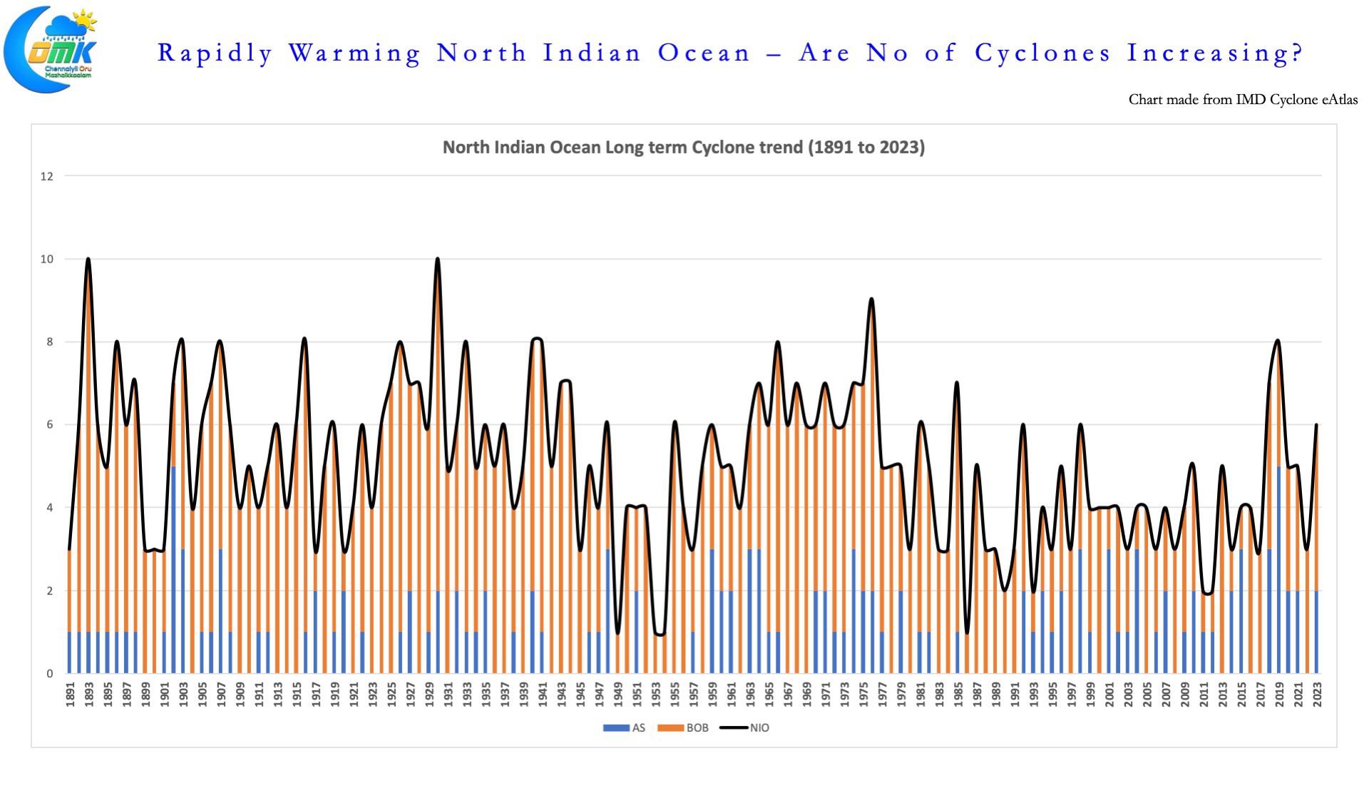
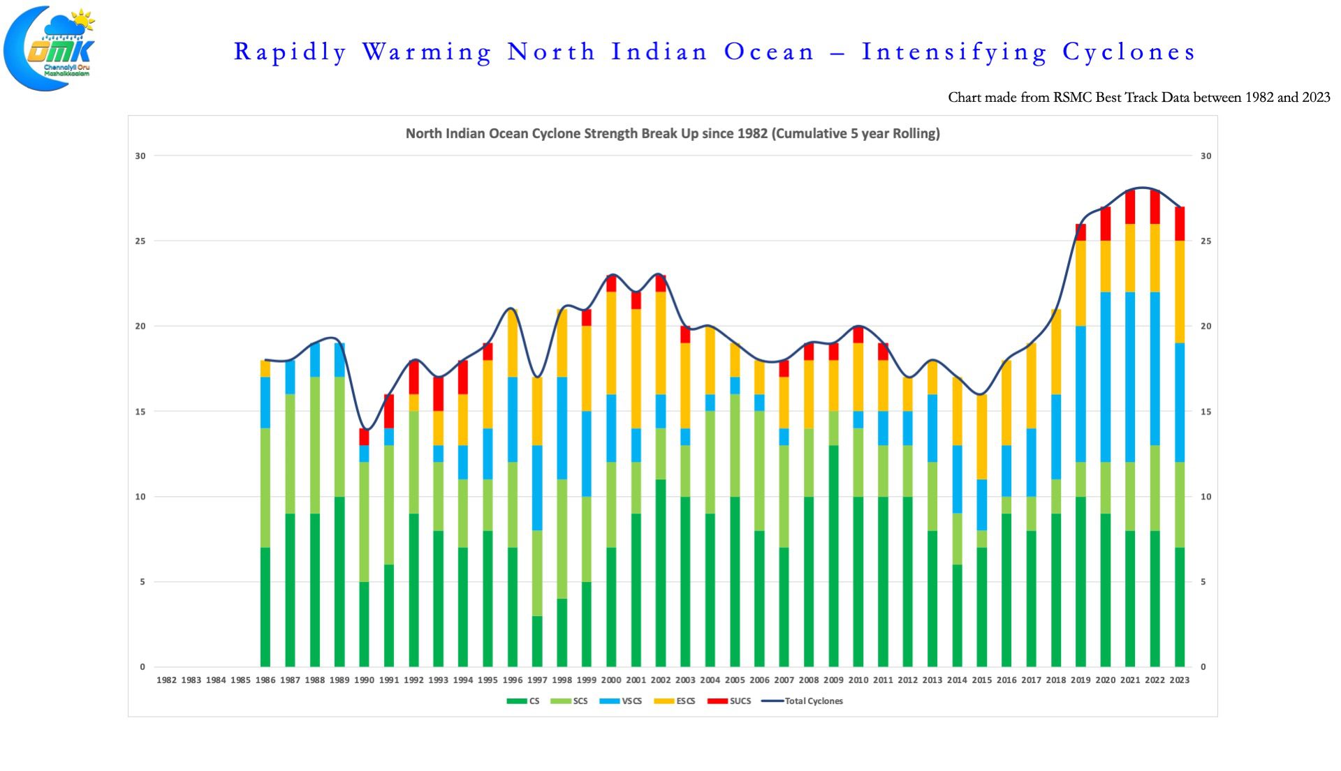
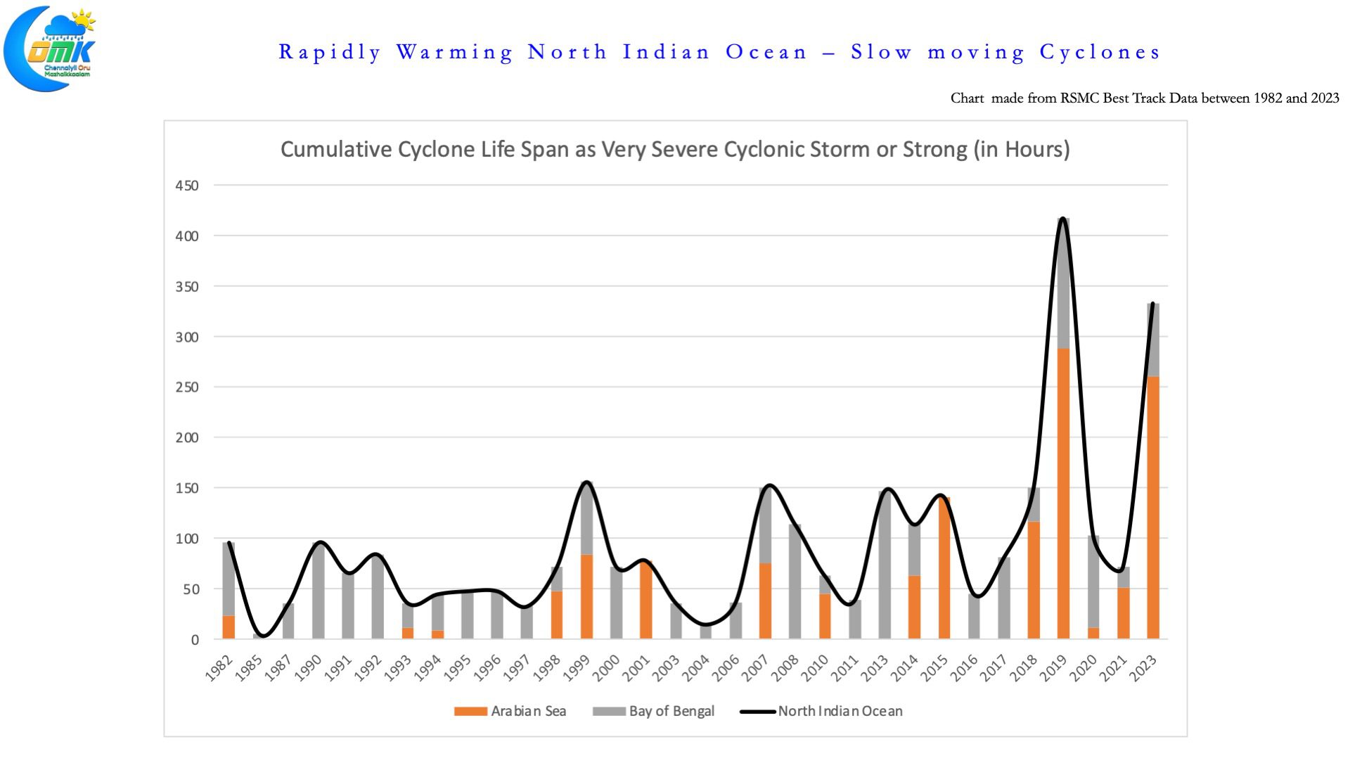
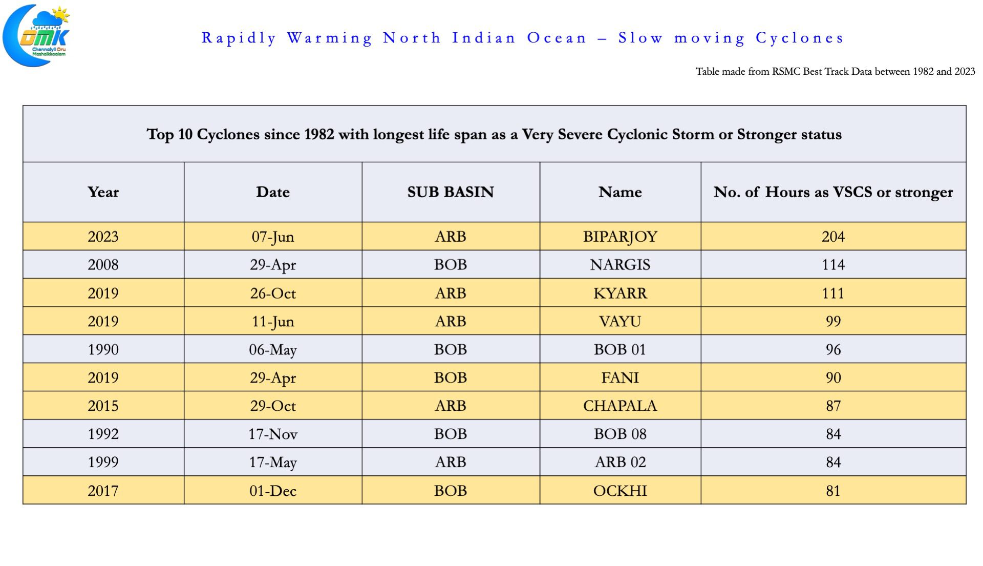
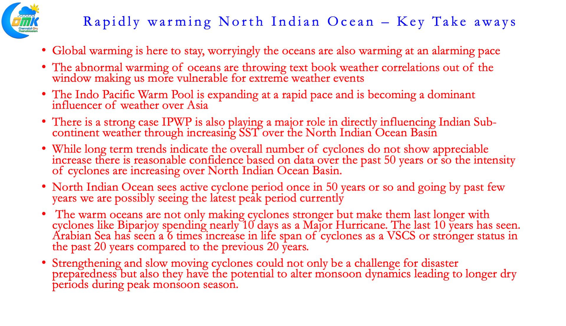
This increasing sea surface temperatures is making oceans more conducive than ever before for cyclones to intensify over the North Indian Ocean Basin. Though the pre satellite era cyclone intensity analysis have to be taken with a pinch of salt there is increasing confidence in North Indian Ocean churning more number of intense cyclones over the past couple of decades but also the cyclones are seen spending more time in the open waters. For e.g Biparjoy stayed as a Very Severe Cyclonic Storm or stronger for nearly 10 days right at the cusp of Monsoon onset during the year 2023. Similarly a slow moving Kyarr pretty much threw the Northeast Monsoon Onset window out of the park during the year 2019.
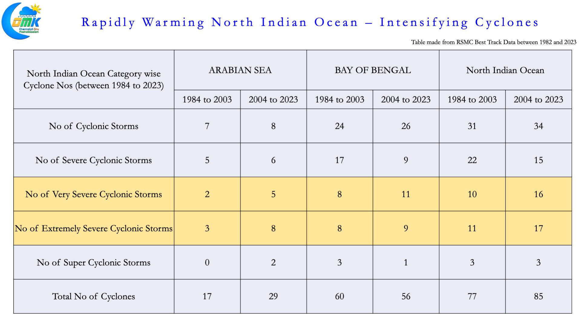
In a clear change in trend over the past 20 years the number of cyclones have nearly doubled in the Arabian Sea compared to the previous 20 years. The bulk of this increase has come from an increasing number of more intense cyclones. Between 1984 to 2003 a total of 5 cyclones formed that were either Very Severe Cyclonic Storm or stronger, comparitively between 2004 and 2023 a total of 15 cylones of VSCS strength of stronger including two super cyclones formed. A three fold increase in very severe cyclonic storms. Though Bay of Bengal has not seen similar multifold increase in very intense cyclonic storms it has still seen a 40% increase over the past 20 years or so.
This change in how cyclones are intensifying is certainly going to bring about its own associated challengers for disaster managers as cyclone intensity during landfall over the Indian coast may be stronger than ever before. Additionally it may also affect the rainfall pattern particularly during monsoon onset period by altering monsoon winds thereby creating longer dry periods.