
1964 Rameswaram Cyclone, 2005 Cyclone Fanoos, 2011 Cyclone Thane & 2016 Cyclone Vardah all have one other thing in common in addition to being late NEM season monsoon cyclones during the month of December. All of these also happened during La Nina years in addition to showing a more pronounced WNW path during their life cycle. This is a typical characteristic of La Nina conditions with a high probability of December cyclones impacting coastal TN on account of favorable location of ITCZ which moves south of equator in a delayed manner compared to say an El Nino year. This is also the reason why many of the La Nina years also see “Unseasonal Rains” during the month of January. When one puts observations in place some of these patterns will become more obvious to prevent being called “Unseasonal” any more.
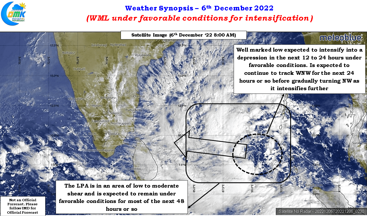
With IMD confirming the LPA over Andaman Sea intensifying into a Well Marked Low today morning the next 48 hours become very crucial in terms of trying to understand what is in store for coastal Tamil Nadu between delta and South AP. Satellite image indicates conditions look very favorable for the WML to intensify into a Depression by later today evening / tonight and further intensifying into a deep depression during the subsequent 12 to 24 hours. There is a fairly tight alignment among models on this disturbance intensifying into a Cyclone by the it reaches NE of Sri Lanka on 8th morning.
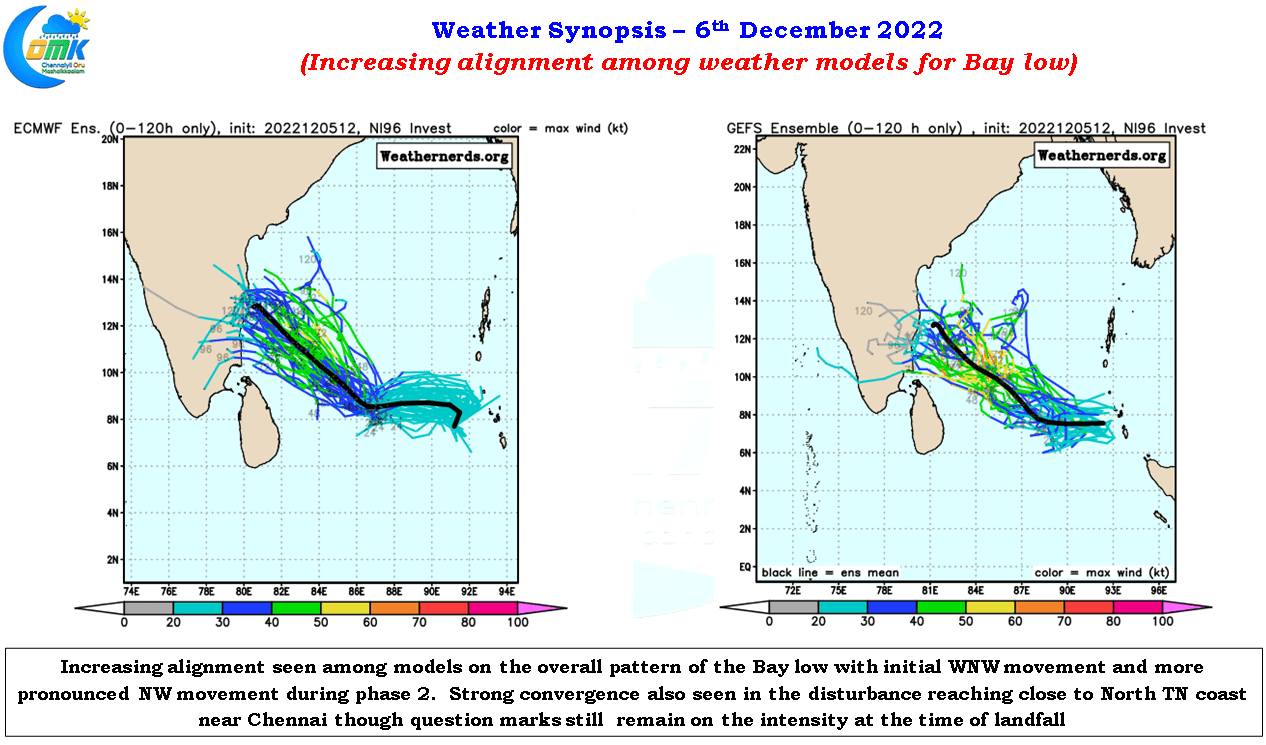
It is not often one sees a tight alignment among models but also a fairly close alignment in terms of the overall nature of the disturbance in terms of track and potential landfall zone. ECMWF and GFS ensemble cyclone tracks almost look like a mirror image though an exact replica is unlikely even if the incident is a day or two away. But a close observation does indicate the ensembles of both the models are very similar in terms of overall outlook though the timelines of GFS in terms of landfall seems to be an outlier expecting no organized landfall even by 11th at the time of making this post.
Almost all the models are in sync about this disturbance coming close to North TN coast on 9th morning as a cyclonic storm and subsequently crossing the coast over North TN & South AP. ICON which was expecting a south of Pondicherry landfall and GEM which was expecting a delta landfall in their 12Z runs of 4th December also have pushed the landfall zone to North TN / South AP.
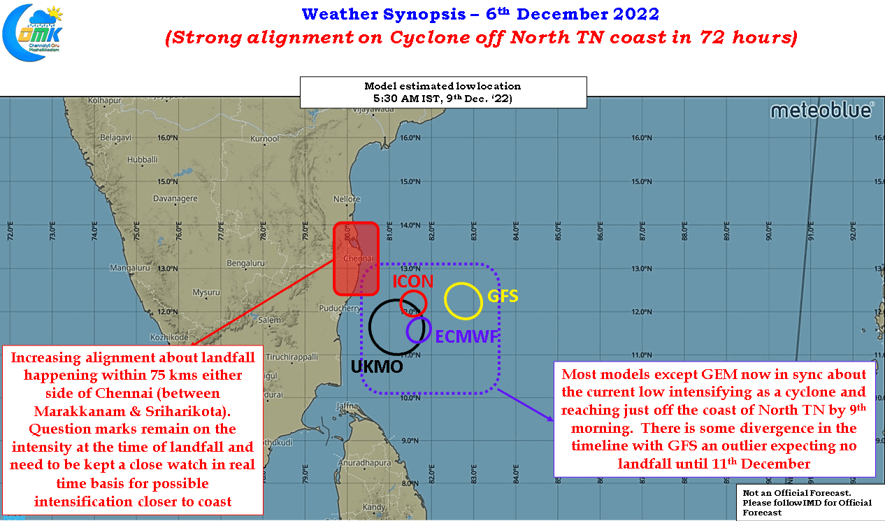
Keeping the tight alignment in consideration there is a fair bit of confidence in the landfall happening 100 kms either side of Chennai. There exists question marks on the intensity at the time of the landfall though it may be prudent to expect the landfall to happen as a cyclone even though there is no strong convergence yet among models on this disturbance making landfall as a cyclone.
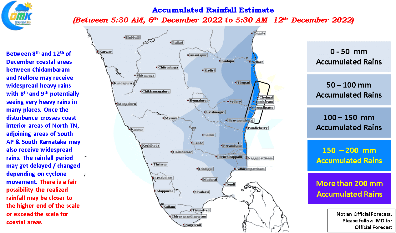
Giving a rainfall outlook when there is a cyclone involved is very tricky because of lot of factors that come into play like track, intensity at the time of landfall etc. But crucially if we have a situation like Cyclone Nivar which got sheared closer to the coast the rainfall dynamics completely changes as the convection may get pushed inland much more than what models estimated. The rainfall estimate as part of today’s post is with the objective of keeping everyone updated on the potential impact from this disturbance and be prepared accordingly.
To summarize
- There is a high convergence of a cyclonic storm reaching just off the coast of North TN on 9th morning.
- There exists a very high possibility of the disturbance making landfall 100 kms either side of Chennai. The possibility of this disturbance making landfall as a cyclone cannot be ruled out.
- The period between 8th to 12th December we may see widespread rains along the coastal areas between delta and Nellore.
- Heavy to very heavy rains likely at many places on 8th and 9th along coastal TN.
- If you have an event scheduled for the period 8th to 12th December if it is possible to reschedule please do so, in case you cannot reschedule please take utmost precautions and follow weather by the minute from 8th morning.