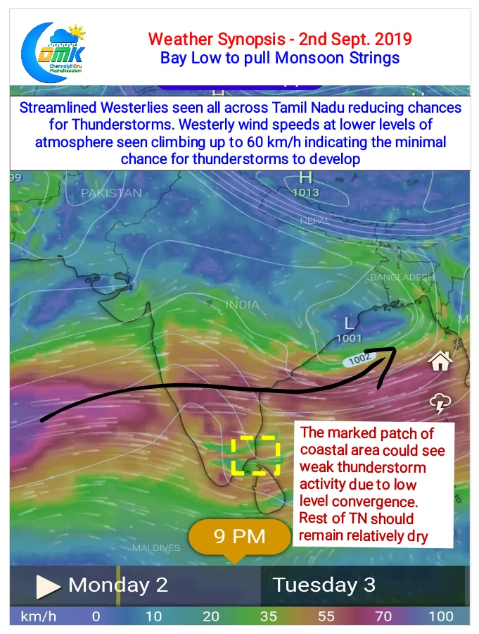
The developing low pressure in Bay of Bengal is likely to pull monsoon strings during this week. Expected to form off the North AP / South Odisha Coast it’s likely to bring an increased moisture drag across Peninsular India over the next few days. Weather models are already indicating an increased Westerly wind speeds at…
Author: Chennaiyil Oru Mazhaikkaalam
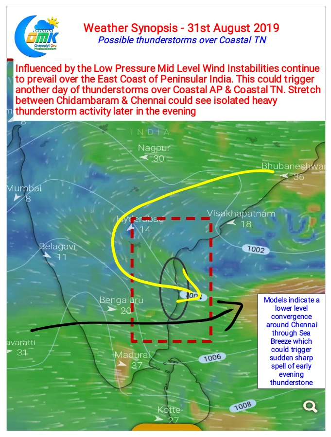
Possible Thunderstorms over Coastal TN
Yesterday saw the return of heavy duty thunderstorm action over Chennai & suburbs. Late in the afternoon a batch of thunderstorms developed slightly to the west of Chennai. Under the influence of remnant sea breeze front that was just moving inland the storms bloomed closer to the coast bringing a spell of intense rains for…
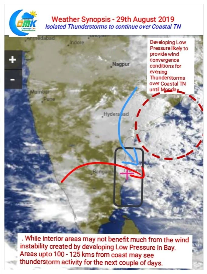
Favorable Bay Circulation to bring Thunderstorms
Yesterday parts of North Tamil Nadu including Chennai saw Thunderstorms during the evening hours. While few places in Vellore & Tiruvallur districts recorded moderate to heavy spells of rains many parts of Chennai recorded light to moderate spells bringing some relief to the citizens. Unlike last week when Thunderstorms we spatially well spread yesterday it…
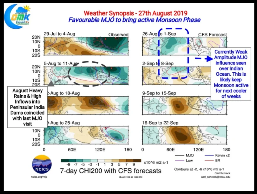
Favorable MJO to keep Monsoon Active
As we often mention whether it’s Southwest Monsoon or Northeast Monsoon the active phases more often than not coincides with favourable MJO transit over Indian Ocean and adjoining parts of Maritime Continent. With MJO normally traveling West to East the Enhanced (Connective) phase is always followed by a Suppressed Phase. Monsoon remains active during the…
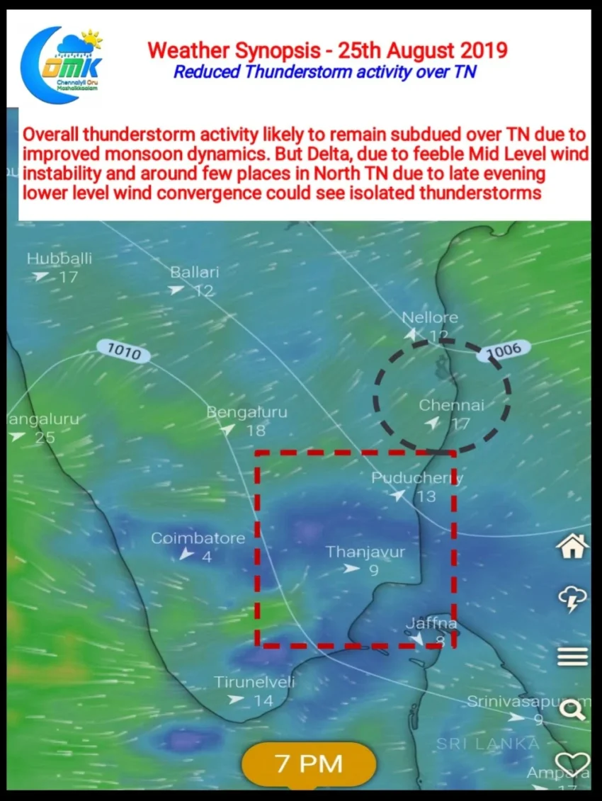
Reduced thunderstorm activity over TN
Thunderstorm activity started to taper down over Tamil Nadu with not much rains happening yesterday in the state. Isolated pockets over South TN along with few places in North TN recorded light to moderate rainfall during the evening. Central India has been seeing a fairly robust monsoon conditions with favourable circulation in the region. With…