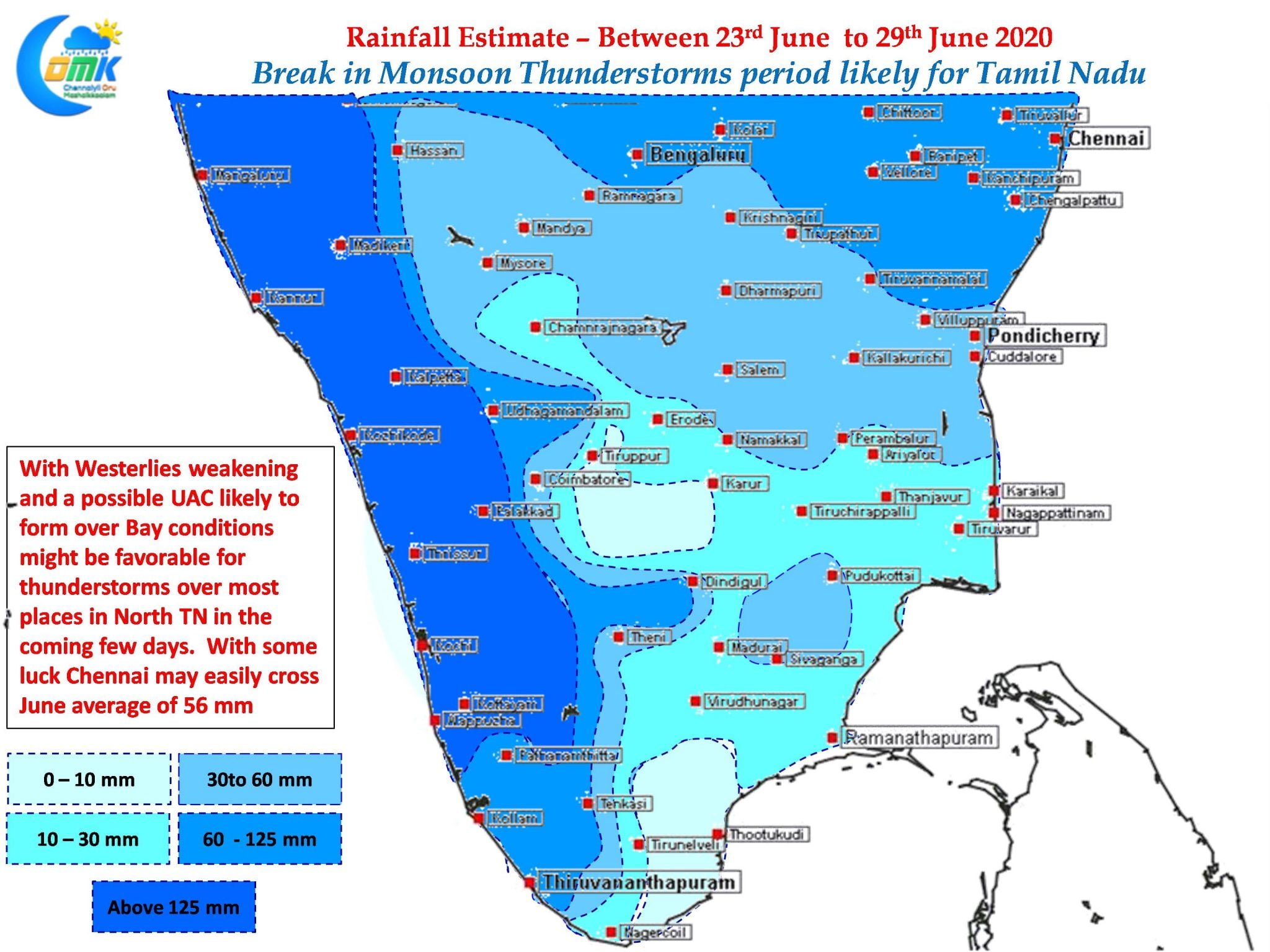
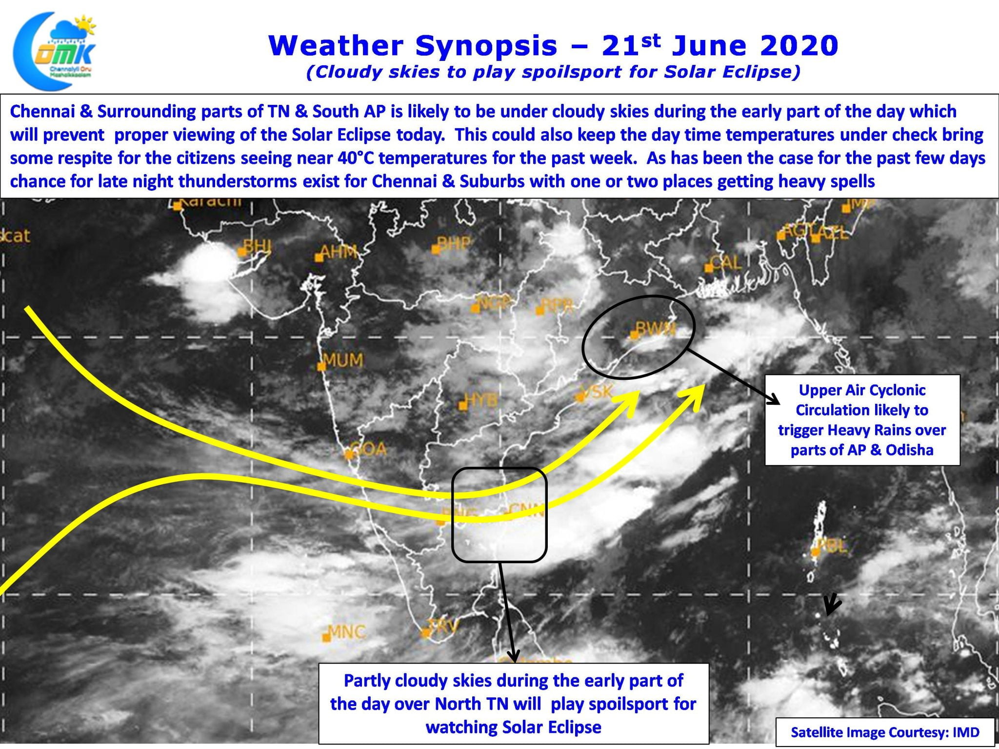
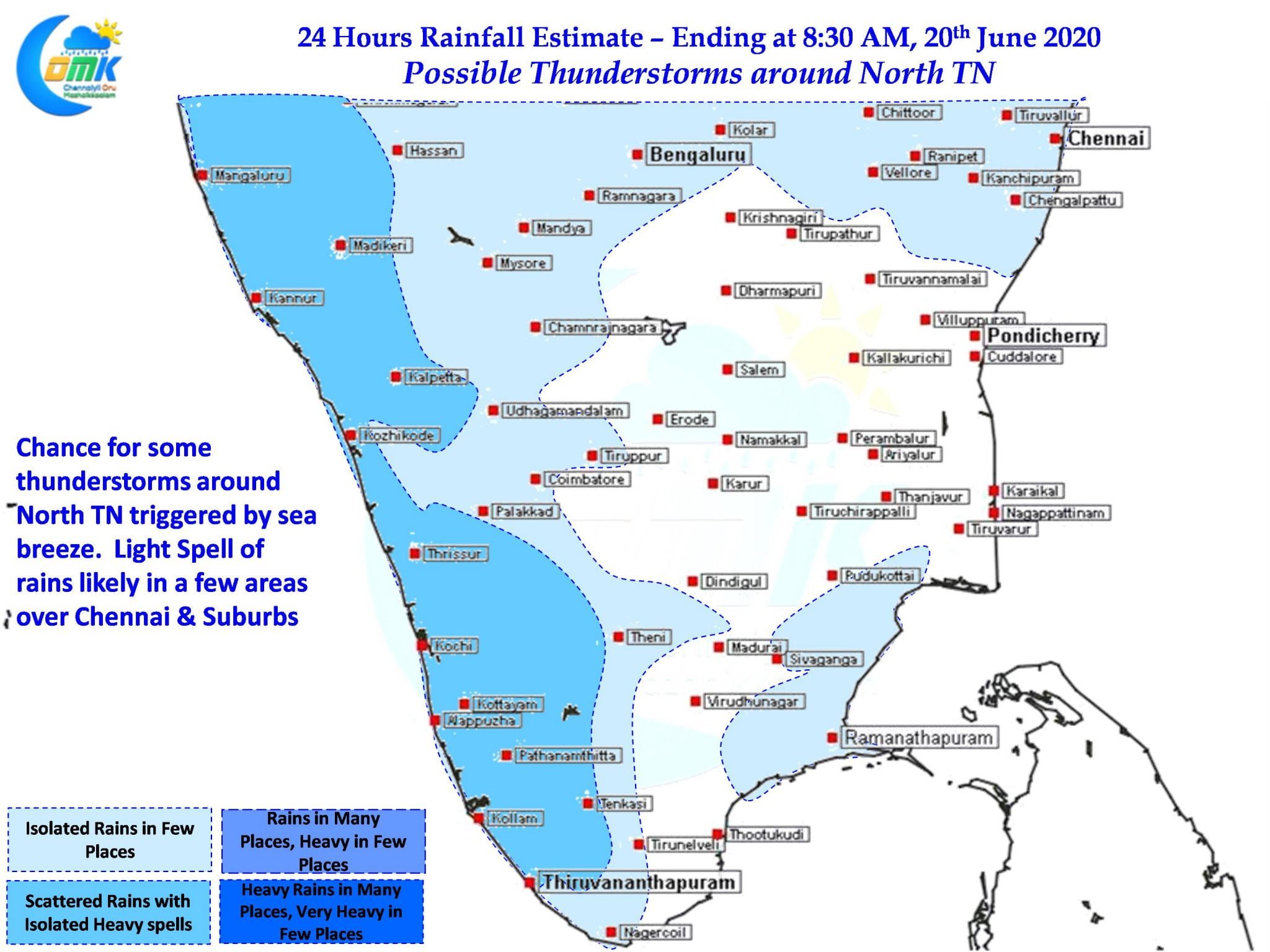
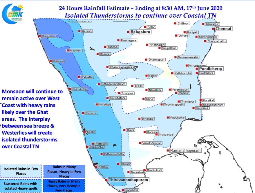
The last couple of days have seen thunderstorms slowly improve over Tamil Nadu. Yesterday turned out to be a very good day for not only thunderstorms but also areas under monsoon influence with Nagercoil recording more than 8 cms rains along with places in the Ghats over Kanyakumari & Tirunelveli district. Parts of Villuppuram, Salem,…
Author: Chennaiyil Oru Mazhaikkaalam
Isolated Thunderstorms to pick up over TN
The remnant depression from Cyclone Nisarga now lies over parts of Madhya Maharashtra as it continues to move in a East / Northeast Direction over Central India. Expected to weaken into a Well Marked Low later in the day it ended up giving a scare to Mumbai but spared the metropolis of major damage after…
All Set for Southwest Monsoon 2020
It is that time of the year when all eyes are over West Coast for the arrival for the annual Southwest Monsoon. Traditionally the Monsoon Onset date over Kerala has been 1st of June with a variance of +/- 7 days as per IMD. This year IMD has revised the dates for Onset & Withdrawal…
Thunderstorms to move closer to the Ghats
On Wednesday & Thursday large parts of Tamil Nadu saw thunderstorms under the influence of an elongated Upper Air Cyclonic Circulation that was stretching from off Tamil Nadu coast to Comorin Sea. Weather models were consistent on this circulation moving over to Arabian Sea and subsequently descending into a Low Pressure triggering monsoon dynamics for…
Another Stormy Evening ahead for Interior TN
Yesterday saw a very active evening of thunderstorms with many parts of the state recording fairly intense thunderstorms. Hailstorms were reported over parts of Tirupathur, Tiruppur & Salem districts as wind induced instabilities created by the Upper Air Cyclonic Circulation off the TN coast aided the thunderstorms triggered by the convective process through day time…


