
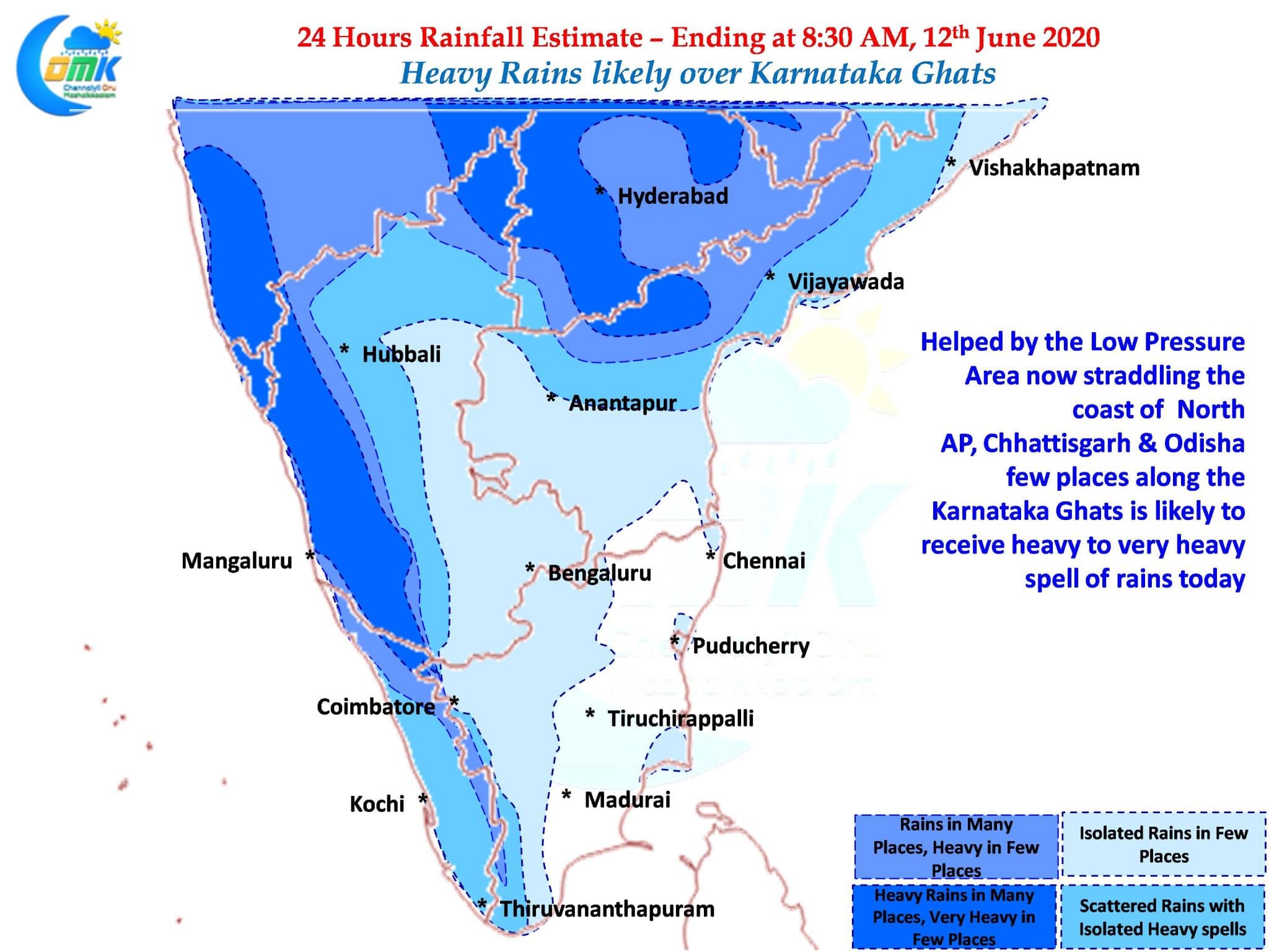
The Low Pressure Area over Central Bay continued to move in a W/NW direction and now lies straddling the North AP Coast along with adjoining parts of Chhattisgarh & Odisha. Yesterday the Monsoon touched down over the southern edge of Maharashtra pretty much completing the onset over most areas of South India, with only the northern areas of Telangana still to be covered.

As the LPA continues to move in a W/NW direction into parts of Central India it is likely to drag the Monsoon onset over more parts of Konkan and adjoining areas of Maharashtra with Mumbai possibly seeing onset by the weekend. While the normal dates for Mumbai is 10th, this year it might set in a couple of days though overall it is likely to be a strong onset nevertheless.
In the meanwhile through the moisture drag created by the LPA heavy to very heavy rains are likely over few places in the Karnataka Ghats. The stretch from the South Shahyadris to Chickmagalur district could be the vulnerable stretch coming under the heavy spell of rains. Also over the next couple of days starting from today we can start seeing the Cauvery catchment area also record good rains.

Yesterday parts of Chennai saw light rains / drizzle late in the evening. While it is indeed a disappointment Chennai missed out on a possible thunderstorm opportunity before the LPA moved inland nevertheless with Monsoon just starting the next 4 months will give us enough opportunities for “Break in Monsoon” thunderstorms. As a matter of fact the driest period of the year for Chennai is just behind us so its time to say “All is Well”