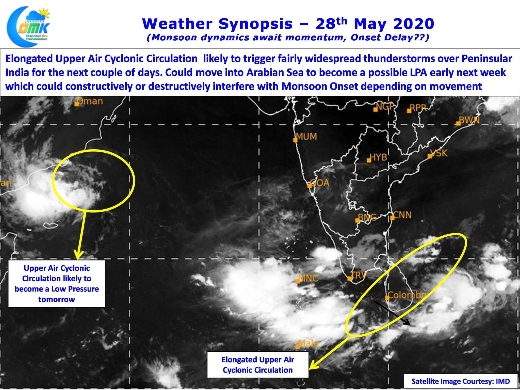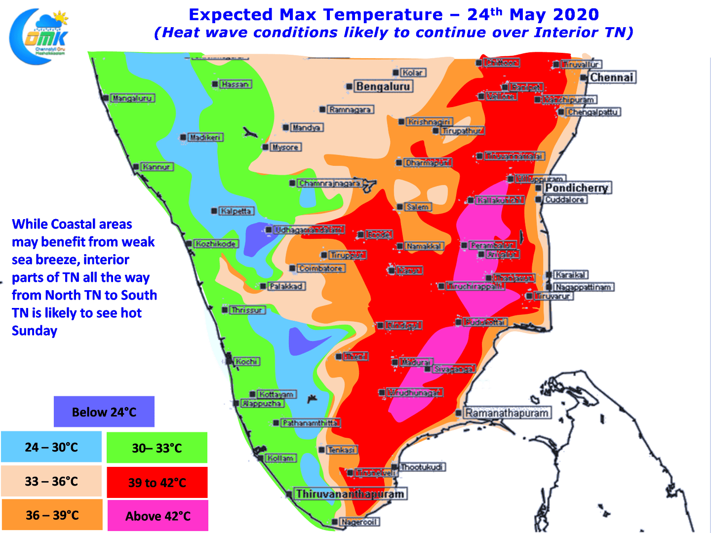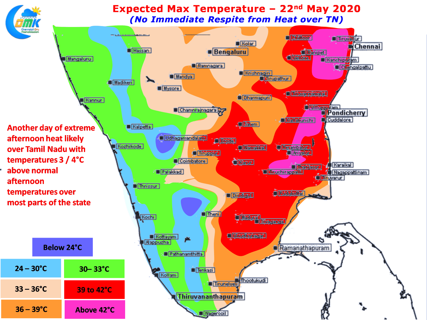
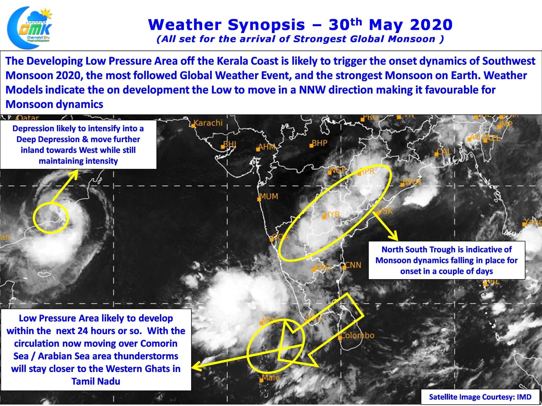
On Wednesday & Thursday large parts of Tamil Nadu saw thunderstorms under the influence of an elongated Upper Air Cyclonic Circulation that was stretching from off Tamil Nadu coast to Comorin Sea. Weather models were consistent on this circulation moving over to Arabian Sea and subsequently descending into a Low Pressure triggering monsoon dynamics for…
Author: Chennaiyil Oru Mazhaikkaalam
Another Stormy Evening ahead for Interior TN
Yesterday saw a very active evening of thunderstorms with many parts of the state recording fairly intense thunderstorms. Hailstorms were reported over parts of Tirupathur, Tiruppur & Salem districts as wind induced instabilities created by the Upper Air Cyclonic Circulation off the TN coast aided the thunderstorms triggered by the convective process through day time…
Has something changed with ECMWF??
Failures are stepping stones to Success is a famous proverb which is normally used for motivation. In the context of weather forecasting understanding failures becomes critical to become successful as feedback is an integral part of numerical weather models. As most know by this time some of the most common & popular numerical models used…
Interior TN continues to sizzle
After a few days of intense heat places along the coast got some respite yesterday due to the arrival of weak sea breeze early in the afternoon for places like Chennai. Further away from the coast there was no respite with sea breeze unable to make a headway until late in the evening. Tiruttani recorded…
No respite from Heat for North TN
Since Tuesday the heat quotient over North TN has increased with both Chennai observatories recording above 41ºC for the past three days while the IMD Observatory at Chennai AP recording two consecutive days of 42ºC for the past couple of days touching 42.5ºC which was the highest recording since 10th of June last year. As…