
Its been now a week since the Northeast Monsoon 2022 began from the statistical perspective. The first days performance has been below par even though the last couple of days have seen rains return over the coastal areas of Tamil Nadu. As against the long period average of 29.4 mm the Tamil Nadu & Pondicherry sub division has recorded 12.1 mm for the first week of October. It becomes pertinent to point out here the average rainfall numbers for first fortnight of October is driven by thunderstorms, mostly in the interior areas of Tamil Nadu, while as we move into the second fortnight through the arrival of Northeast Monsoon dynamics coastal areas like Chennai will start contributing to the rainfall chart.
Since the first week of September rains have been mostly sub par for across Tamil Nadu with interior places also no exception. Except for the period 26th to 29th September we did not see an active spell of thunderstorms since 8th of September. But it appears before Southwest Monsoon gives way to Northeast Monsoon interior areas of Tamil Nadu could see one active spell of thunderstorms that might go a long way in helping the water cycle in these areas.
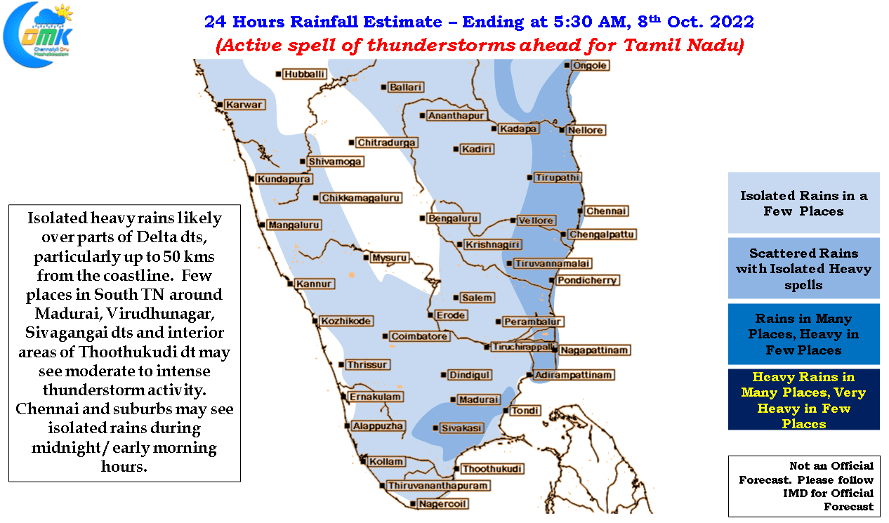
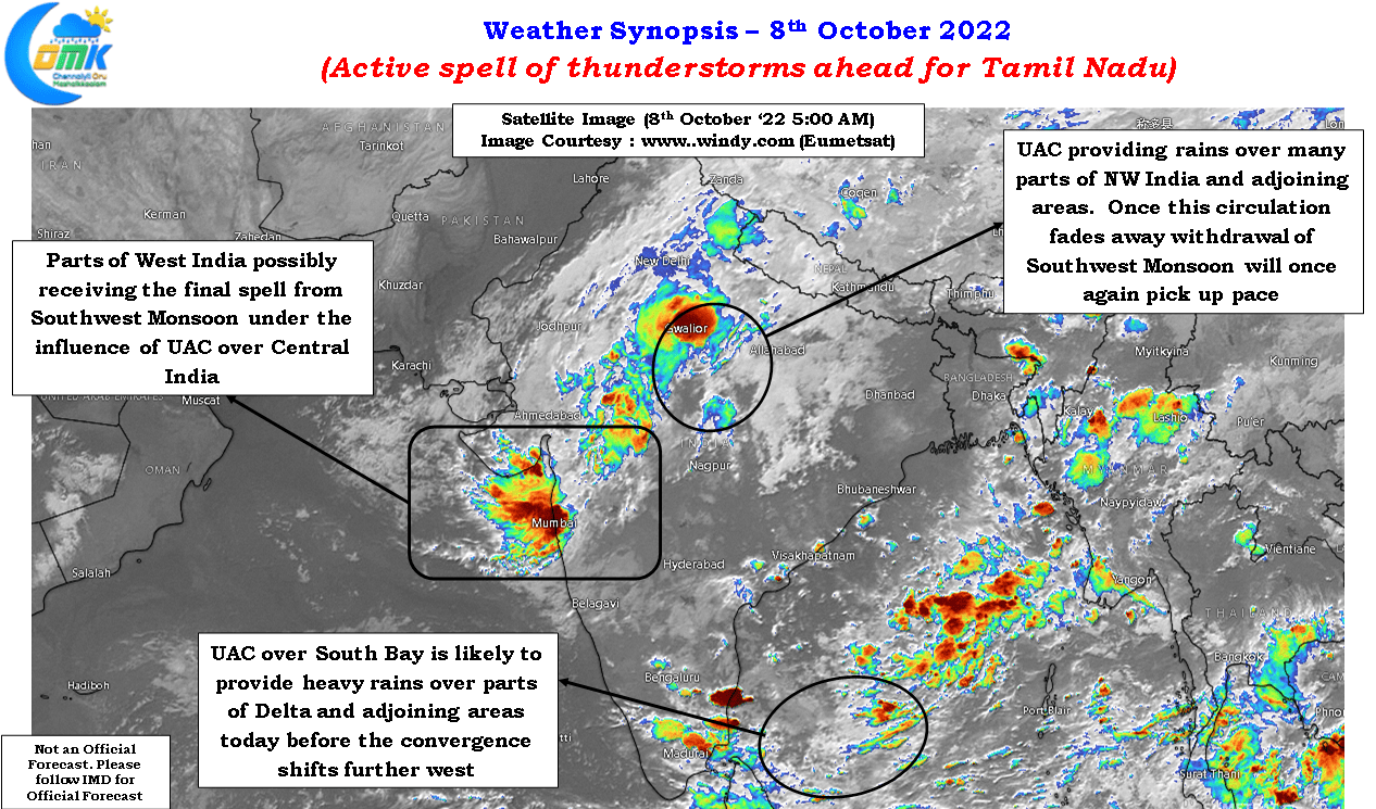
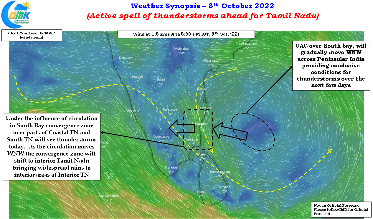
Under the influence of a circulation seen over South bay active zone of wind convergence is expected to fall over Tamil Nadu bringing conditions conducive for thunderstorms over the next few days. While today coastal areas, particuarly around Delta dts may benefit from these conditions in the form of moderate to heavy rains in a few places, the wind convergence zone is expected to gradually shift west as the circulation moves WNW across Peninsular India over the next few days. This phase of active thunderstorms is expected to benefit interior areas more than the coastal areas as the circulation moves across slowly.
Chennai and suburbs did get some light to moderate rains over the past couple of days including some heavy rains in a few places around North suburbs of Chennai yesterday morning. As the wind convergence moves interiors the rains will taper off for the city and suburbs due to unfavorable wind pattern. It is necessary to remember here Chennai and surrounding North TN coast due to the convex nature of the coastline is one of the last areas to see Southwest Monsoon thunderstorm and is also one of the first to give up Southwest Monsoon thunderstorms as the season transitions to Northeast Monsoon.