
In a dress rehearsal for the upcoming Northeast Monsoon season many parts of Tamil Nadu has been receiving widespread rains under the influence of the upper air cyclonic circulation that moved across South bay and subsequently into the southern parts of Peninsular India. By bringing temporary Easterlies the circulation created pseudo NEM conditions providing for rains that mimiced that of the rainfall pattern during Northeast Monsoon time. The first couple of days rains stayed closer to the coast and as the circulation nudged further west interior areas started to get increased rainfall activity with yesterday fairly widespread rains happening even over West interior Tamil Nadu.
Weather models indicate with the circulation now moving further west it is expected to weaken slowly while pushing across Peninular India. This is likely to bring a reduction in rains over the coastal areas for the next 2 / 3 days while interior areas of Tamil Nadu and rest of Peninsular India will continue to see thunderstorms influenced by the wind instabilities triggered by the weakening circulation. Today once again interior Tamil Nadu is likely to see rains at many places as remnant moisture pushed by the Easterlies go through convective development influenced by the day time heating.
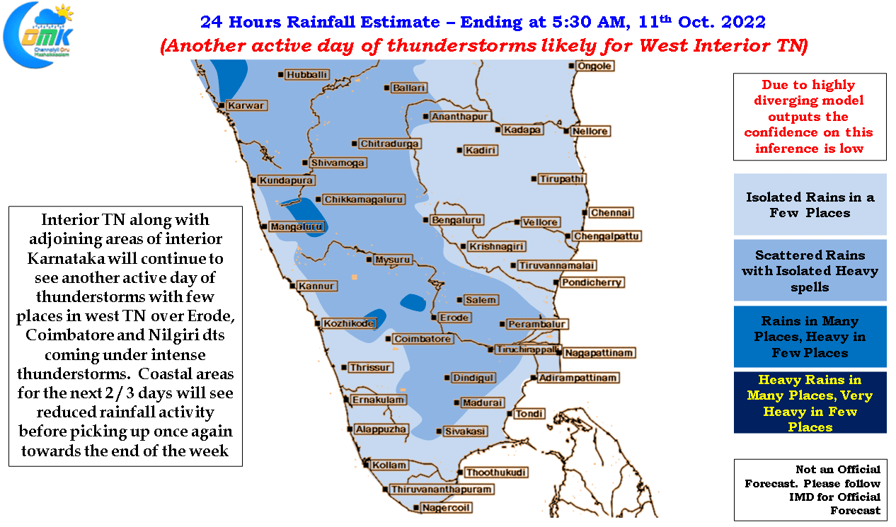
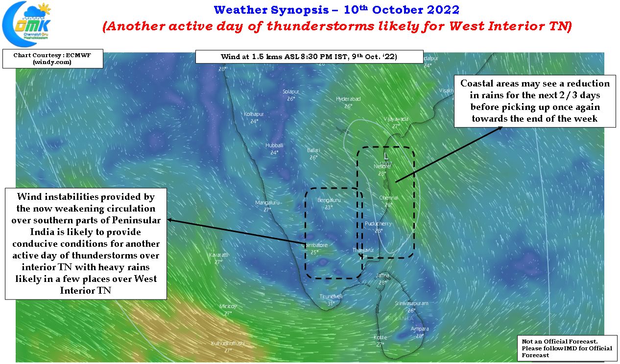
West Interior Tamil Nadu and adjoining areas of South Interior Karnataka may see rains at many places once again today with few places in Coimbatore, Erode and Nilgiris districts likely to come under intense thunderstorm during the late night hours. Chennai and suburbs may see a reduction in rains though one may come under a sudden spell of rains brought forth by the Easterlies. Weather models indicate the Easterlies to fade away by middle of this week bringing forth a scrambled wind pattern over Peninsular India that is likely to be conducive for thunderstorms to persist over the interior areas. Towards the end of the week once again coastal areas are likely to come under good spell of rains with the arrival of a next weak pulse into South Bay.
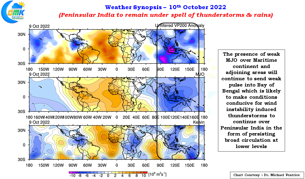
But looking a little further East could provide us some cues on why the next couple of days irrespetive of how close are we to Northeast Monsoon onset could turn out to be good for Tamil Nadu. Weak MJO is seen stationary over Maritime Continent and adjoining areas that is likely to send weak pulses into South Bay, due to sub par conditions prevailing over Indian Ocean these pulses are less likely to become organized systems and in turn become a conveyor belt of triggers for maintaining a broad circulation over Bay of Bengal embedded with UAC time to time as the pulses move East to West. In the process ripe conditions for thunderstorms will continue over Peninsular India with the coastal areas and interior areas likely to enjoy spells of rains back and forth as favorable wind pattern swings back and forth for these areas.