
Fear Sells. Across the Globe many a time powerful commercials have used fear subtly to promote products, ranging from industries like insurance, automotive and even simple home appliances. At its core, however, a fear-based purchase is not simply a matter of peace of mind, but it is deeply rooted in our biology. An evolution of Fear Sells in today’s complex social media world is FearMongering. While on many occasions weather bloggers are accused of FearMongering in a development that is possibly a year or two old we have now started seeing Mainstream media channels adopt “Fear Sells” as their primary driver of content particularly during Northeast Monsoon period. In this era of it is tough to be a sane voice and present weather in a detached manner with a focus to highlight what is more likely to happen while keeping in mind providing sufficient advance information if there is an incident that is likely to make large scale impact like cyclones. It is in this context today’s post has been made in an attempt to decode what is ahead of us in terms of Northeast Monsoon.
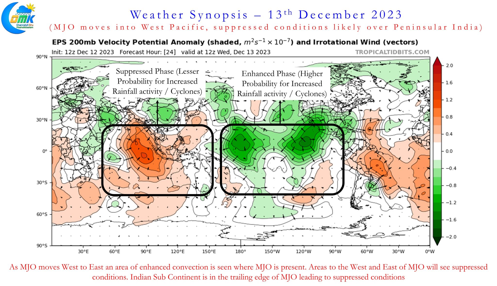
A look at the satellite image indicates the state of things currently over the Indian Ocean basin on the back of MJO moving further East into West Pacific and adjoining areas. The most active phase both during Southwest Monsoon and during Northeast Monsoon time is when MJO moves West to East from East Indian Ocean to Maritime Continent. It becomes essential to point out here last week’s Cyclone Michaung also benefitted a lot from this favorable transit of MJO. With the Indian Sub continent now in the trailing edge of the MJO wave we are likely to see the suppressed phase over the next couple of weeks until MJO completes its Global circuit and heads back to West Indian Ocean which could be anywhere between 15 to 18 days from now. As things stand it appears rest of December may not find any support from MJO while we could see some support from Kelvin Wave which might benefit South Tamil Nadu areas and places closer to the Ghats.
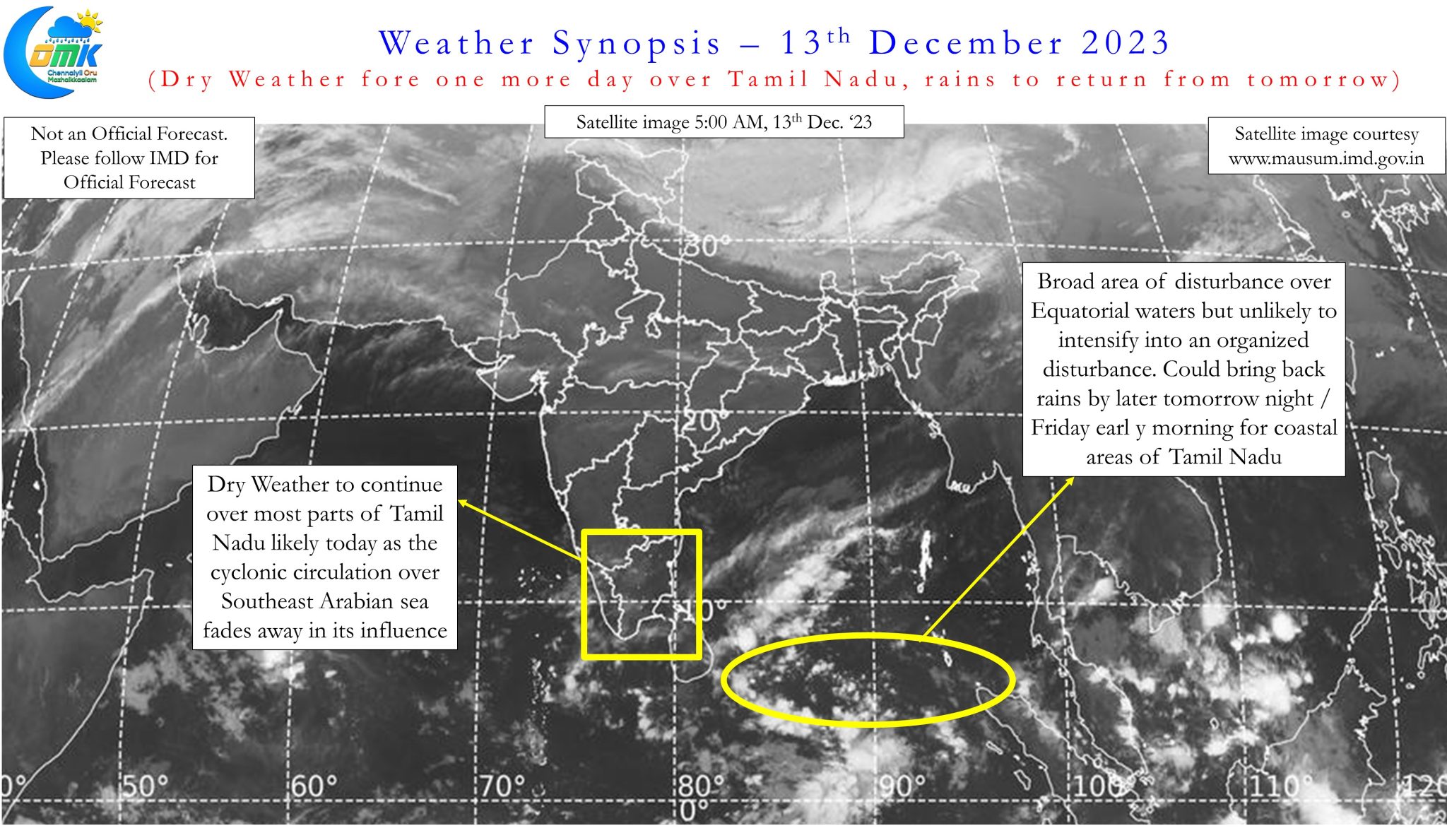

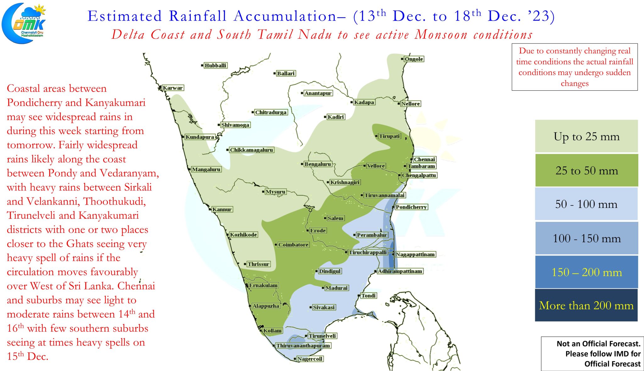
A close observation of weather models also indicate a changing trend in terms of potential for Depression / Cyclone reducing gradually with each passing day. Ensembles are fairly in sync with the scenario of disturbances remaining weak and sticking closer to the Equatorial waters for the next couple of weeks. This could potentially mean the most favorable area for rains could be south of Pondicherry latitude with parts of Delta and South TN likely to come under heavy rains over the next week to 10 days. Models indicate two distinct disturbances (both expected to remain weak) to bring rains over Coastal TN. The first one currently to ESE of Sri Lanka is expected to bring rains between 14th to 17th December while the second one is expected to bring rains between 18th to 23rd December. Bulk of the rains will happen between Pondy and south TN coast.
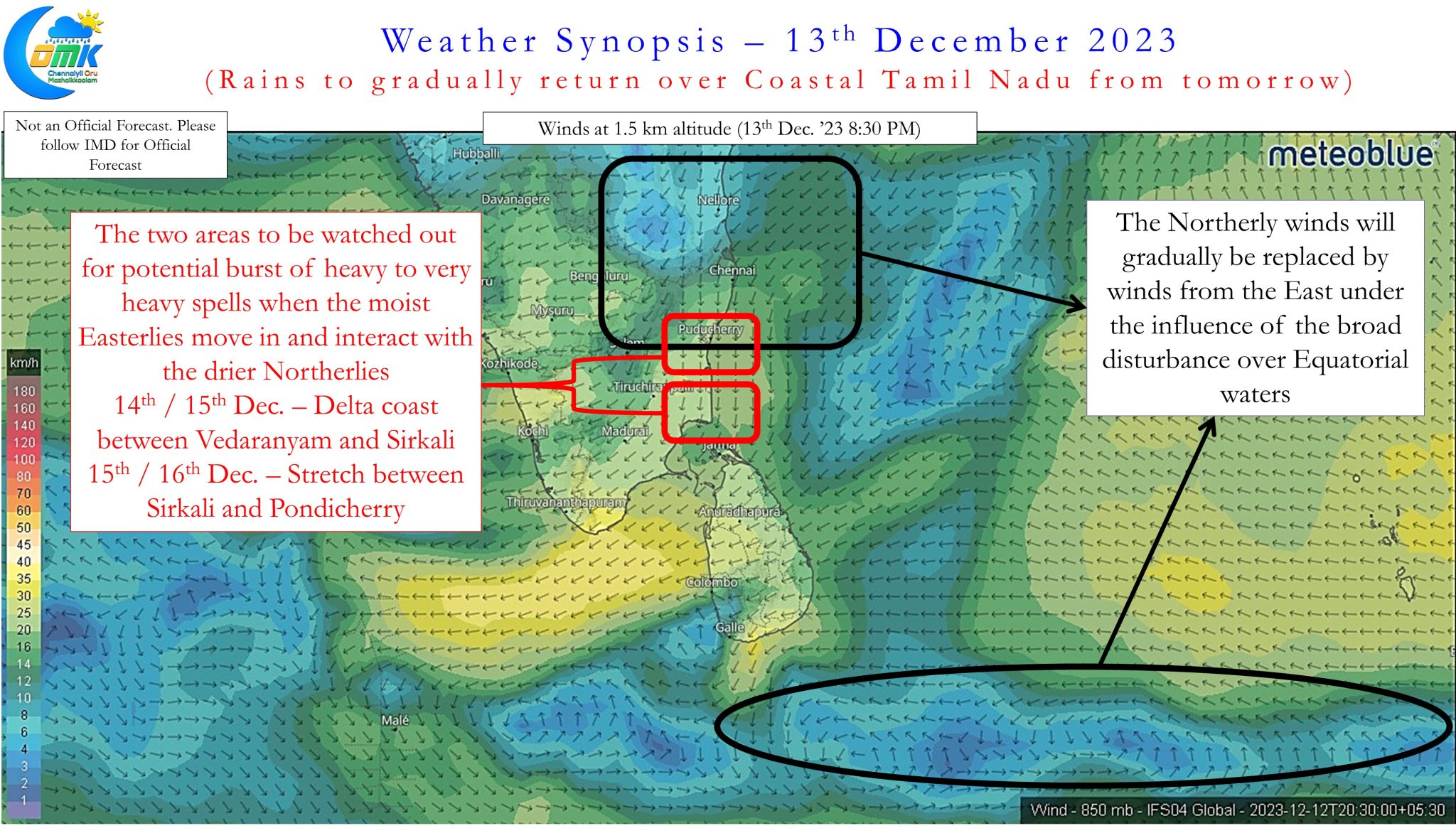
While widespread rains are likely along the coast between Pondicherry and South TN, two areas to be watched out for potential burst of heavy to very heavy spells when the moist Easterlies move in and interact with the drier Northerlies 14th / 15th Dec., Delta coast between Vedaranyam and Sirkali
and 15th / 16th Dec., stretch between Sirkali and Pondicherry. These could be over isolated places where the wind convergence happens.
As far as Chennai and suburbs go there could be light to moderate rains between 14th and 16th with some places, particularly to the South of Chennai, seeing heavy spells at times. It may not be a surprise if the actual rains end up being much lesser than model indicated accumulation if the disturbance over Equatorial waters end up moving South of Sri Lanka without moving into Gulf of Mannar / Comorin sea region. Models indicate some weak rainfall activity after 18th which will be covered in due course after ascertaining how real time conditions evolve over the next couple of days.
There is no reason for Chennai to panic. With water table and soil moisture very high there could be a possibility a few places might see localized water logging during moderate rains. If your area is prone to water logging keep a watch and stay alert.