
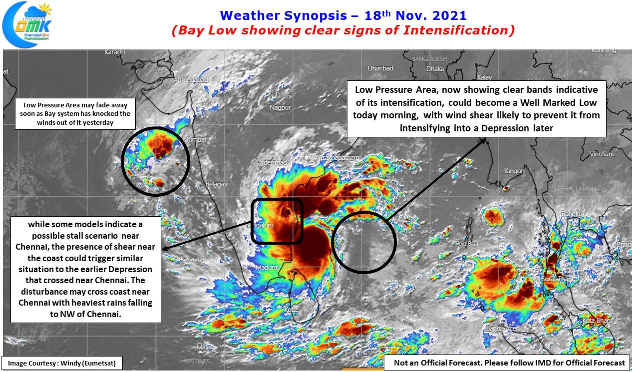
The events happening over the last 24 hours or so once again confirms how despite all the technological advances that have happened to Global Weather Models North Indian Ocean remains a grave yard for these models. Is it because of reduced observations or improper parameters only a detailed study could throw light on that. On 16th Nov. most models expected the Arabian Sea to intensify taking energy from the Bay Low, the current satellite image pretty much sums up why Bay of Bengal is called Boss of Bays by the weather bloggers of Chennai.
Interestingly the events over the past 12 hours or so also indicate even the famous Tamil Poet Thiruvallur may find it hard to justify his Couplet
தெய்வம் தொழாஅள் கொழுநன் தொழுதெழுவாள்
பெய்யெனப் பெய்யும் மழை.
வேறு தெய்வம் தொழாதவளாய்த் தன் கணவனையே தெய்வமாகக் கொண்டு தொழுது துயிலெழுகின்றவள் பெய் என்றால் மழை பெய்யும்! – மு வரதராசன்
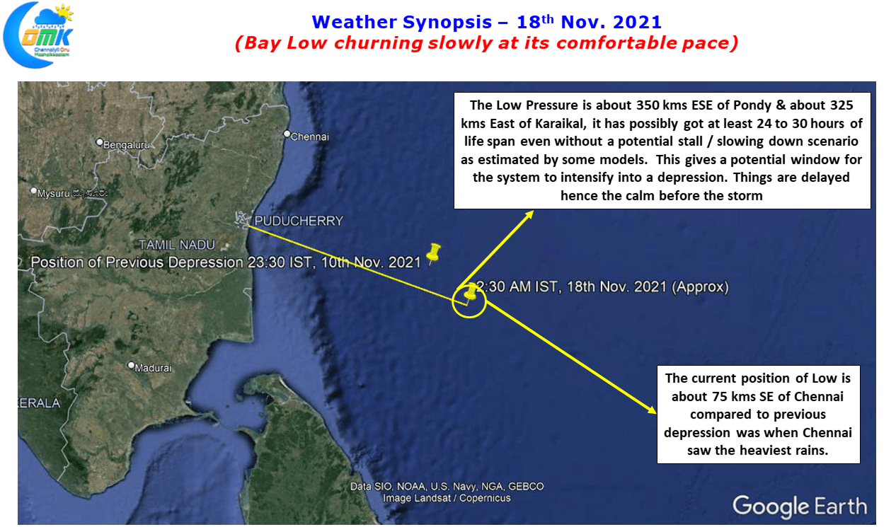
The Low Pressure Area in Bay which might get confirmed as a Well Marked Low in the next few hours by IMD is currently placed about 350 kms ESE of Pondicherry and if one were to compare it with the previous depression, it is roughly 75 kms SE of the location when Chennai got its heaviest rains. With pretty much similar track expected by the current one as well the quiet night behind us is not an indication of the system weakening or moving away but a delay in the overall dynamics as estimated by the weather models.
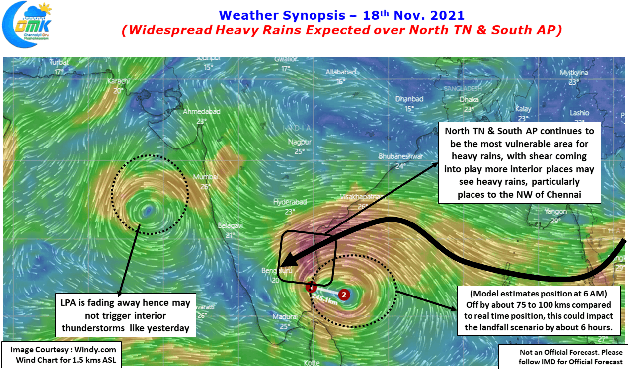
If one were to compare the model forecasted position at 6 AM today morning & the real time position of the LPA at 2:30 AM there is roughly 75 to 100 kms difference in the position. Overall this could possibly explain the delay in the dynamics by about 6 hours or so than model estimates. Nevertheless the wind charts also confirm there is no change in overall pattern with the system expected to cross coast close to south of Chennai coast around late night today bringing North TN & South AP as the most vulnerable region for heavy rains.
The only difference possibly we could envisage is Wind Shear could come into play later in the evening which could possibly trigger a scenario of the heaviest rains happening about 100 to 150 kms NW of Chennai. This does not indicate Chennai will not get any more rains to the contrary the coastal stretch around Chennai & Suburbs continues to remain vulnerable for heavy to very heavy spell of rains today.
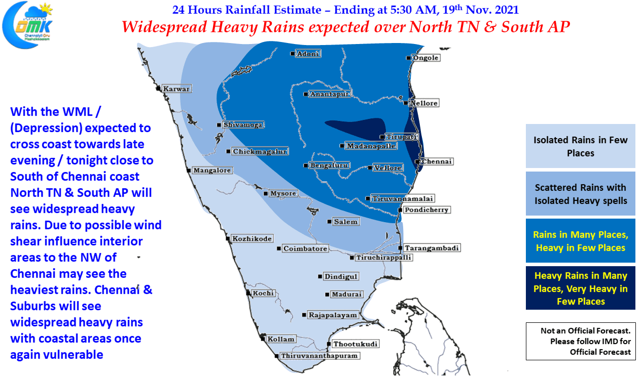
A word of Caution. Due to constantly changing dynamics there is reduced confidence on the Precipitation Chart for today.