

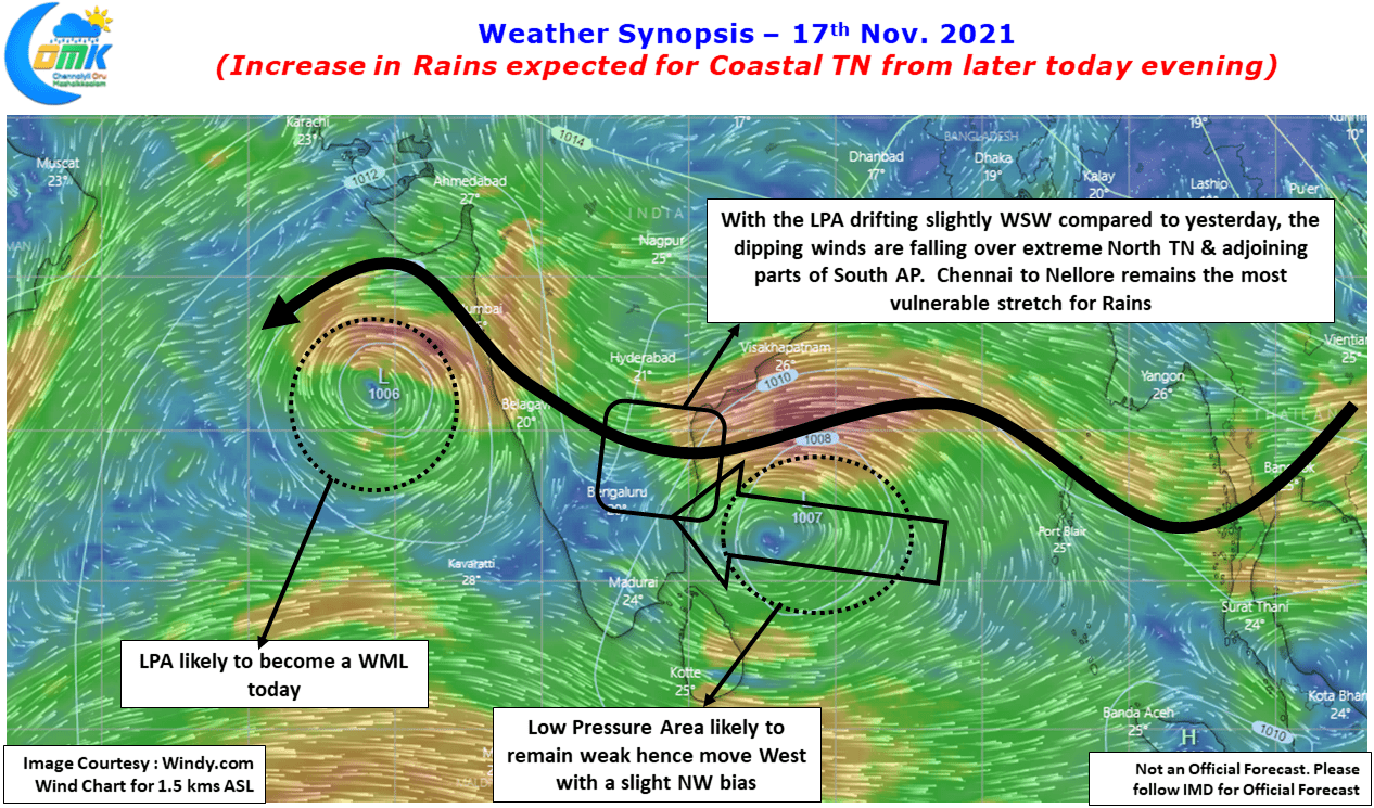
The popular proverb Man Proposes God Disposes becomes Models Propose Bay Disposes for Weather Bloggers. Weather models struggling even in the short term is nothing new especially with weak to moderate intensity disturbances which tend to have their own dynamics at a much smaller scale than getting involved with larger scale factors like Indo China Ridge / Indo Arabian Ridge etc which come into play for Cyclones to be guided. Adding to boiling Bay pot is another weak disturbance in Arabian Sea which is hell bent on not only creating unfavorable environment but also putting models off guard in their assessment of things.
In all this one cannot also ignore the fact North Indian Ocean Basin is a much smaller basin compared to Pacific, Atlantic or for that matter even South India Ocean. This comes into play when two pulses develop at the same time occasionally creating a case of competing interests. In the current context the pulses are not very far away even though they are on either side of the Peninsular India. This has set a Yo Yo pattern as the two pulses struggle to dominate each other in a fight to finish combat.
This struggle for space has resulted in the Bay pulse moving WSW compared to last night in a bit to maneuver itself some free space to push WNW as the Arabia Sea pulse has sort of remained stationary around the same region for most of yesterday. The current events once again are a very good example of chaos theory in weather. This bit of WSW Relocation / Movement has now opened up a different set of dynamics for not only Chennai but most of North Tamil Nadu which may see an increase in rainfall quantum now compared to say 24 hours back.
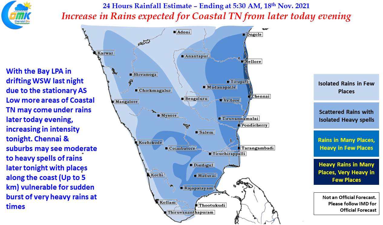
The rains are expected to increase from later today as the LPA in Bay moves west towards the TN Coast and is expected to peak from tomorrow morning till evening tomorrow. The rains are expected to increase in intensity from the night with few places about 5 to 10 kms from the coast line especially vulnerable for some heavy to very heavy spell of rains like the previous instance.
As of now the way things are shaping up Chennai to Nellore continues to remain vulnerable with the hotspot gradually shifting south as fresh model outputs come up taking the current conditions into account. This is likely to make Chennai & particularly northern suburbs extremely vulnerable for a bout of extreme rains in the next 18 to 36 hours window. Considering the current soil moisture levels & lake levels it is indeed a huge risk even if Chennai gets about 15 cms or so over the next 24 to 36 hours which most models are expecting to breach comfortably.