
The last couple of weeks has seen Southwest Monsoon show some of its regular traits of becoming vigorous over the Western Ghats and the Himalayan states. The weekend saw extreme rainfall instances over parts of North India with record breaking rains from places like Chandigarh, Delhi etc. Many parts of Uttarakhand, Himachal Pradesh saw intense rains over the weekend resulting in large scale flooding cutting off access to many part of the state with roads getting washed away. 9th July saw the highest single day Rainfall accumulation for the country overall primarily driven by the numbers from North Indian states. It was also for the first time the overall Monsoon performance across the country moved into positive zone this season.
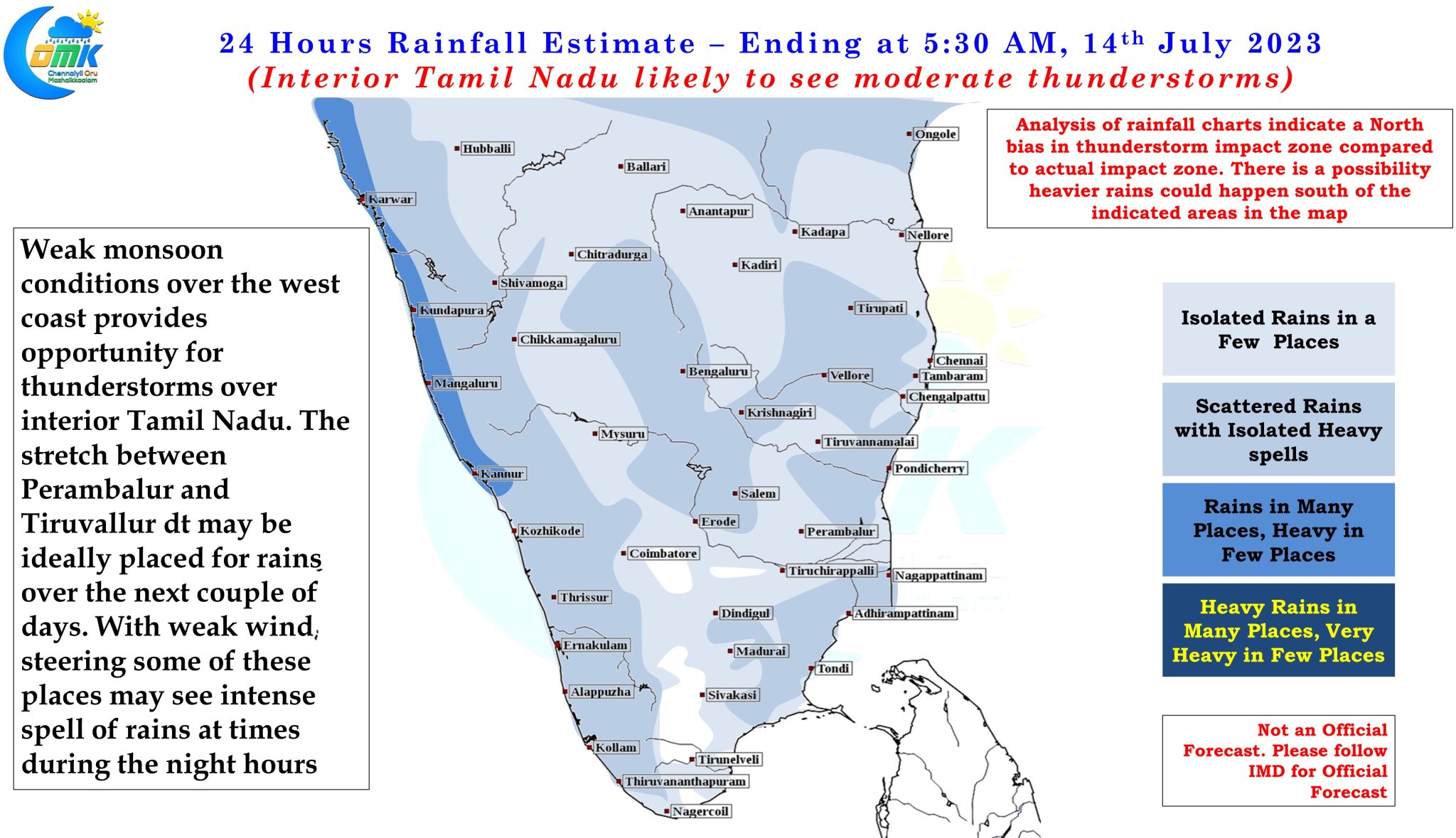
In the meanwhile thunderstorms continue to tick over the leeward areas of Tamil Nadu. Parts of Villupuram district got pounded by very intense spell of rains which brought in more than 20 cms of overnight rains to places like Manampoondi which recorded a whopping 273 mm of rains for 24 hours ending today morning. In a way the heavy rains over parts of Villupuram district is an indicator of the weak monsoon conditions over the West coast leading to slow moving storms dumping a lot of rains over some places.
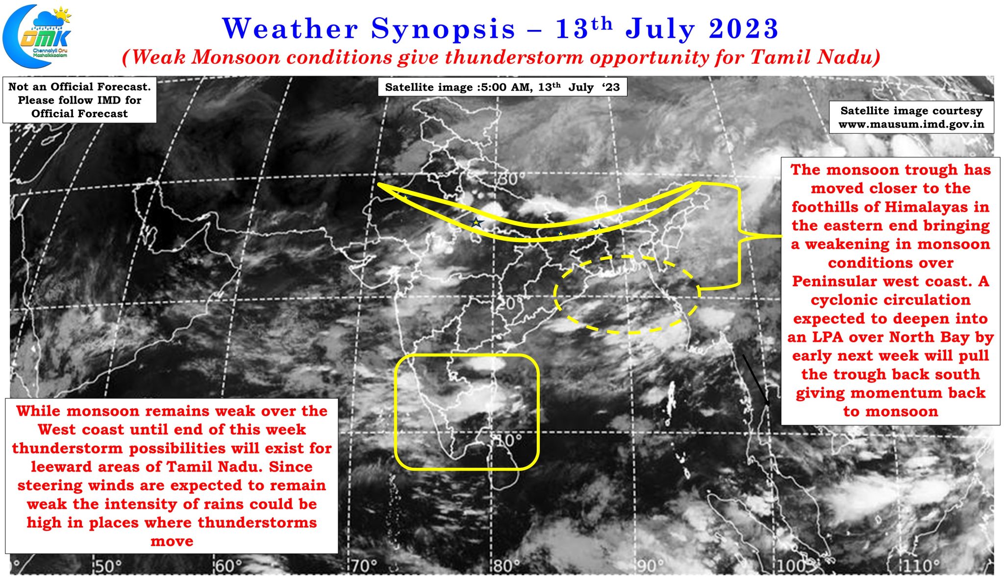
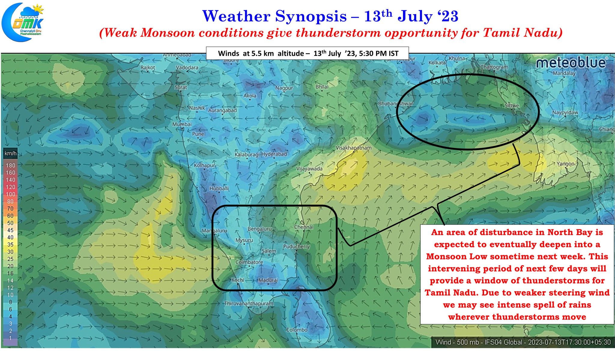
While one cannot call the current state of monsoon as text book break in monsoon conditions since the western end of the trough is slightly to the south of regular position while the eastern end has shifted very close to the foothills of Himalayas. IMD has given an extreme rainfall warning for Sub Himalayan West Bengal and Sikkim today indicative of the break in monsoon conditions prevailing over East and NE India. This is expected to prevail until early next week when a cyclonic circulation that is expected over North Bay eventually deepens into a Monsoon low thereby dragging the monsoon trough further south. This is also likely to coincide with a fresh momentum to monsoon dynamics.
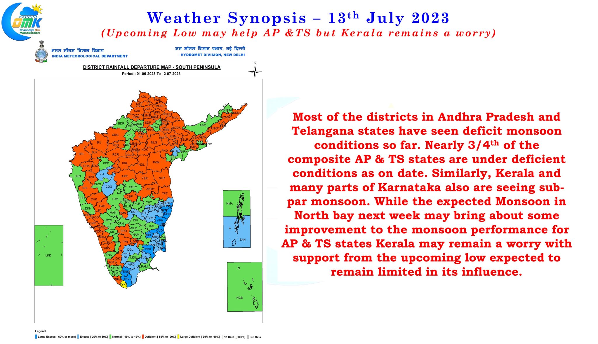
States like Andhra Pradesh and Telangana which as on date have nearly 3/4th of the districts under deficient rains since Southwest Monsoon began is likely to be the biggest beneficiary of this Monsoon low when it develops middle of next week. But the same cannot be said for Kerala and adjoining Ghats of Tamil Nadu and places like Kanyakumari in South TN which may see lesser influence from the upcoming Monsoon low compared to say the Shahyadris of Maharashtra & Goa.
In the meanwhile the next few days gives an opportunity for thunderstorms over the leeward areas of Tamil Nadu with the monsoon dynamics remaining weak over the Peninsular West Coast. The part of Tamil Nadu between Perambalur and Tiruvallur district roughly about 50 to 75 kms from the coastline may see the most intense thunderstorms with weak steering making storms remain near stationery over places there is a fair possibility the coastal stretch between Cuddalore and Pulicat to also see one or two days of good rains during this period. This favorable period for thunderstorms is expected to persist until Monday for the leeward areas of Tamil Nadu. As is the case during southwest monsoon thunderstorms the days are expected to be warm / hot leading to conducive convective development which start interacting with remnant moisture from the west to trigger thunderstorms around the Eastern Ghats during evening hours eventually maturing by late night as it heads towards the coastal areas. This could provide for atleast a couple of days of good rains for Chennai and suburbs until Sunday.