
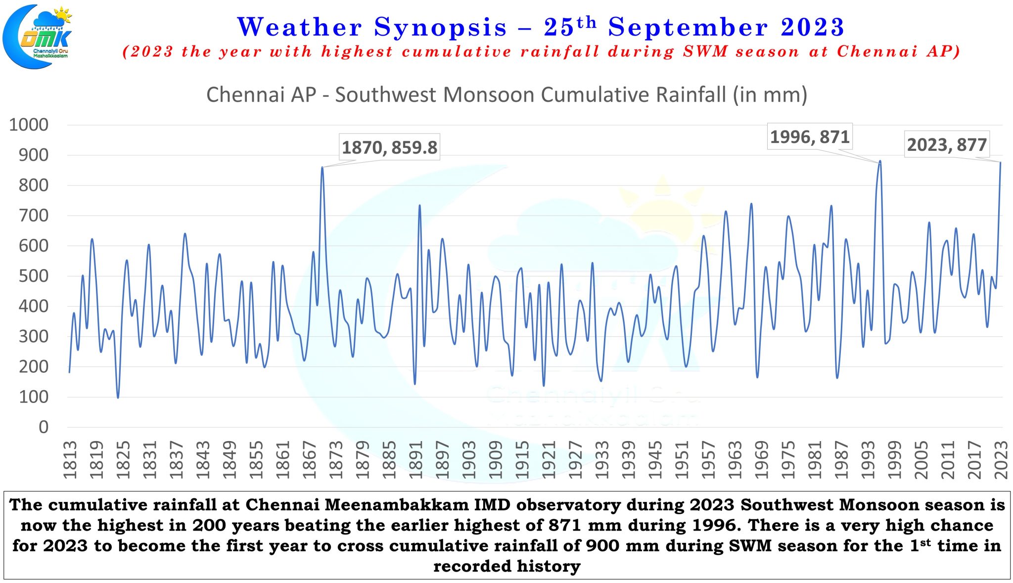
The Southwest Monsoon season this year is indeed turning out to be special for parts of leeward Tamil Nadu. In particular Chennai and the surrounding districts of Tiruvallur, Kanchipuram and Chengalpattu along with Villupuram in North Coastal Tamil Nadu has been enjoying an extremely active season of Thunderstorms. All these districts have so far seen excess rains in the rage of Chengalpattu with 43% and Chennai with 70% excess over average as of yesterday. With the overnight widespread rains over North Tamil Nadu this number is expected to be pushed up further. It is no wonder that the IMD observatory has recorded the wettest Southwest Monsoon season in 200 years cumulatively recording 877 mm since 1st of June.
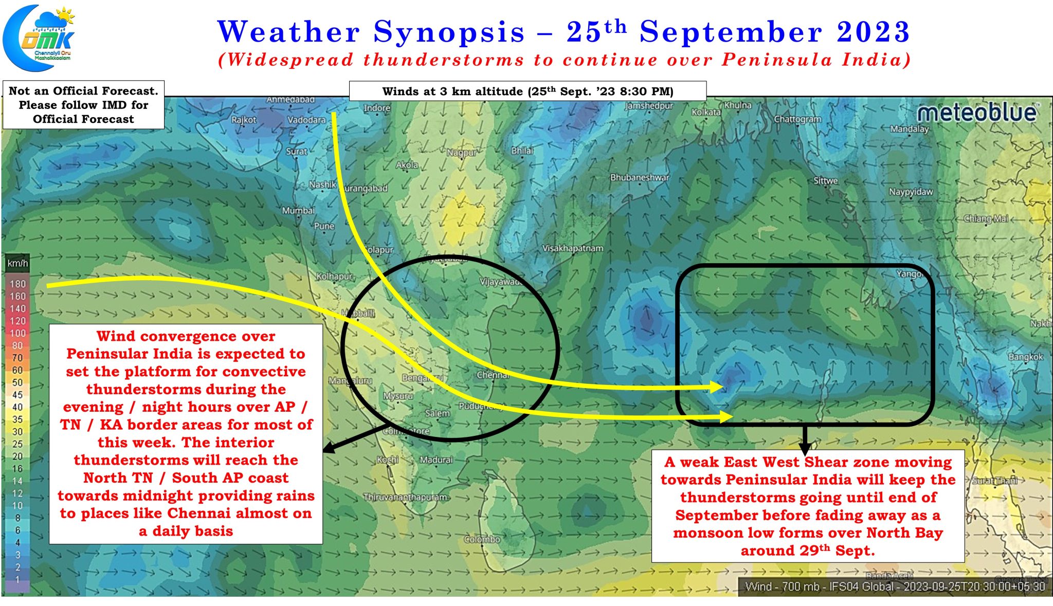
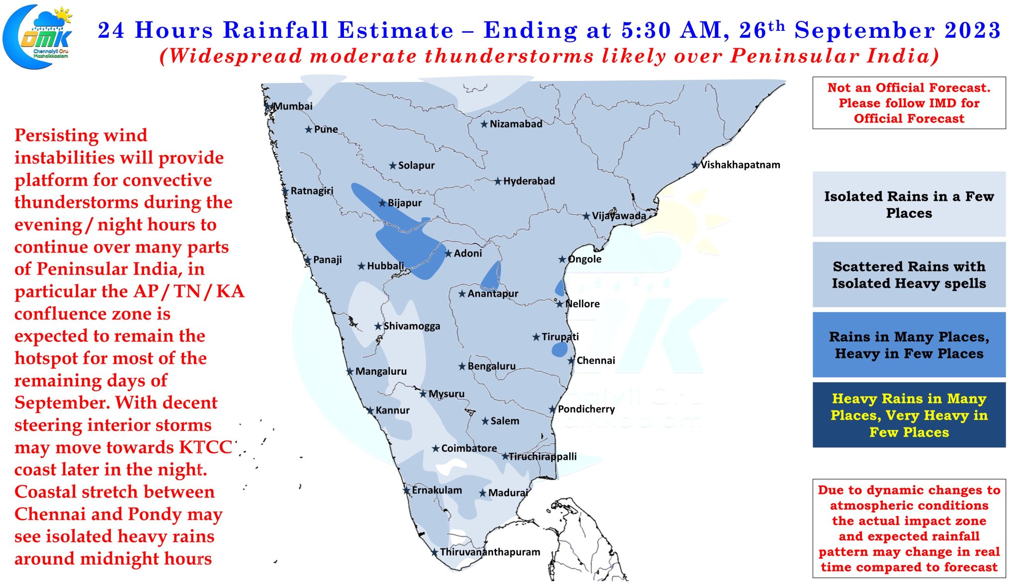
With IMD expecting the start of withdrawal of Southwest Monsoon from Northwest India in the next 24 hours the transition season thunderstorms are expected to continue over Peninsular India due to wind instabilities prevailing over the region. While wind convergence is expected to provide the platform for thunderstorms today and tomorrow over the interior areas of South India a weak East West Shear Zone at mid tropospheric levels that is pushing in from Bay of Bengal is expected to keep the atmospheric conditions favorable for thunderstorms to persist over most of the remaining days of September.
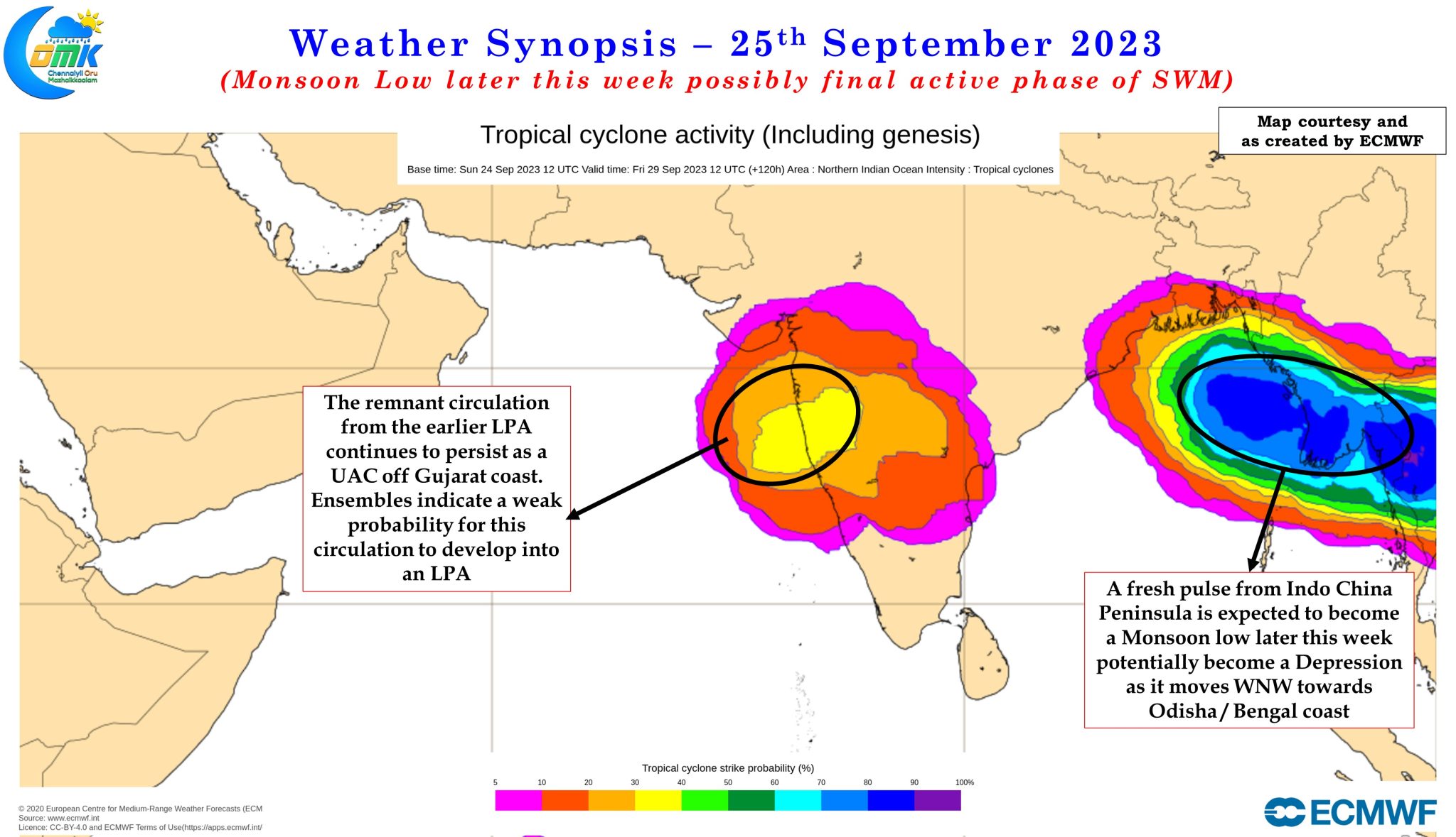
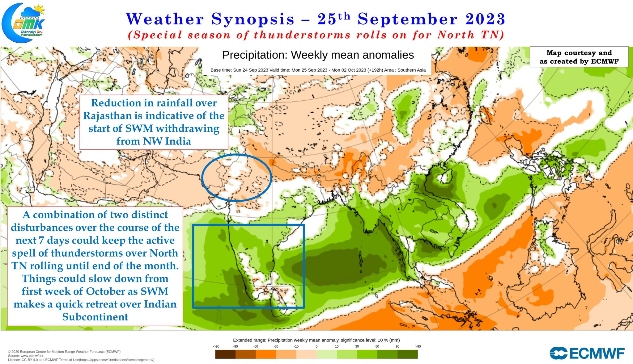
A pulse from Indo China Peninsula is expected to develop into a Monsoon Low over North Andaman Sea and adjoining North Bay area around 29th of September. There is a strong consistency among the ensembles about this LPA strengthening into a depression or possibly a marginal cyclone. This potentially could be the last spell of favorable activity for the core monsoon zone before Southwest Monsoon starts its retreat across the Indian Sub Continent. With MJO expected to move further East towards West Pacific around 1st week of October overall conditions may turn less favorable allowing the monsoon to withdraw quickly over most areas of India except Peninsular India. This unfavorable transit of MJO potentially could mean the first half of NEM season which statistically starts from 1st October may remain weak for Tamil Nadu though in a way the above average thunderstorm season during SWM mitigates the effect.
In the meanwhile for the next few days thunderstorms are likely to continue almost on a daily basis along the KA / AP / TN confluence areas with most days these storms expected to shift during the night hours towards North TN / South AP coast. With westerlies weakening the storms are expected to move slowly over the interior areas, further slowing as it crosses the land to sea due to land / ocean friction. This could potentially mean few coastal places could see intense burst of rains between Chennai and Pondicherry this week when the steering is favorable and storms are intense while moving from the interiors.