
During the Southwest Monsoon season Kerala and Mahe roughly receives 200 cms of rains during an average year. Roughly 13% of the seasonal rainfall is expected to fall during the month of September. The monthly average for September is 27 cms or so. After a record breaking August, not for the right reasons, the cumulative rainfall total for September is now at 19 cms. With September being good so far the possibility of 2023 being the worst ever Southwest Monsoon year in more than 100 years has all but vanished. The current year’s seasonal tally is at 1101.4 mm just short of 1104.2 mm recorded during the year 1918 which is the lowest since 1901.
Regular weather observers would not have forgotten how monsoon dynamics picked up supported by a favorable MJO presence over the Maritime Continent. Most of July saw MJO and El Nino base state interfere against each other resulting in a weak MJO parked over the Maritime Continent. This resulted in a train of pulses moving into Bay of Bengal keeping the monsoon dynamics going in the form of regular Monsoon lows traversing over Central India and adjoining areas. This went a long way in keeping this year’s monsoon in a reasonable shape with both June and August seeing extremely suppressive conditions.
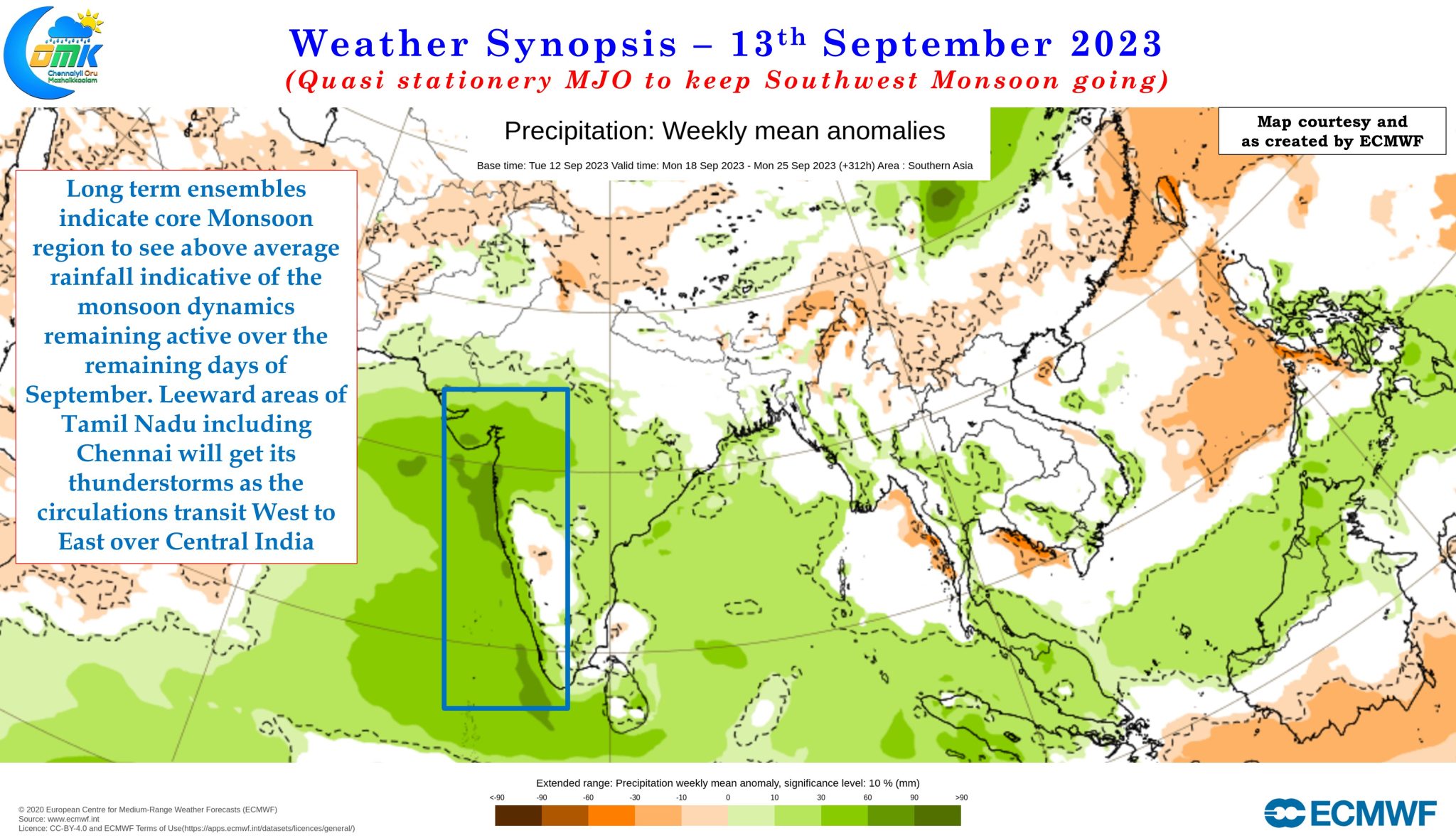
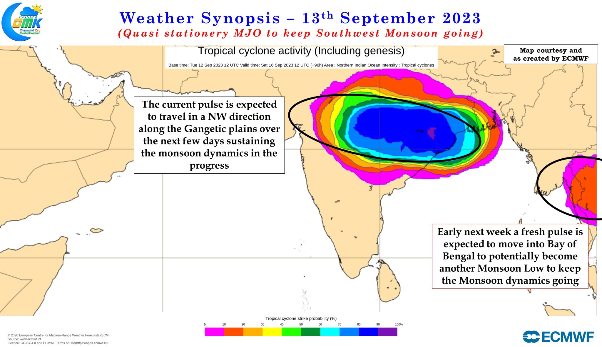
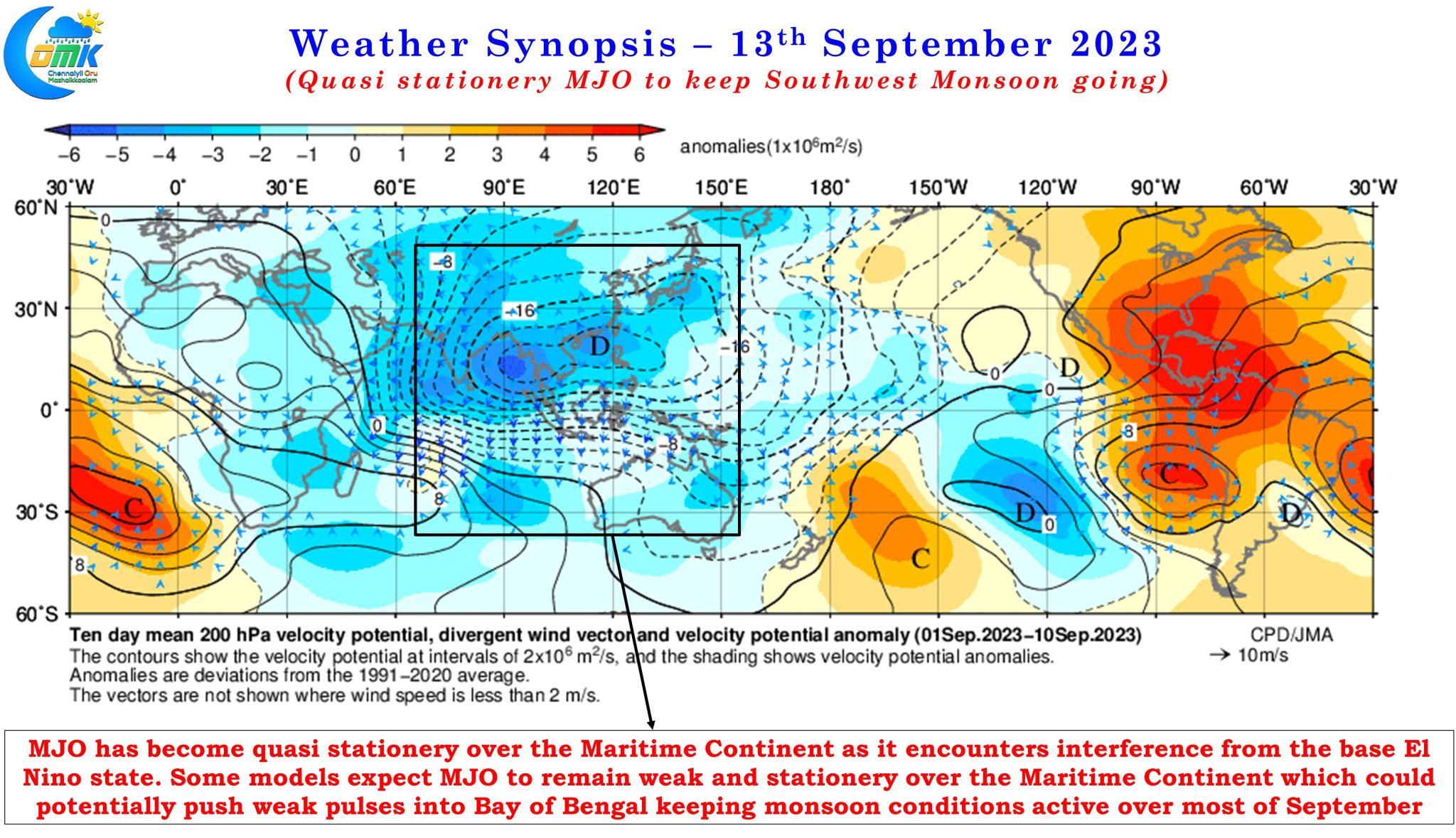
A similar scenario is now unfolding with MJO once again becoming quasi stationery over the Maritime continent as once again interference between El Nino and MJO resulting in MJO not only losing its strength but also the ability to make a quick transition towards West Pacific. Weather models expect over the next week to 10 days MJO could possibly remain weak and remain quasi stationery over MTC and adjoining areas. This could mean once again back to back Monsoon lows could keep the Monsoon dynamics going during the remaining days of September bringing rains to not only the core monsoon regions of Central India but also the west coast.
The North bay currently has a monsoon low that is expected to move NW towards Central India as it moves further west a fresh pulse is expected to move into Bay of Bengal early next week which could also become a Monsoon Low around middle of next week. There is a faint chance one more Monsoon Low could follow that though as of now we can be fairly sure of two lows influencing the Monsoon dynamics over the next 10 days or so. All in all it could mean September may be like July as far as the core monsoon areas are concerned allowing it to recover from the very poor August.
There is a catch though which could potentially have implications for Northeast Monsoon. Based on how MJO is currently behaving we could potentially see most of October remain unfavorable for the Indian Subcontinent. We are possibly looking at a period of anywhere between 4 to 6 weeks before a fresh pulse of MJO appears over the North Indian Ocean and bring back favorable conditions. This is likely to impact the onset of Northeast Monsoon though the overall unfavorable conditions could potentially hasten the withdrawal of Southwest Monsoon during the first half of October. This is something that is likely to keep the weather bloggers of Chennai on tenterhooks over the next couple of weeks.
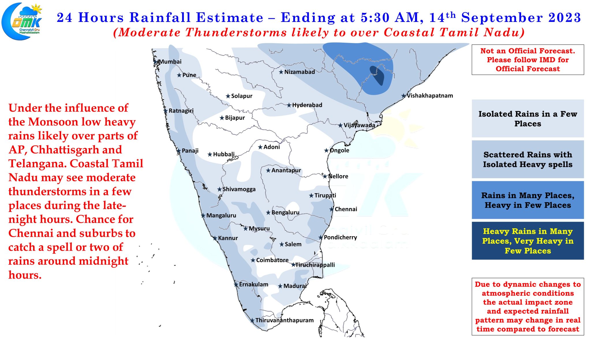
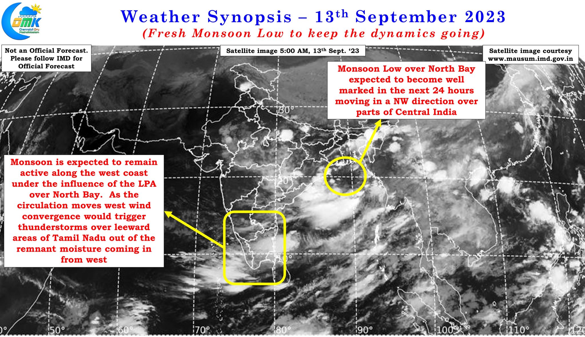
In the meanwhile as circulations move west over Central India from the Bay of Bengal it is likely to give window of thunderstorms for the leeward areas of Tamil Nadu through wind convergence bringing spells of rains which could last a couple of days before a bit of dry weather returns. Unlike peak monsoon surge associated with the months of July and August even if monsoon is active it may not be completely dry for the leeward areas of Tamil Nadu including Chennai.
Over the next couple of days coastal areas of Tamil Nadu may get witness some late night / post mid night thunderstorm activity as remnant moisture coming in from the west develops into thunderstorms as it travels over interior Peninsular India during the day time.