
A week is a long time in weather particularly in the tropics where things could evolve at a pace much faster that what models can anticipate. But at times events go exactly as per script written by models, Cyclone Jawad was one such event that went exactly as written. Weather models were consistent on the disturbance intensifying & taking a gradual NW track before taking a NE recurve along the East Coast completing its life cycle without probably making an organized landfall in the process. But despite the events happening exactly as estimated by weather models the unseasonal rains over places in North AP, Odisha & West Bengal would certainly not be kind to those expecting to harvest their crops around this time.
Meanwhile looking at larger scale of things it appears Madden Julian Oscillation could remain favorably placed for West Pacific bringing along with it a suppressed phase over Indian Ocean region. With the forcing shifting slightly to the East we need to now see whether what happened over the Maritime Continent replicates over West Pacific for the next 2 / 3 weeks or so. Similarly the ITCZ is seen South of the Equator which while not exactly stopping the rains over Peninsular India could possibly reduce the Northward Propagation of Rains thereby bringing possible curtains to Northeast Monsoon Season over places in Andhra Pradesh unless a strong disturbance forms in South Bay & climbs North towards the East Coast like Jawad.
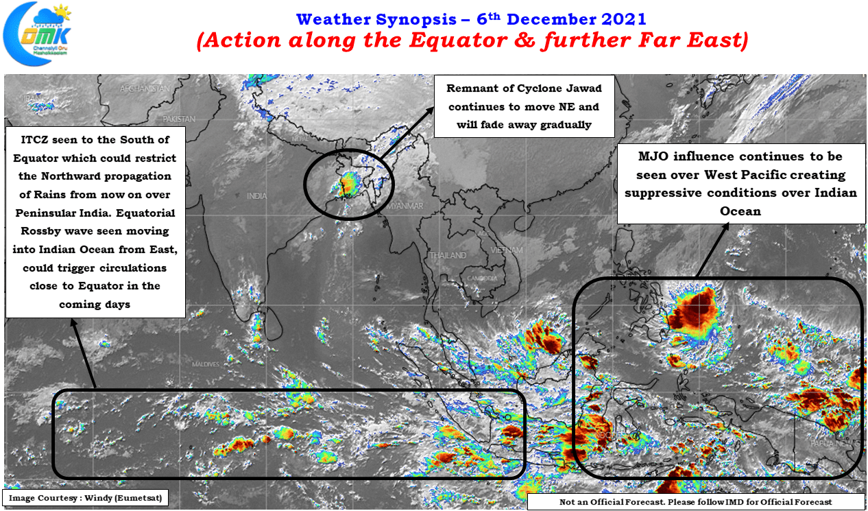
In this context it is also interesting to note if the expected arrival of the Equatorial Rossby wave will change things around for Peninsular India considering the suppressed phase which MJO’s presence over West Pacific has created over the Indian Ocean. Though the arrival of the ER wave over Indian Ocean is likely to trigger a set of circulations on either side of the equator it appears they could be weak in nature & possibly bring the heavier rains over South TN & Sri Lanka rather than widespread heavy rains over Tamil Nadu.
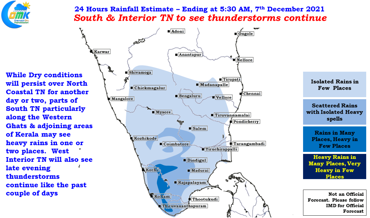
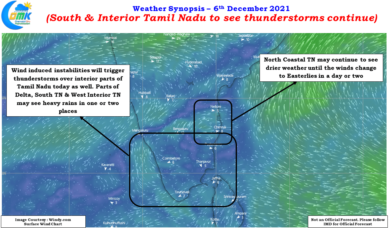
Looking at the immediate time frame the last couple of days have seen thunderstorms happen over the interior parts of Tamil Nadu & South TN areas, today could be no exception with rains likely in these areas once again due to wind instabilities. One or two places along the Western Ghats in TN & Kerala may see heavy rains as well. The Easterlies are expected to return back over North Coastal TN around mid week which may bring back light to moderate rains over the coastal areas like Chennai which will be after almost a week of dry weather in the region.