
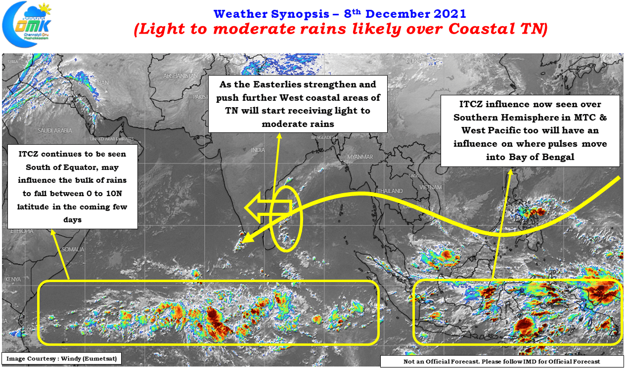
The ebbs & flows over a Monsoon season is always fascinating to watch & Observe. During Southwest Monsoon a slightly larger scale ebb & flow brings forth active & break phase of the monsoon conditions resulting in west & east coast benefitting from rains respectively. Northeast Monsoon has its own variant of this phenomenon when interior places were enjoying the Thunderstorm associated Rains for the past week coastal areas remained quiet.
Now with the arrival of strengthening Easterlies the dynamics will once again shift back to the coastal areas though it is not going to be a case of the interior areas completely missing out. But places further into the west like Coimbatore, Erode etc which benefit from these wind induced thunderstorms certainly miss out once Easterlies strengthen along the coast. It is also interesting to observe real time satellite images & compare it with model forecast to understand how things evolve.
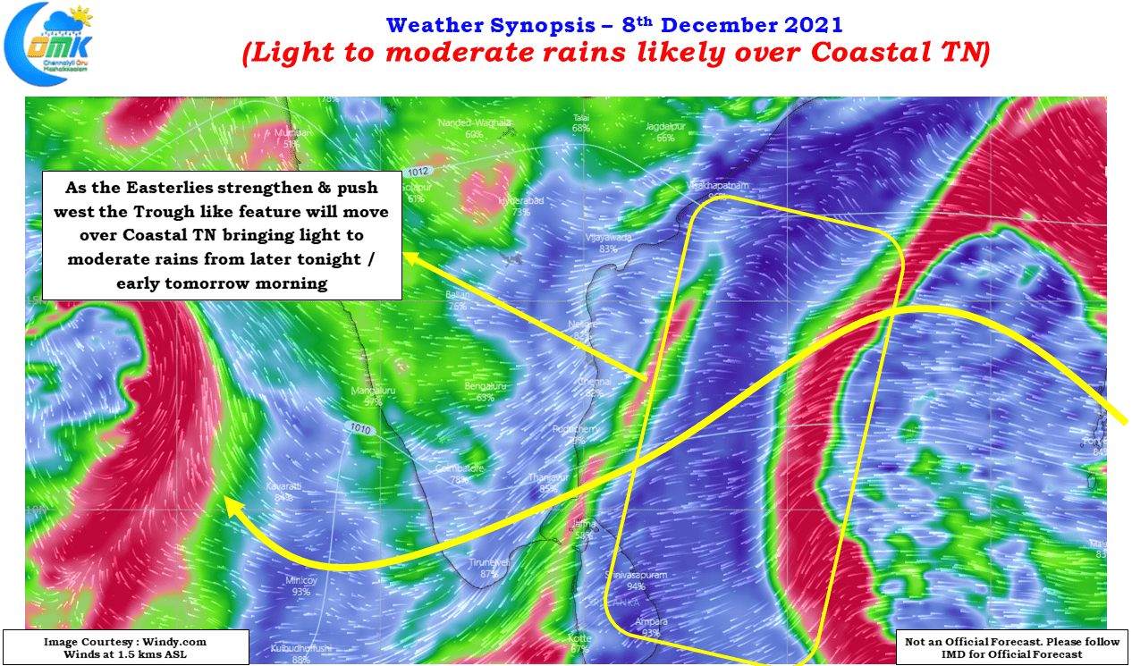
Today’s Satellite images clearly indicate the impact of the trough like feature triggered by the returning Easterlies. As the Easterlies strengthen and push further west towards Peninsular Coast, the rain bands will move into Coastal Tamil Nadu & Pondicherry bringing with it light to moderate rains over many places. But looking at the location of ITCZ it might be a case where the heavier spell of rains may stay to the south of 10N latitude or possibly Delta & south of it.
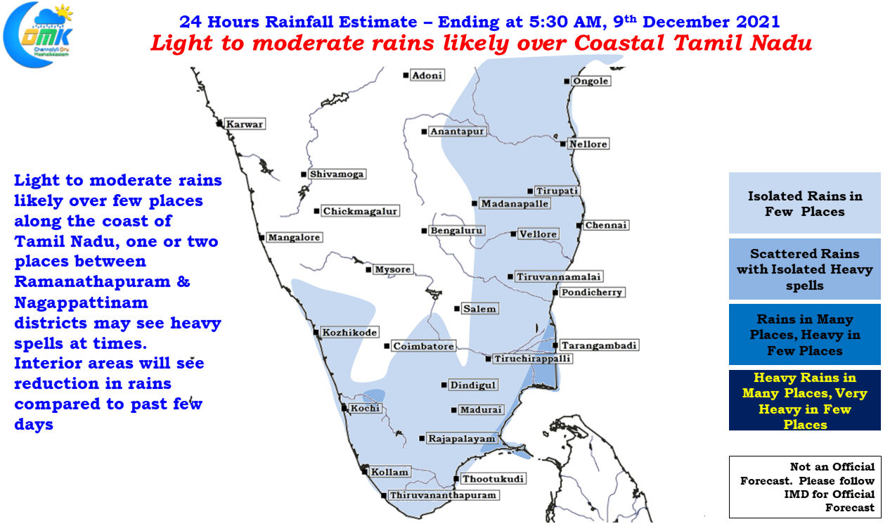
Today we might see places like Chennai & suburbs receive some light to moderate rains later in the night or early tomorrow morning which is likely to the pattern for the next couple of days with most coastal areas of Tamil Nadu receiving light to moderate rains. Few places between Ramanathapuram & Nagappattinam though may receive slightly heavier spell of rains at times. Tomorrow when the Easterlies strengthen we may see more places receive moderate rains.