
தெய்வம் தொழாஅள் கொழுநன் தொழுதெழுவாள்
பெய்யெனப் பெய்யும் மழை.
குறள் எண் – 55 (அறத்துப்பால்)
Many often remark, in the context of weather forecast in India, about how when the met man says is will rain in the USA it rains on the dot at the said hour and said minute. So much so if Thiruvalluvar was possibly living in today’s world he would have opted to change the above couplet to mean when the Met man says it will rain, it indeed rains in the USA. In all this what most people miss out is unlike the mid latitudes the tropics are much more dynamic in terms of atmospheric conditions and factors that influence a rainfall event.
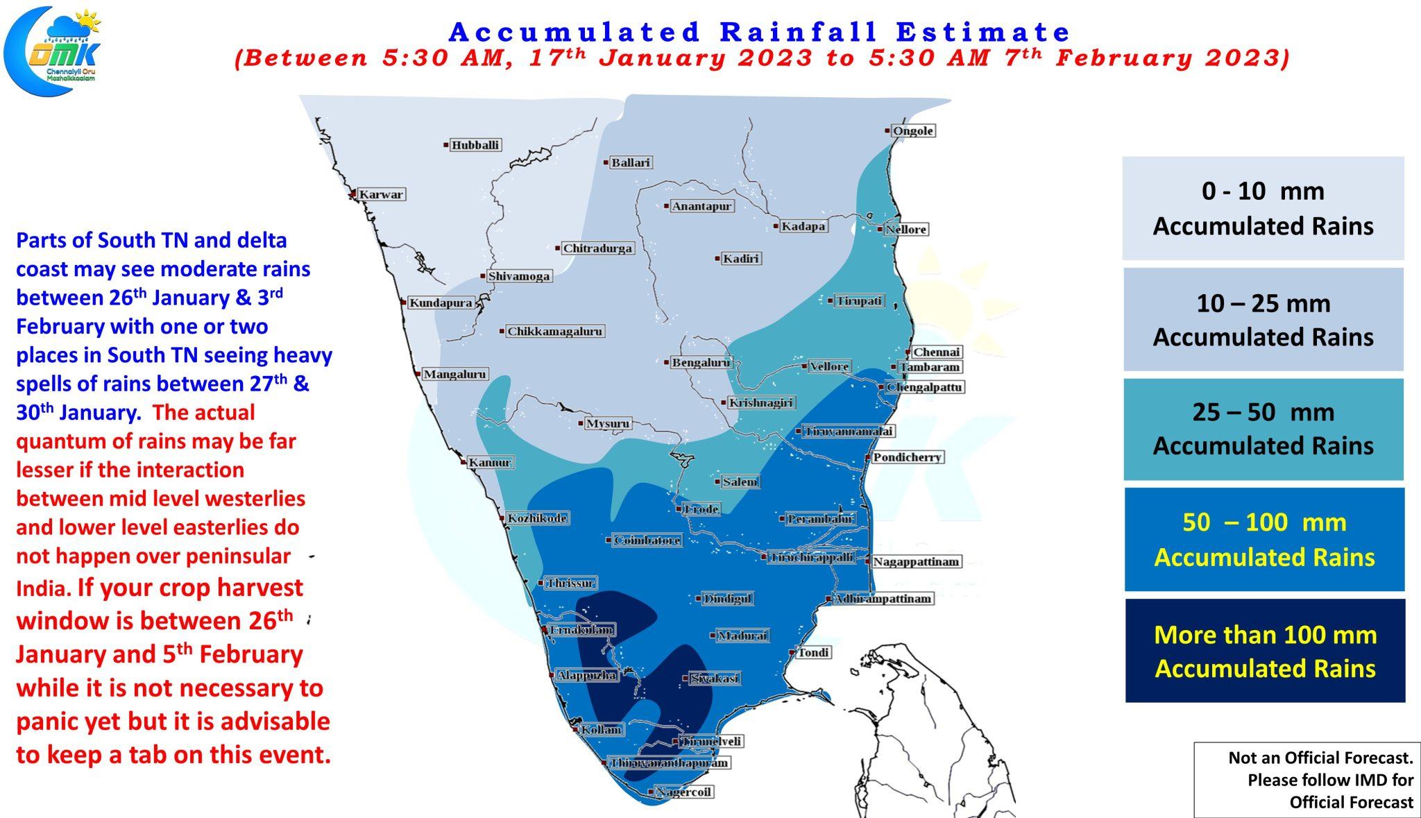
Towards the end of last month weather models were picking up a possible Rainfall Event over parts of Tamil Nadu. It involved an interaction between mid level westerlies and lower level easterlies bringing about rainfall associated with this interaction. As we got closer to the event it became clear the rainfall event that was expected to happen over land was more likely to happen over the sea east of Tamil Nadu coast. This interaction between mid level westerlies and lower level easterlies have brought about heavy rains over parts of Tamil Nadu even during late January / early February at times. But the window is always narrow and will require a lot of things falling in place at the right place and right time.
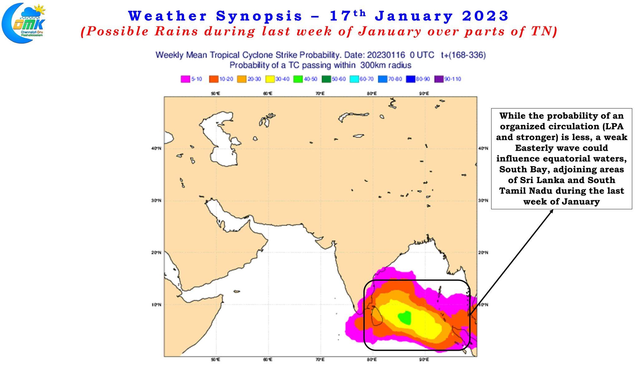
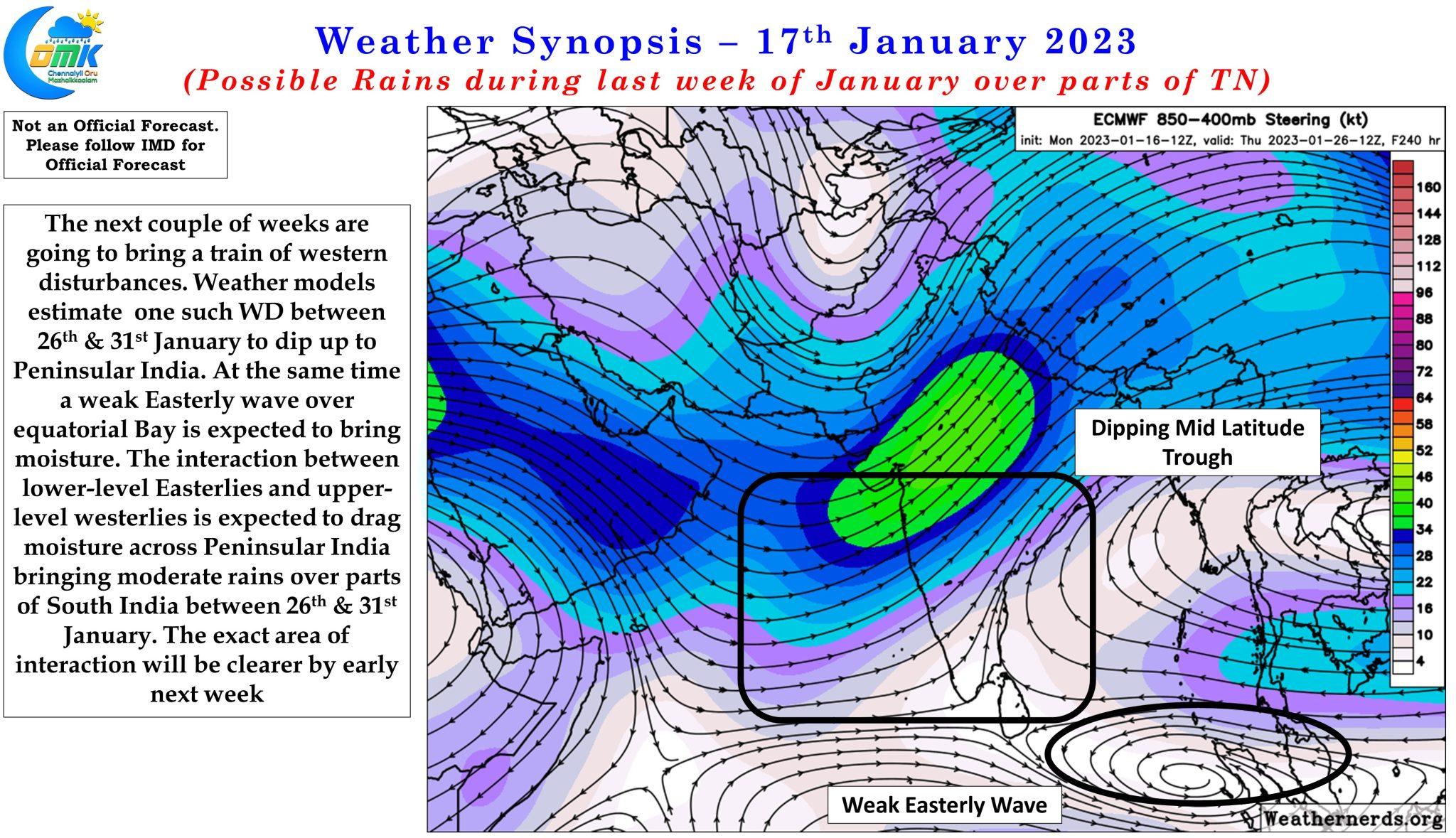
Weather models once again pick up one more rainfall event which is likely to be driven by the interaction between easterlies and westerlies. Over the next couple of weeks a train of western disturbances is expected to move across from west to east over the Indian sub continent. One of these is expected by weather models to dip well into parts of peninsular India opening a window of interaction between moist easterlies and mid latitude drier westerlies. At the same time models are showing a potential easterly wave that is likely to bring about moisture over equatorial waters, South bay, adjoining areas of Sri Lanka and south TN.
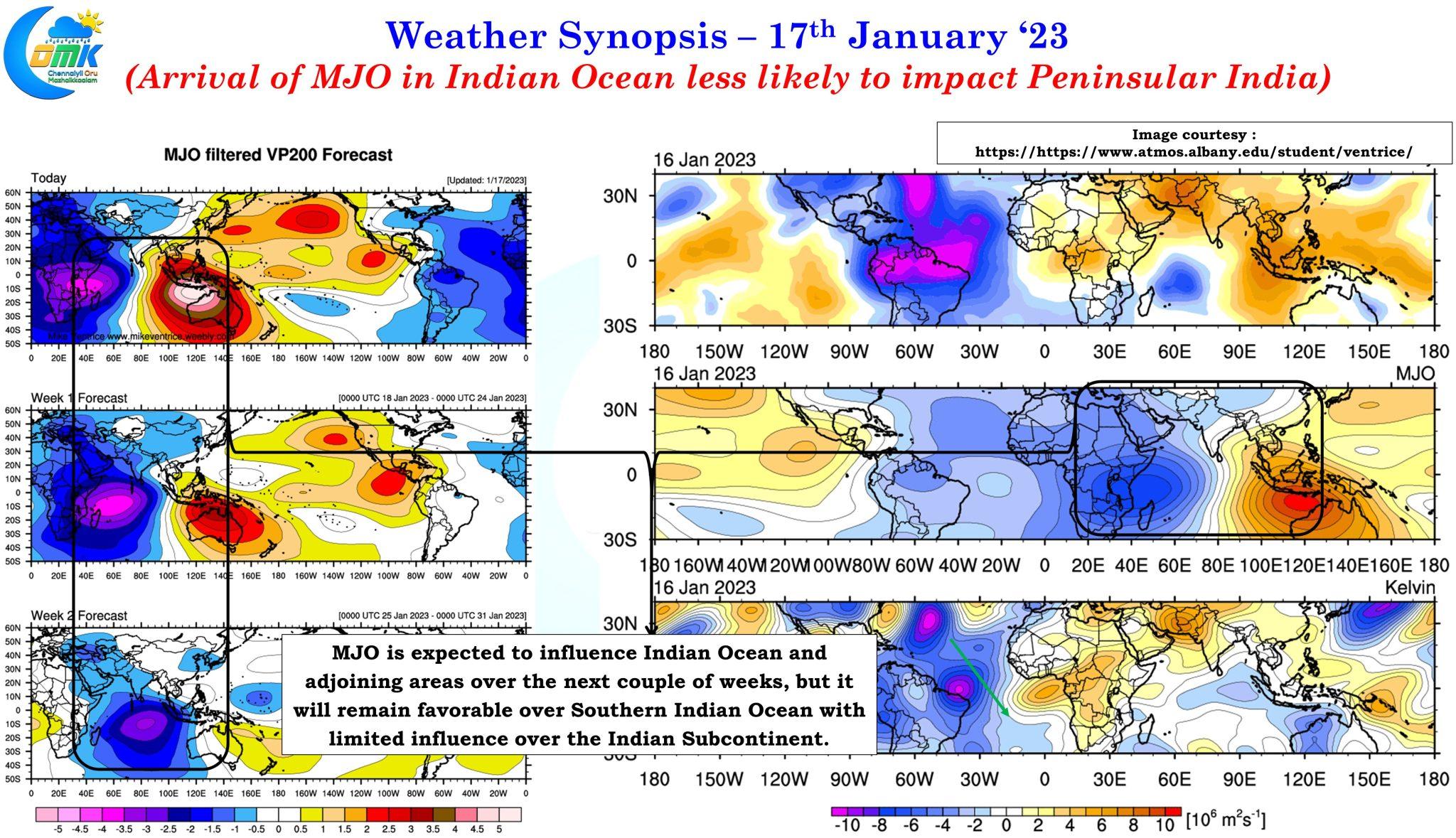
At this point it is also essential to bring a clarity on the expected influence of MJO over India Ocean. To start with real time satellite image indicates the influence of MJO is seen over parts of Africa and adjoining areas of the Indian Ocean. But the crucial thing is both in real time observations and the model estimates the influence of MJO is expected to be favoring the South Indian ocean and the influence of the Indian sub continent is likely to be marginal. This clarification becomes essential as there is a line of thought among many about arrival of MJO over the Indian Ocean always results in heavy rains over Peninsular India. This upcoming rainfall episode if it happens will owe a lot to the interaction between westerlies and easterlies rather than the influence of MJO over North Indian Ocean.
To cut the long story short. There is a possibility of possible rainfall event over parts of Peninsular India and today’s post is aimed at providing a head start to farmers whose harvesting window is falling around last week of January / first week of February. It is not time yet to panic but it will be certainly prudent to keep a watch on the weather forecasts for the next 3 weeks and be prepared to advance / take up harvesting at short notice to prevent rainfall related crop damages.