
Visits to circus whether they were done a couple of centuries ago or today is never complete without witnessing a bunch of performers defy gravity and literally fly at heights that could induce vertigo to many. We used to sit there with our mouths open not only out of excitement but also with a palpable tension wondering what happens if they fall down though there was always the safety net. Flying Trapeze an act where humans fly like birds. The Encyclopedia Britannica mentions Flying Trapeze was invented by the French acrobat Jules Léotard in 1859.
In the year 1956 came the film Trapeze which featured Burt Lancaster who was a real life trapeze artist. The highlight of a Flying Trapeze act is when the catcher holds the other person who comes flying towards him after executing a summersault. This catch has to be perfectly timed through a well coordinated maneuver between the catcher and the flyer otherwise it ends up as not only a failed entertainment attempt but also a potential safety hazard. This sweet spot to execute this maneuver is just a couple of seconds as both the catcher and the flyer are perpetually in motion.
One may wonder why so much about a circus act. Some times different factors in atmosphere also perform such trapeze acts which could trigger weather events that may not be possible in the normal context. One such trapeze act is unfolding in front of our eyes as a fluid Bay of Bengal once again attempts to showcase itself as the graveyard for global weather models. It is events like these that make estimating long term weather events around Peninsular India complex and challenging as not only localized developments but also global scale developments that provide a layer of complexity.
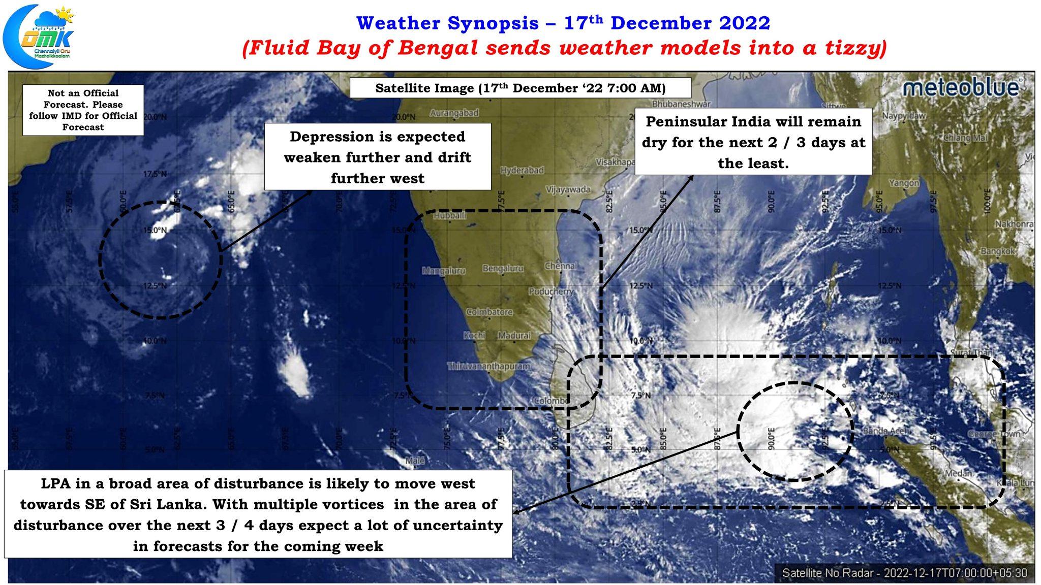
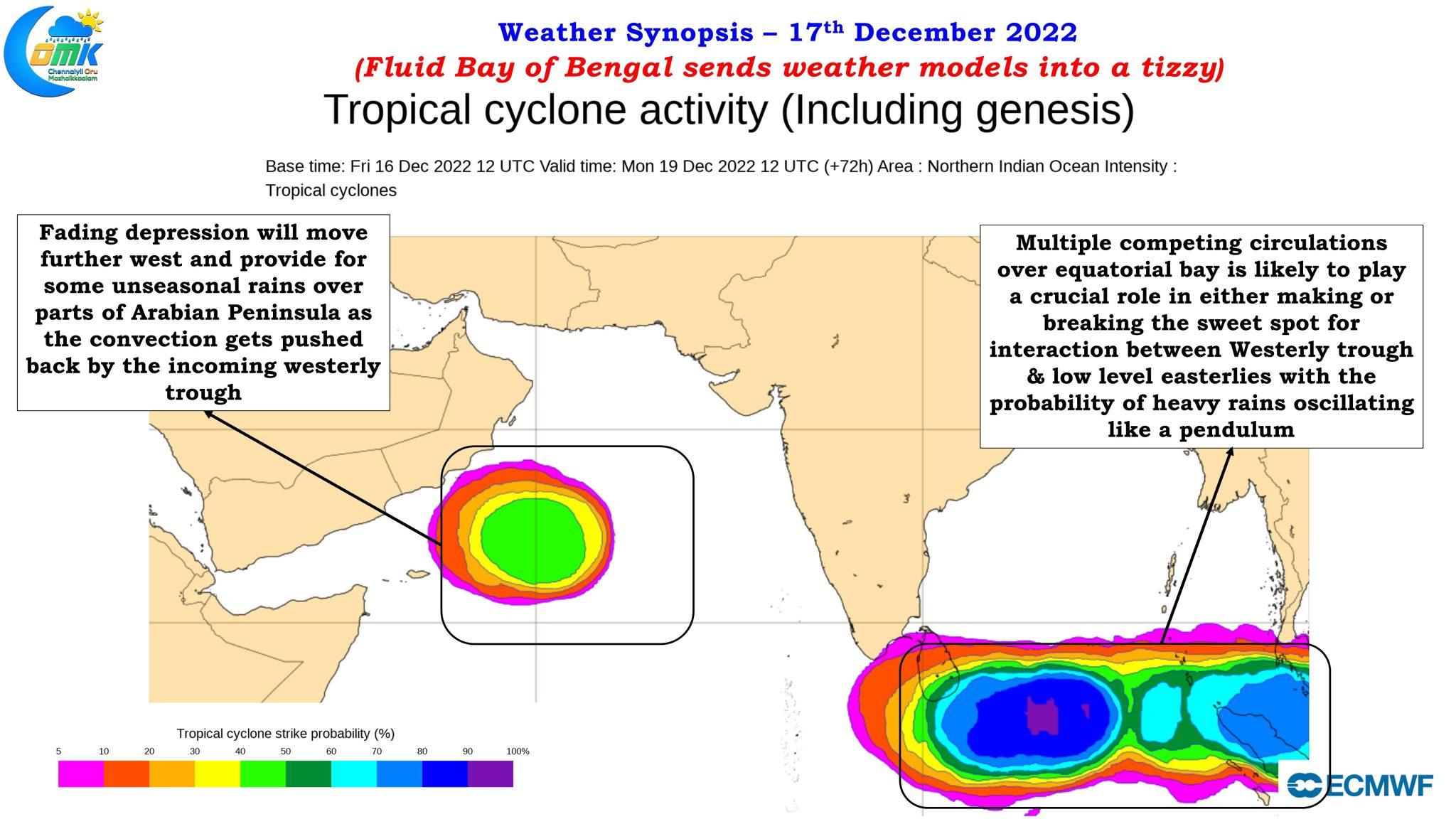
Satellite image captures the two pair of circulations, interestingly both fading away, one over the Arabian sea and the other over equatorial Bay. The bay depression is expected to weaken into a well marked low and further drift towards the Arabian Peninsular while the Bay low is also expected to drift west towards the southeast coast of Sri Lanka. It is the one over equatorial Bay that is of interest to us as it is not only closer to us but also in a position to influence weather events over the next week or so. But it is not as straight forward as it appears due to the potential for multiple competing vortices in a broad area of disturbance that is stretching from Sri Lanka to Sumatra region with an embedded low within it.
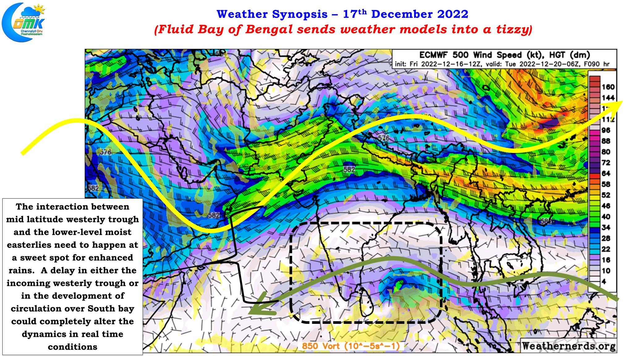
There was a fairly tight alignment among models about this broad area of disturbance being the trigger for the expected rains over most parts of Tamil Nadu next week. But the trigger for heavy to very heavy rains which is estimated on and off by weather models is coming in from elsewhere. The mid latitude westerly trough that is expected to pass across Indian sub continent next week. It is this interaction between the dipping mid level westerly trough and the low level moist easterlies that was expected to create enhanced conditions for heavy to very heavy rains at a few places.
But just like the sweet-spot in the flying trapeze act this enhanced rainfall also has a sweet spot in terms of interaction between the westerly trough and low level easterlies. A delay on either side could drastically alter the dynamics resulting in a scenario which could change from a deluge forecast to dry wintery conditions in a matter of few hours. With competing vortices in play we may not know which of the vortex becomes dominant and where this interaction is expected to happen and whether would it happen at the right time and right place. So many questions for which the answers will be available only through observation rather than looking at weather forecasts alone.
Just as we sit in the circus to watch with bated breath the Flying Trapeze act getting enacted we will have to remain a spectator and watch the events unfold at its own pace patiently and try to find the right cues in advance to identify potential heavy rainfall events with sufficient notice. More than ever taking one day at a time becomes increasingly essential now.
In the meanwhile winter conditions for the next 2 / 3 days over most of Tamil Nadu including Chennai is fairly assured. As far as rains go, fingers crossed.