Southwest Monsoon continues to stall along the lower latitudes of North Indian Ocean. After a few days lull as of yesterday it touched the extreme Southern shores of Sri Lanka while on a normal year most of the island would have been under Monsoon dynamics by 25th May. Through our Monsoon Inference posts we have…
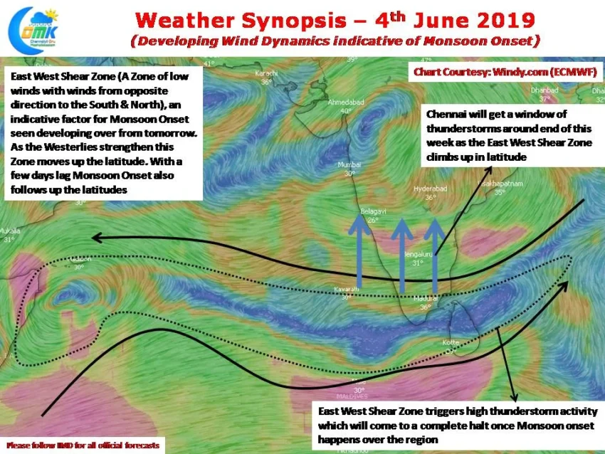
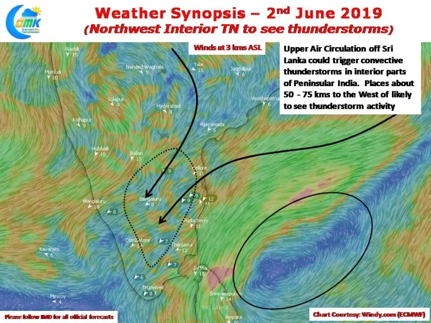
Northwest Interior TN to see thunderstorms
As the wait for Southwest Monsoon onset continues, thunderstorm activity has been quietly giving some much needed rains to interior Tamil Nadu. Yesterday saw few places in Vellore & Kanchipuram district record moderate thunderstorms in the evening as isolated rainfall activity was seen over Interior TN & South Interior Karnataka. Satellite Images indicate a visible…
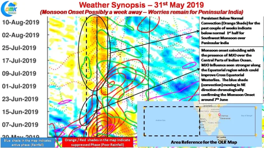
Monsoon 2019 Remains a Worry – (COMK SWM Series – 2)
On 20th May we had given a slightly long term inference on what to expect from Southwest Monsoon 2019 during its initial stages where we had indicated about weak / delayed onset. Keeping in mind the importance of Monsoon we will try to give a slightly long term take on what to expect from Southwest…
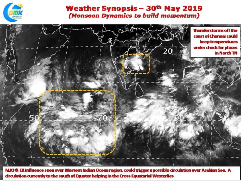
Monsoon dynamics to build Momentum
The stuttering start to Southwest Monsoon could slowly pick up pace as MJO influence has appeared over the western parts of Indian Ocean. Satellite images indicate convection improving along the Equator indicative of the improved conditions due to the presence of MJO over the region. Weather models also indicate a weak Equatorial Rossby wave influence…
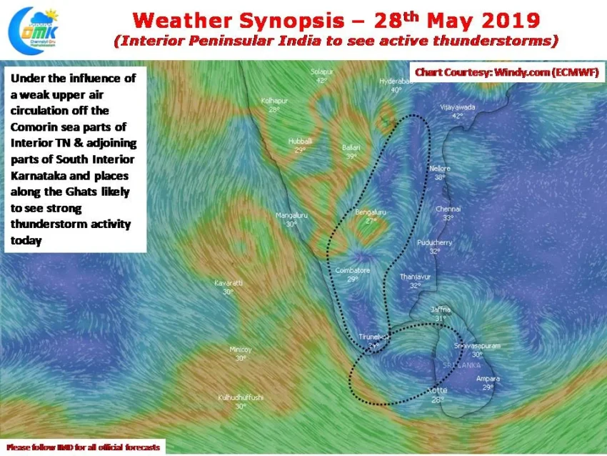
Interior Peninsular India to see active thunderstorms
The last few days have seen many places in interior Peninsular India record good evening thunderstorms. On Sunday Bangalore saw many trees uprooted as a high intensity thunderstorm lashed the metropolis and surrounding parts of Karnataka. As the country waits for the onset of Southwest Monsoon the Bay branch is showing signs of building some…