

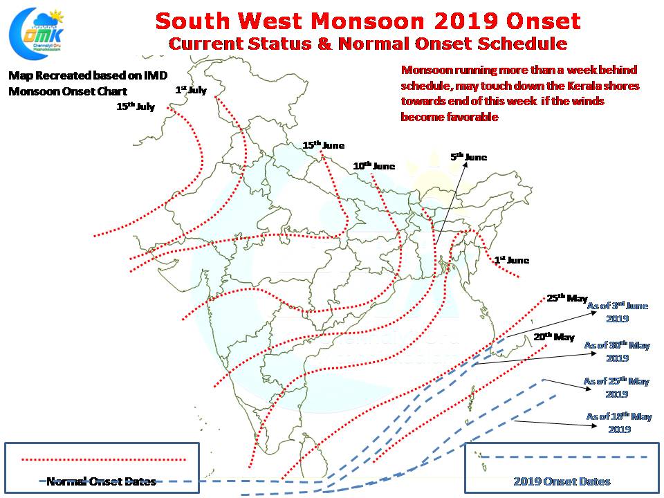
Southwest Monsoon continues to stall along the lower latitudes of North Indian Ocean. After a few days lull as of yesterday it touched the extreme Southern shores of Sri Lanka while on a normal year most of the island would have been under Monsoon dynamics by 25th May. Through our Monsoon Inference posts we have been indicating about the possibility of delayed onset this year. As things stand we are still awaiting for both the branches of Monsoon to gain some momentum and push North.
The last few days have seen extreme heat over parts of Pakistan & Rajasthan which will be a much needed boost for Monsoon dynamics. The Heat Low over the Indian Sub Continent is a key component of the overall monsoon dynamics, the below par summer till a couple of days back in Northwest India surely played a role in delaying the overall dynamics.
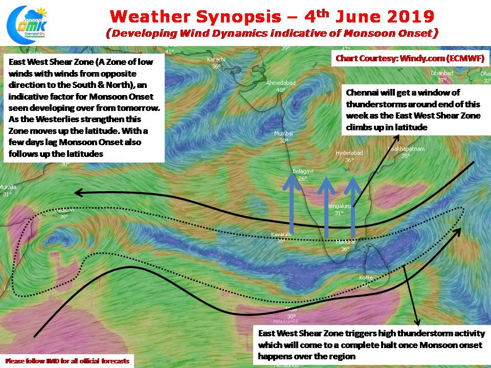
The good news though is wind patterns put out by weather models are indicating things could evolve soon for Monsoon to touch down over the Kerala shores. An East West Shear Zone, pre monsoon onset phenomenon, is seen developing from tomorrow over Peninsular India. This East West Shear Zone triggers an active phase of thunderstorm activity and starts to climb up in latitude under the influence of Strengthening Westerlies which push up the Zone as the depth of Westerlies increase. Once Monsoon Onset happens the thunderstorms cease while core monsoon zones over the West Coast get their share of rains.
While this East West Shear Zone climbs up the latitude it opens a window of thunderstorms for places like Chennai towards the end of this week.