

The events over the last few days once again has proved Bay of Bengal is indeed the Boss of Bays even as far as Southwest Monsoon goes even though for most people it is Arabian Sea that takes all the TRP. While a few may argue it is the offshore trough that is the trigger for the Monsoon surge over the west coast, it is debatable if the off shore trough is a response to developments over the Bay of Bengal or a homegrown event out of Arabian Sea that is powerful enough to create monsoon surge.
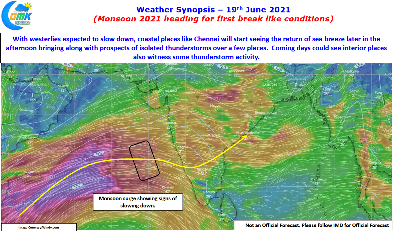
With the Monsoon low ending its life cycle we have started to see things looking up on the thunderstorm front over the East Coast, as they say it is time to watch for the pendulum to swing the other way, even if it is for a a short duration. The precursor to it happened yesterday in parts of Coastal Tamil Nadu including Chennai which saw a sudden burst of thunderstorms triggered by the sea breeze intrusion. With westerlies weakening we will start to see some of the remnant moisture interplay with day time heating under clear skies & the incoming Sea Breeze Front from the East creating unstable atmospheric conditions over coastal areas of Tamil Nadu. The upcoming few days will also give chance for some isolated thunderstorms in the interior areas of TN as well.

At the time of writing this post it is promising to be another fairly hot & clear day over Chennai with a possibility of late sea breeze front making its presence felt around evening time providing for thunderstorm opportunities in the Western Suburbs.