
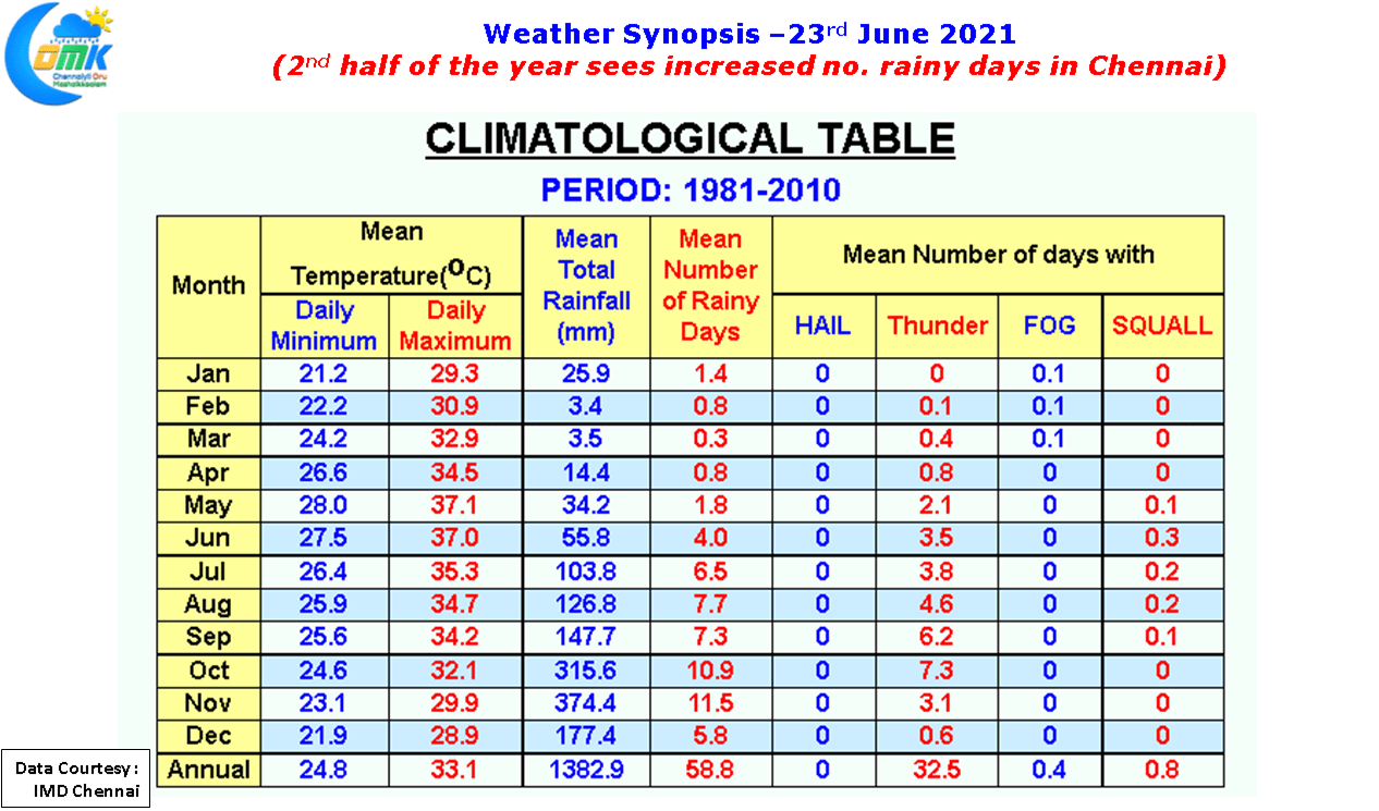
While tracking weather many a times a very important factor that is ignored by weather bloggers is Climatology. On the one hand looking to track unseasonal rains through thunderstorms bring forth a certain pleasure when it materializes one should never forget Climatology exists for a reason. If one were to look at the long term climate trends for Chennai as far as rains go, the period between January to May is expected to only see little more than 5 rainy days & an average rainfall of about 81 mm which is about 6% of the total annual rainfall the city receives. The good news though is if one were to look at monthly mean rains from June things are only getting better with the peak being achieved in November.
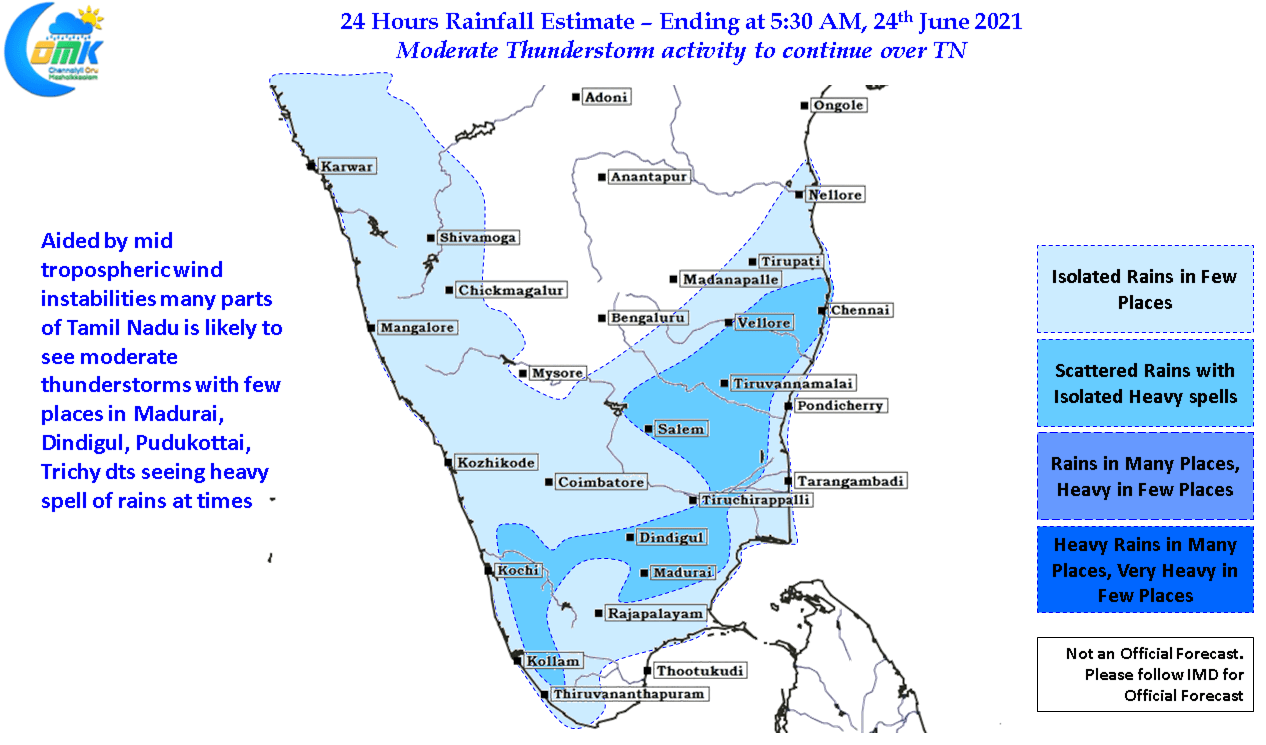
The last couple of days have seen thunderstorms make a gradual return over Tamil Nadu, while Monday saw Cheyyur in Chengalpattu & Valavanur in Villuppuram dt record 7 cms yesterday saw parts of Perambalur, Cuddalore record intense thunderstorms with Thirumanur in Ariyalur recording more than 11 cms of rains from thunderstorms that developed around midnight as westerlies further weakened and wind induced instabilities started to pull the strings for thunderstorms to develop.
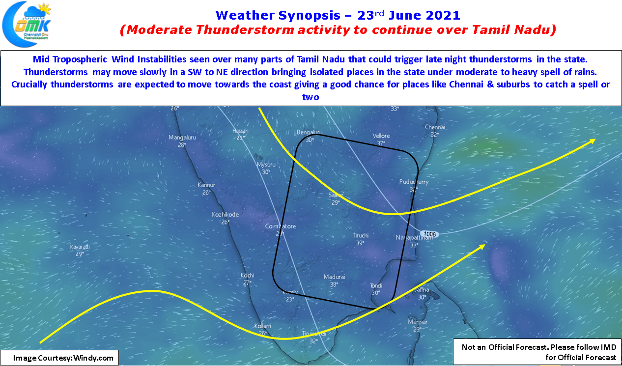
Weather models indicate today large parts of Tamil Nadu could be under wind instabilities induced at Mid Tropospheric Levels, with no organized circulation around Peninsular India the overnight cloud cover & remnant thunderstorms are expected to clear up as the day progresses bringing day time heating into consideration while sea breeze is expected to trigger thunderstorms closer to Chennai with models indicating upper level westerlies to be from SW today while sea breeze is likely to replicate yesterday’s pattern coming in from SE creating a wind shear effect for thunderstorms to develop later in the evening. With some luck some parts of Chennai could be in line for two separate spells of rains one triggered locally by sea breeze & another from interior storms moving in from SW. Fingers crossed.