
Last couple of days have been dull days as far as thunderstorms go over Tamil Nadu, while it was expected Thursday could have been a dull day on account of the fairly widespread thunderstorm activity that happened on Wednesday the absence of any large scale factors meant yesterday was fairly quiet with not much activity seen over Tamil Nadu including the Ghats. Interestingly though parts of west coast saw some thunderstorm activity particularly around the Konkan / Shahyadri regions bringing isolated moderate rainfall activity in a few places of the Ghats.
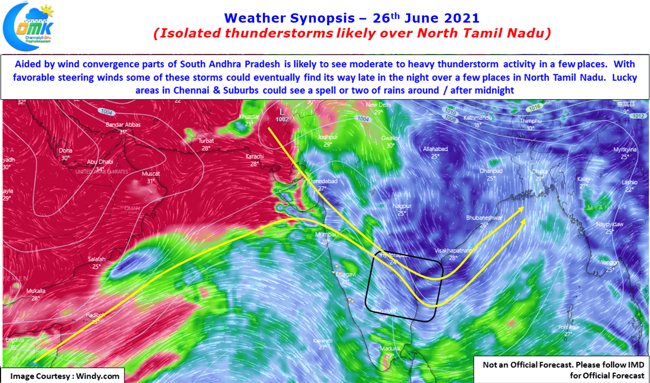
The weekend though promises some thunderstorms for parts of North Tamil Nadu on account of wind convergence from a developing North South Trough like scenario. Weather models indicate bulk of the rains to happen over Andhra Pradesh & adjoining parts of Karnataka as winds from West & Northwest converge over parts of Peninsular India. Some of these could spill over into the NW & interior areas of North TN bringing isolated rains to these places.

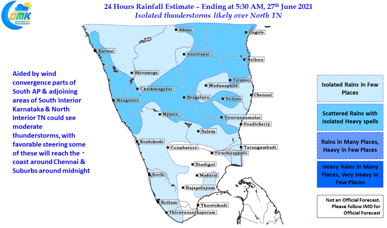
Crucially the westerly winds continue to remain moderately strong which means any thunderstorms forming over the interiors will eventually reach the coast though depending on day to day conditions it might make a quick dash or make a slow amble towards the coast aided by the steering winds. This gives a two window for thunderstorms over Chennai & suburbs. As some of the seasoned sales guys say Under Commit & Over Achieve, the motto for thunderstorms tracking over Tamil Nadu, in particular for Chennai should be, Low Expectation Maximum Satisfaction.
It also gives a lot of pleasure to announce the very popular Digital Mapping Blogger Raj Bhagat will be joining the Chennai Weather Bloggers for a session on Mapping & Weather Blogging. You could join us through the Clubhouse App which is available on both android & iOs platform