
After a few days of dry weather parts of Coastal Tamil Nadu saw light to moderate rains early this week. The scrambled winds at lower levels meant conditions were conducive for weak thunderstorm activity to develop in a few areas triggered by convective development due to warmer than normal conditions during the day time. Even yesterday saw parts of Madurai & surrounding areas record moderate spell of rains during the late evening hours similarly triggered by convective development with most parts of the state seeing day time maximum temperatures stay a couple of degrees more than normal.
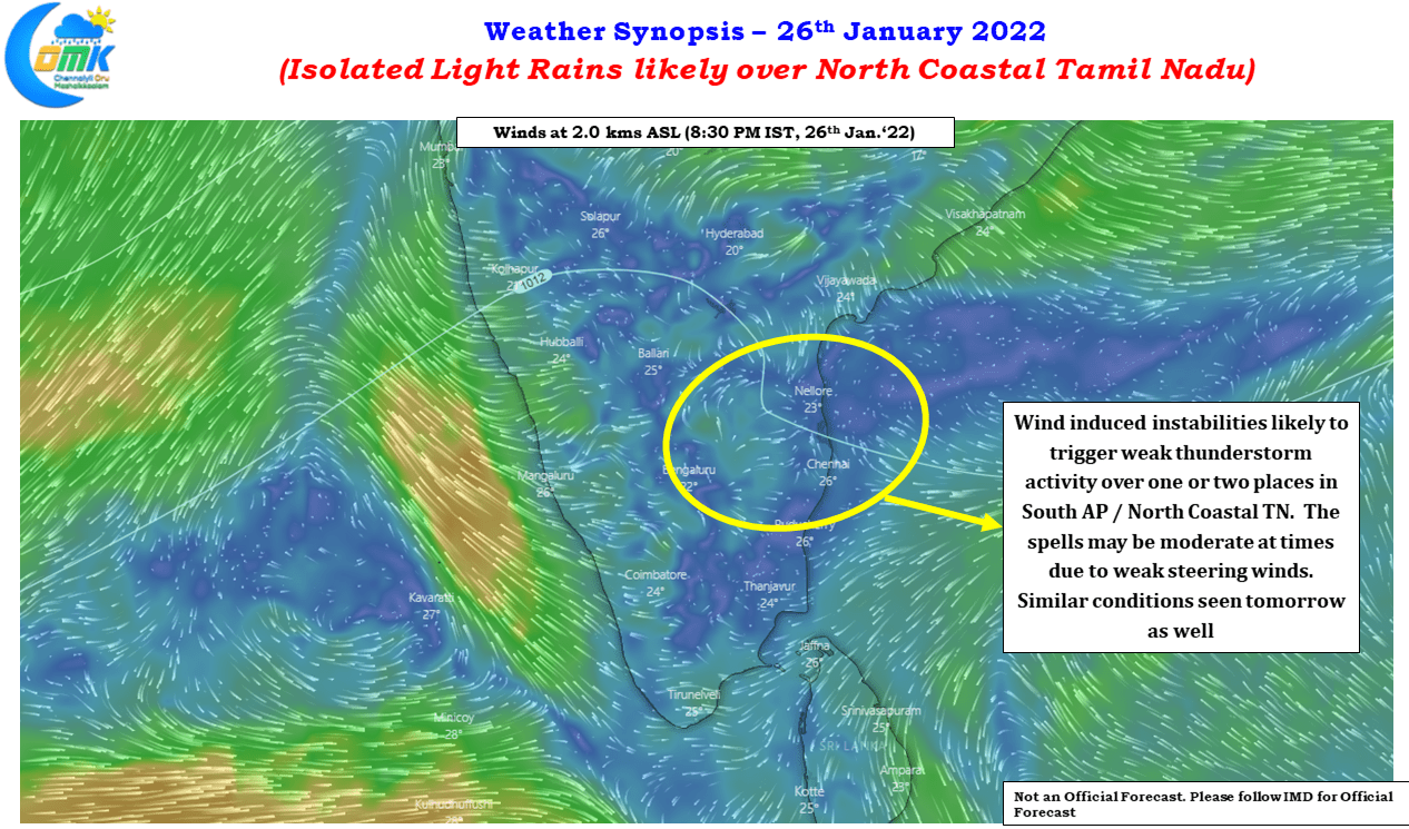
Wind charts indicate over the next 3 / 4 days this spell of light rainfall activity in a few areas of Tamil Nadu may continue aided by the instabilities in winds. As this zone of instabilities shuffle around the southern parts of Peninsular India the prospect for light rains will also move around. Today & tomorrow looks like it will the turn of South AP & adjoining parts of North Coastal Tamil Nadu while later this week we might see parts of Delta coast see light rains under similar conditions.
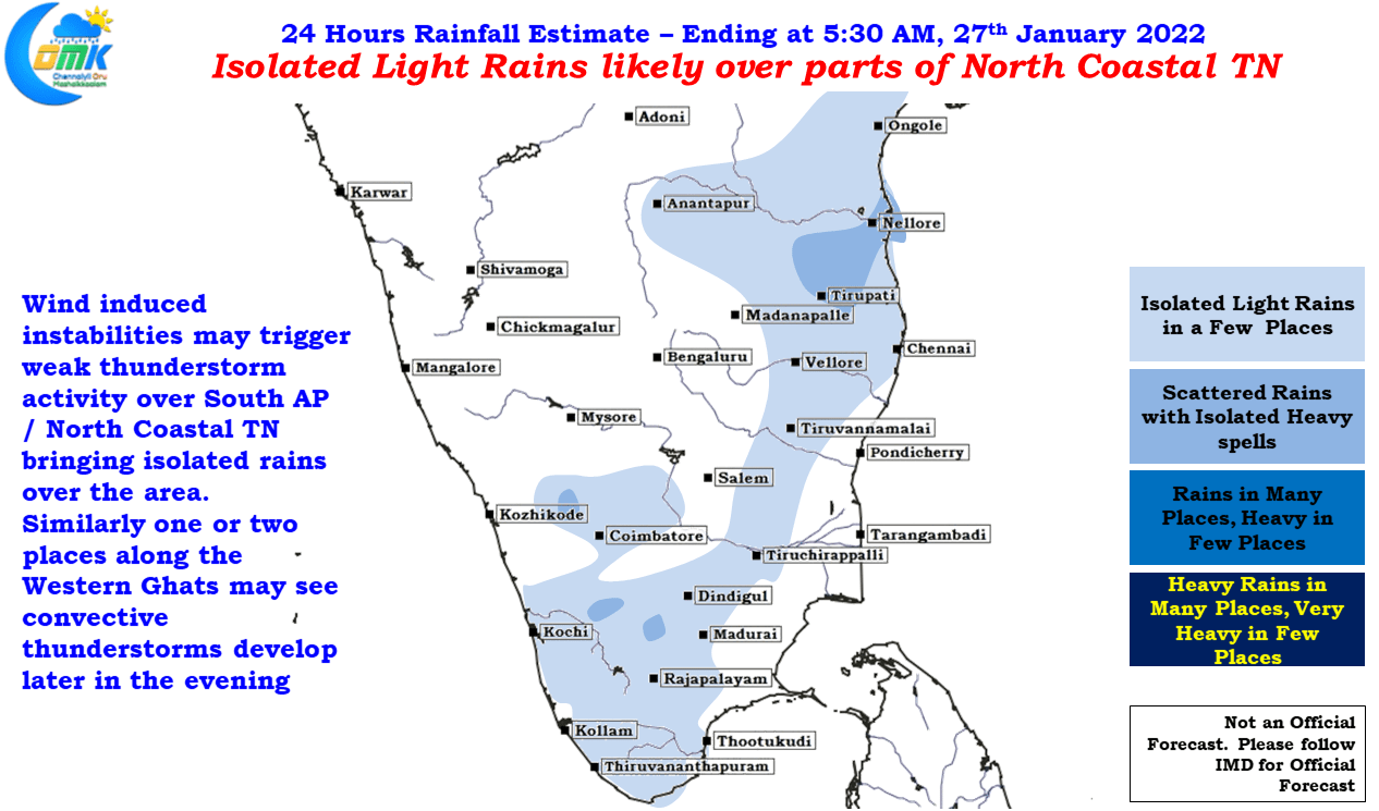
Weather models indicate these conditions to persist until 29th / 30th January before a spell of dry weather across the state develop for a week to 10 days once again. Due to the weak steering winds at lower levels occasionally the rains may be moderate on account of slow moving rain bands but overall the thunderstorm activity is expected to be weak & light rains expected in a few areas along the coast. Places closer to the Western Ghats, particularly in South TN may also see convective thunderstorms develop during the late evening hours in one or two places until weekend.