
The last few days dry weather has slowly taken control over most parts of Tamil Nadu with rains completely fading away from not only coastal areas but also the places closer to the Western Ghats where particularly the Eastern Slopes see rains through trapped moisture effect at isolated places even if almost all of the state remains dry. While overall drier conditions has resulted in slight reduction in the night time temperatures for the next few days surface winds during evening / late night hours may be from the SE which could modulate the night time temperatures over Tamil Nadu.
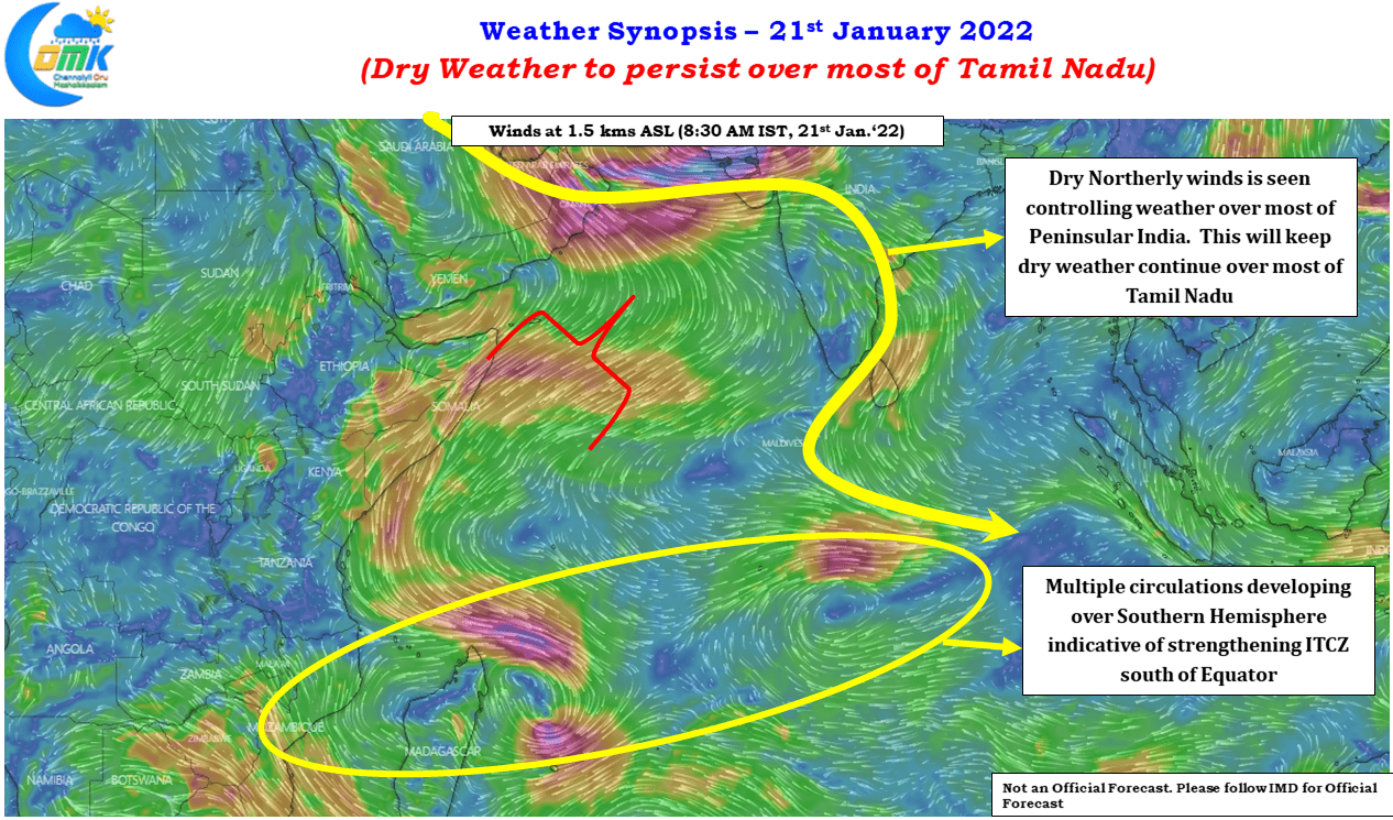
One of the key reasons for this is the strengthening of Northerly winds at the lower atmosphere. Winds at 1.5 kms above mean sea level is completly dry continental wind with practically no moisture seen coming into Tamil Nadu. Addtionally if one sees the larger scale picture we can also realize there are multiple circulations over the Southern Indian Ocean where weather models expect 2 / 3 organized distributions including one land depression over the Eastern Coast of Africa in the next few days. This is indicative of the ITCZ strengthening over the Southern Indian Ocean which is also confirmed by looking at the satellite image.
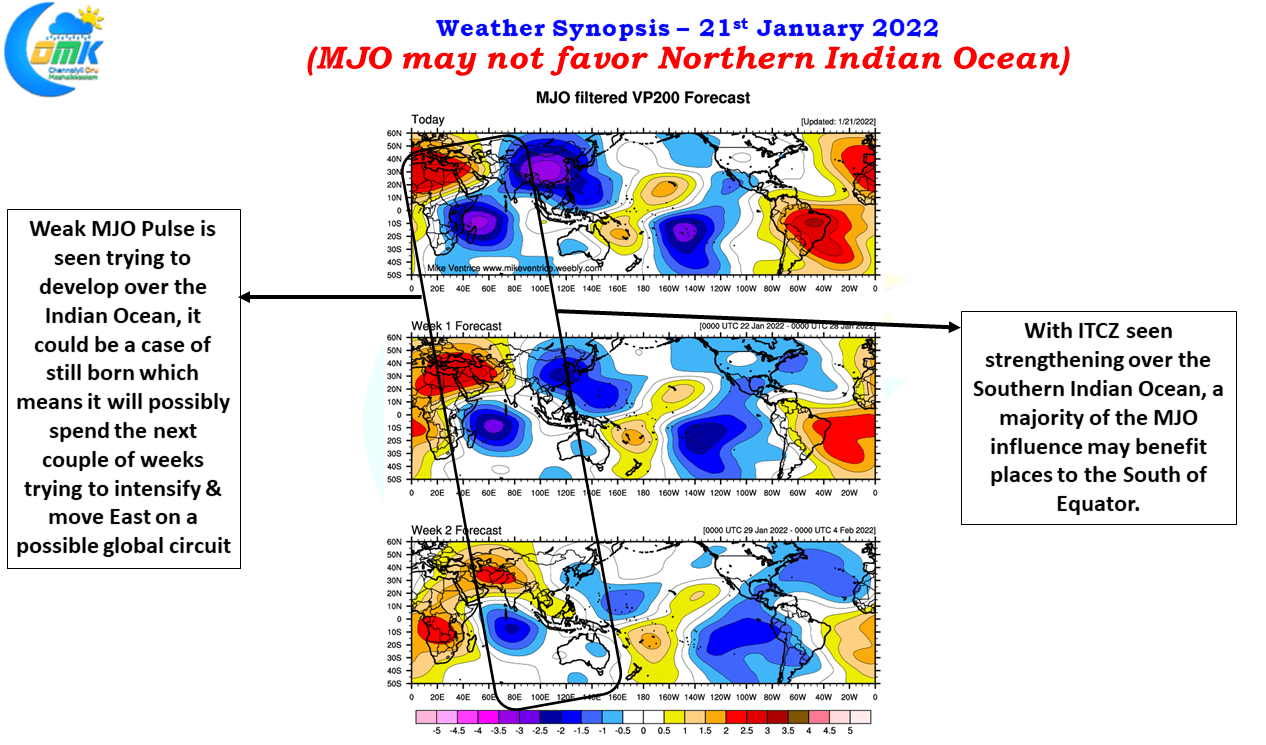
Addtionally one is able to see a weak MJO pulse trying to regenerate as a fresh pulse over the Indian Ocean, this is likely to become a still born development so possibly in a couple of weeks time once again a fresh pulse may try to develop over Indian Ocean. This could mean for the next 3 / 4 weeks we may see the influence of MJO over the Indian Ocean but the strengthening of the ITCZ over Southern Indian ocean could mean the majority of the MJO influence may be favorable to places south of Equator thereby continuing the dry weather over most of Tamil Nadu for the next 2 / 3 weeks.