
Answering prayers of not only the farmers from some of the places in coastal Tamil Nadu, including Delta which was under continuous rains for the past few days, Nature answered the prayers of those who wanted to enjoy their Deepavali with a burst of crackers by making it a relatively quiet day of rains for most of Tamil Nadu. Chennai & Suburbs saw rains stop once the early morning spell of rains ended around 9 AM while the entire coast was rain free right through the day. Parts of South TN & West TN though came under rains with places like Salem etc recording moderately heavy rains during the evening hours.
The LPA in Arabian sea continues to slowly job in a NNW track as it intensifies into a Well Marked Low moving further away from Peninsular India reducing its influence in the bargain. Now it is time look far east as a possible disturbance may emerge from Southeast Bay & adjoining Andaman Sea areas in the coming days. Weather models are fairly consistent on this event which might influence the Eastern Peninsular Coast in the coming week.
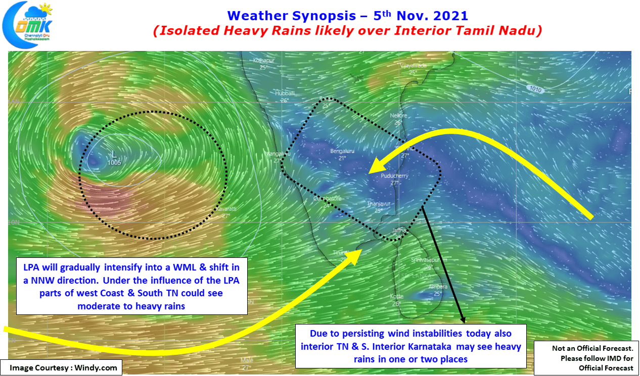
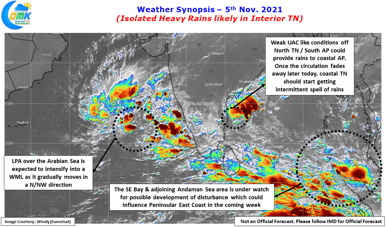
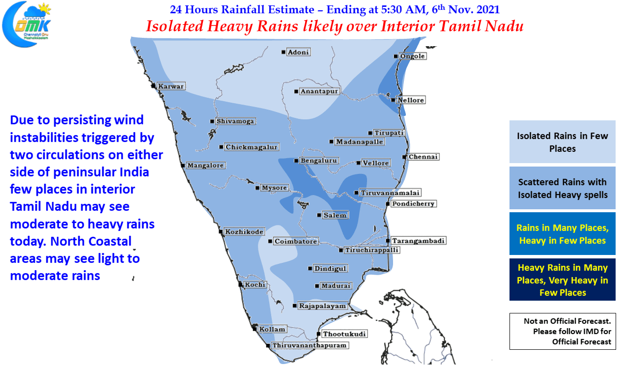
In the meanwhile with a weak UAC prevailing off the coast of TN / AP triggering wind discontinuity like conditions over parts of Peninsular India parts of South Interior Karnataka & Interior Tamil Nadu recorded good rains yesterday. Similar conditions are seen today as well with parts of Tiruvannamalai, Vellore, Krishnagiri, Salem & Dharmapuri district likely to come under moderate to heavy spell of rains in a few places. Once again places like Bengaluru may come under good rains like last evening.
With the UAC like conditions expected to fade away and the Easterlies likely to strengthen over the coastal areas we might see intermittent rains return back to coastal areas like Chennai from later tonight / early tomorrow morning. Until the disturbance evolves and comes closer to the coast moderate to heavy rains may be restricted to isolated places and depending on localized conditions.