
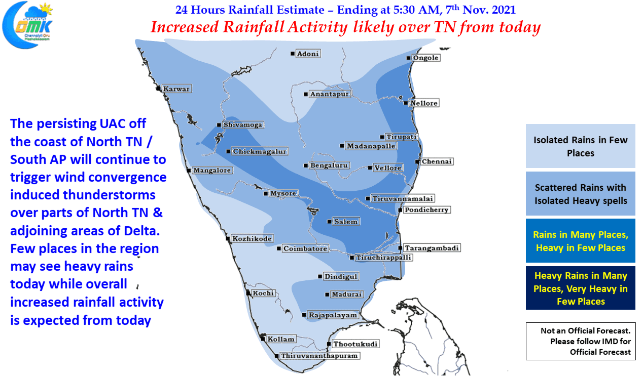
After a day or so break the rains returned over Chennai & suburbs yesterday with many parts of the city recording light to moderate rains late in the night. Though coastal areas saw a return in rains it was once again the interior parts of TN that saw the bulk of the rains due to wind convergence triggered by the weak Upper Air Cyclonic Circulation seen off the coast of North TN / South AP. Parts of Cuddalore, Tiruvannamalai, Salem & Villuppuram districts saw good rains yesterday while the IMD AWS at Aruppukottai in Virudhunagar district recorded more than 8 cms from evening thunderstorms.
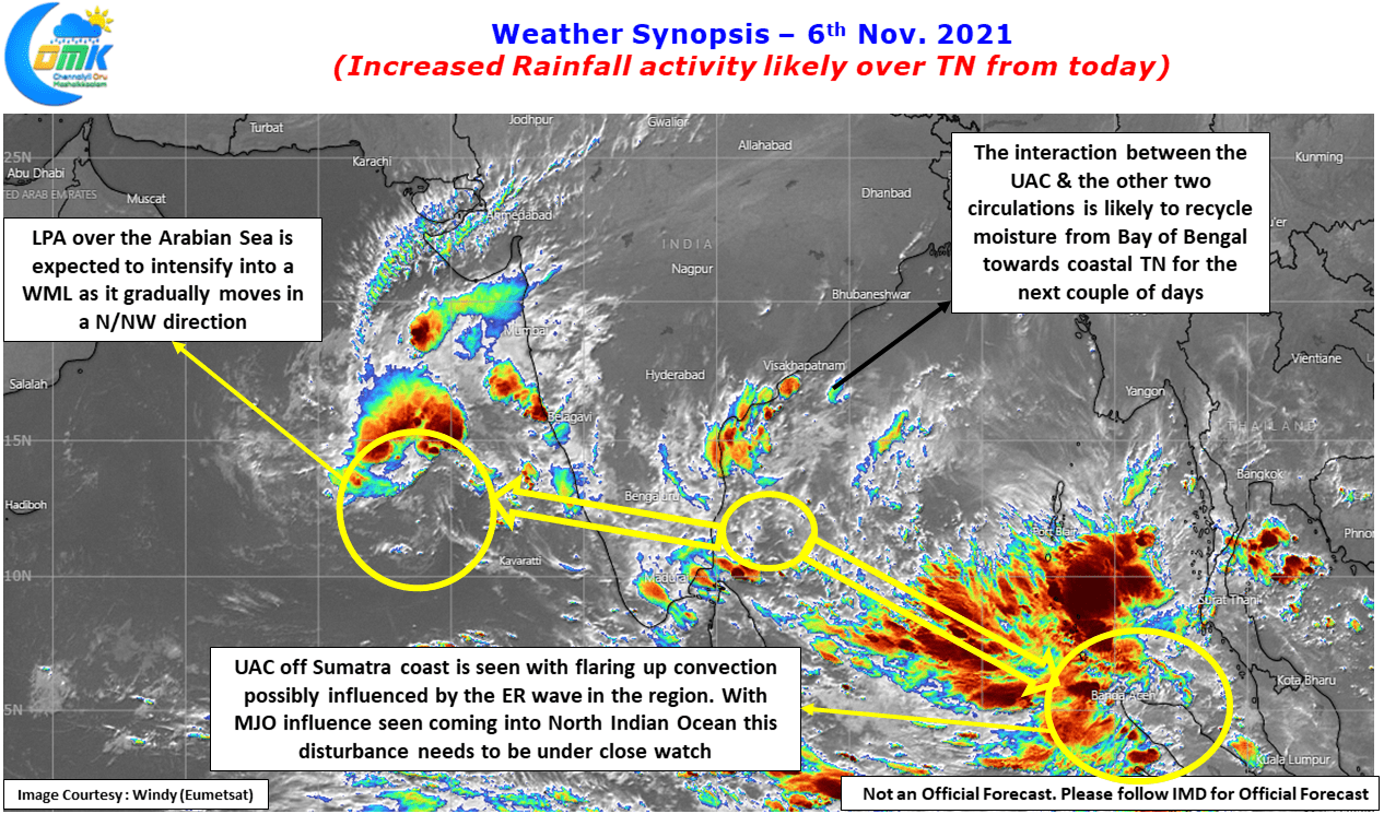
With not only three different circulations seen over North Indian Ocean basin (Bay of Bengal + Arabian Sea) but influence of tropical waves also seen over the basin enhanced rainfall activity is likely to happen the coming week starting from today. The UAC off the TN Coast / South AP Coast is acting like a conduit between the Low Pressure Area over Arabian sea which is expected to strengthen into a Well Marked Low / Depression as it continues to jog in a N/NW direction.
Due to this role by the UAC a lot of interplay & interaction is likely to be seen between these circulations and a constant recycling of moisture from Bay of Bengal is expected to happen over the coastal areas of Tamil Nadu & Pondicherry. This will increase the rainfall activity over the East Coast of Peninsular India from today. Today we might possibly see interior areas of TN & adjoining parts of South Interior Karnataka record another day of thunderstorms due to wind convergence created by the UAC off TN coast, from tomorrow the interior area rains will slowly taper down shifting the focus towards Coastal Areas.
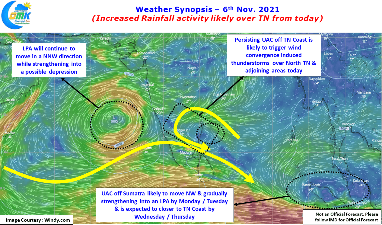
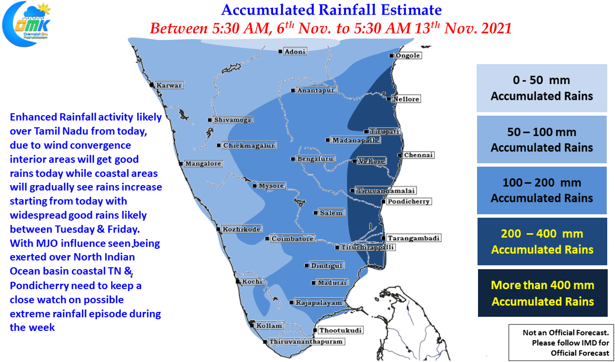
But the one to watch out for is the circulation currently seen as an Upper Air Cyclonic Circulation over the SE Bay & adjoining Andaman sea areas off the Sumatra Coast. It is already showing signs of enhanced convection due to the support provided by the influence of Equatorial Rossby wave seen in the area. Over the next couple of days it is likely to strengthen into a Low Pressure Area around Monday / Tuesday as it moves in a NW direction towards the East Peninsular Coast coming close to TN coast around Wednesday / Thursday. In this context it also becomes important to not ignore the influence of MJO which is seen over North Indian Ocean basin. While a flared up MJO is unlikely even a marginal influence is enough to enhance the rainfall activity due to the favorable background Nina state atmosphere is currently going through.
Looking at how things are shaping up & the favorable support provided by multiple waves not restricted to just MJO & ER it may be wise to be ready for one possible Extreme Rainfall episode in the coming week over Coastal TN & Pondicherry areas.