
Kanyakumari district has been under a literal siege of heavy rains for the past 36 hours or so with many places coming under heavy to very heavy spell of rains that does not seem to stop. Last evening traffic was suspended between Nagerkoil & Tirunelveli due to overflowing flood waters in between. As many would know after a fairly dull Southwest Monsoon season Kanyakumari saw a very strong October which pretty much compensated for the poor performance during core Southwest Monsoon months. Interestingly due to Cyclone Tauktae Kanyakumari also saw a very good pre monsoon period as well bringing heavy rains just before monsoon onset.
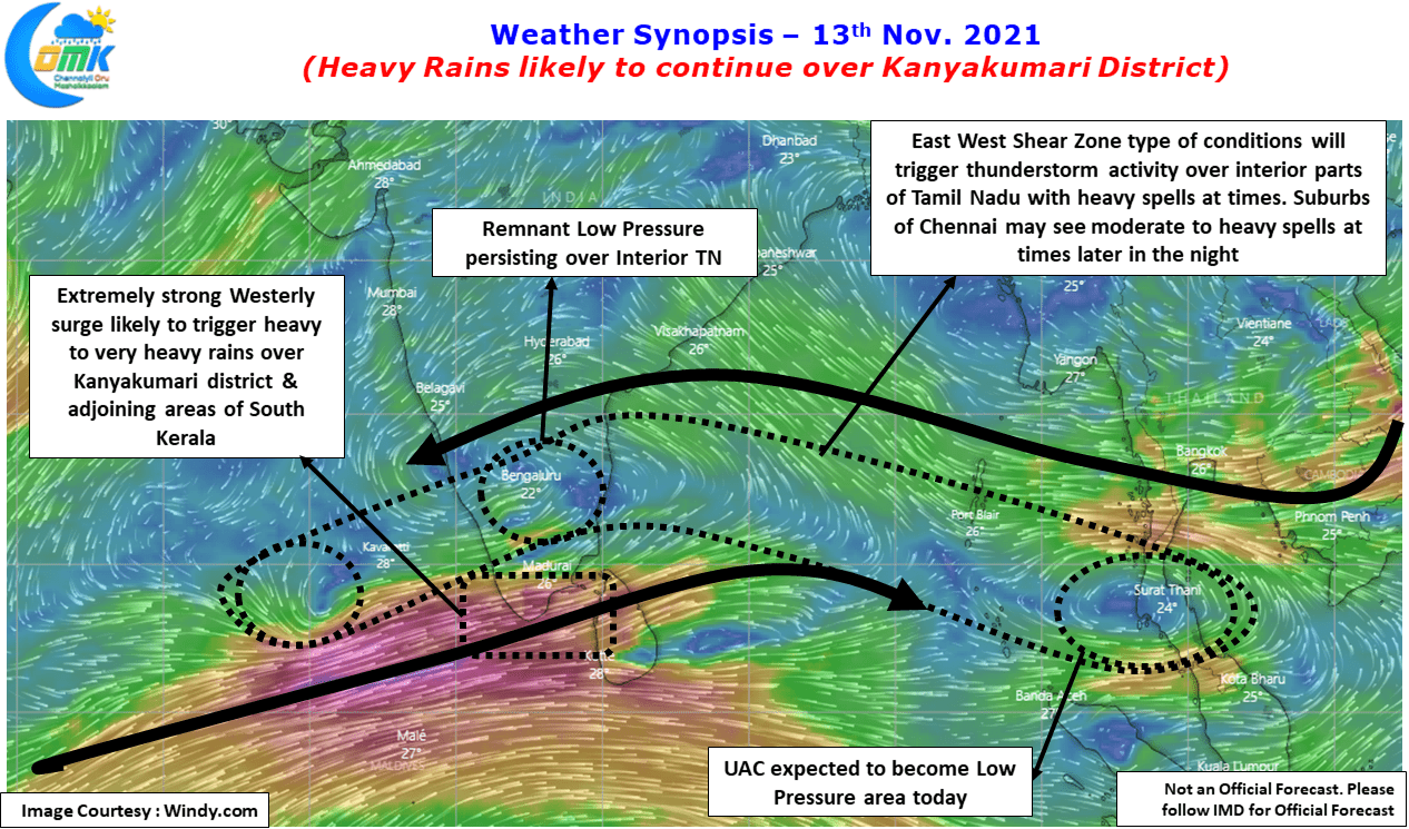
Since the start of NEM onset monsoon has been relatively quiet compared to the rest of the state over the southern most district of Tamil Nadu. But the last couple of days a change in conditions in the form of strong temporary westerlies have created a pseudo Southwest Monsoon type of conditions over the extreme southern parts of the west coast of Peninsular India. This is bringing not only heavy rains to Kanyakumari district but also Kerala as well.
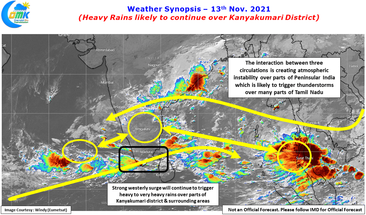
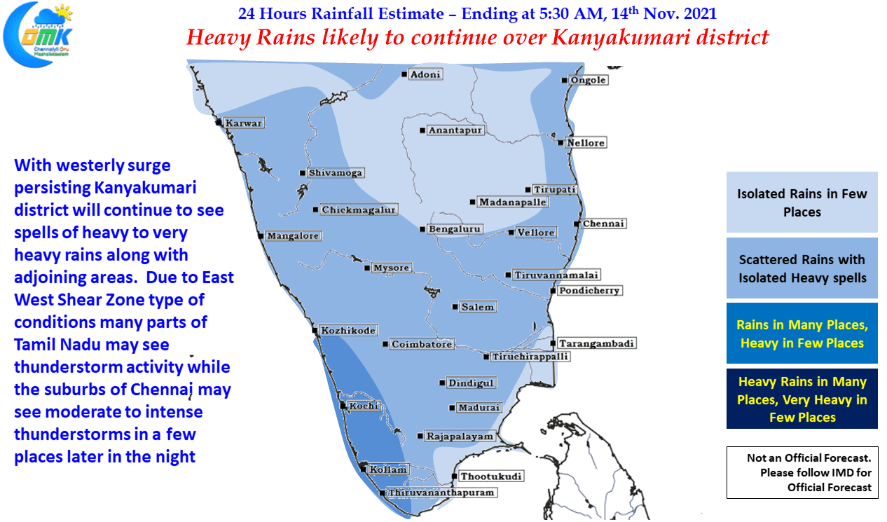
With weather models indicating the next couple of days continuing to see similar conditions weekend is likely to bring more rains to not only Kanyakumari district but also parts of Tiruneveli district with few places likely to come under very heavy rains in Kanyakumari district. Similarly many parts of Kerala, particularly south Kerala, may see heavy to very heavy rains in many places under the influence of the continuing remnant circulation over Arabian Sea.
While on circulation, the three circulations currently prevailing over Indian Sub Continent and adjoining areas are interacting & interplaying with each other to trigger atmospheric instabilities over Peninsular India, this is likely to trigger thunderstorms over many parts of Tamil Nadu and adjoining areas of Peninsular India. This is because of the East West Shear Zone type of conditions being created by these three circulations. Clearer skies during the day time is likely to aid the convective process thereby triggering intense thunderstorms in a few places. While places closer to the coast in Chennai & Suburbs may see lighter rains the western & southwest suburbs of Chennai may see moderate to intense thunderstorm activity later in the night under the influence of atmospheric instability prevailing.
The UAC over Andaman Sea is expected to move into Bay of Bengal which could possibly push the current remnant low from the Depression that crossed near Chennai also to push west towards Arabian Sea. Weather models are at the moment struggling & inconsistent on how these two circulations play with & against each other which will go a long way in deciding the next week rain prospects for Chennai & Rest of Tamil Nadu. Let us not forget all circulations though may compliment with each other at times but at the end of they day the competition between the two will be a matter of survival of the fittest.