
Since the early days of November Northeast Monsoon has been pretty much vigorous over Tamil Nadu. This spell has also seen a few extreme rainfall episodes as well starting with parts of Chennai seeing sudden burst of rains exactly a week back, subsequently parts of delta came under extreme spell that brought more than 20 cms in 6 hours and finally Kanyakumari district and some parts of Tirunelveli district for the past couple of days. Chennai once again saw a spell of heavy rains while the depression crossed coast nearby on Wednesday. So yesterday’s announcement by IMD about the formation of a fresh Low Pressure Area over the Andaman area has triggered a sense of panic among many people on the probability of heavy rains / extreme rains continuing this week over Tamil Nadu.
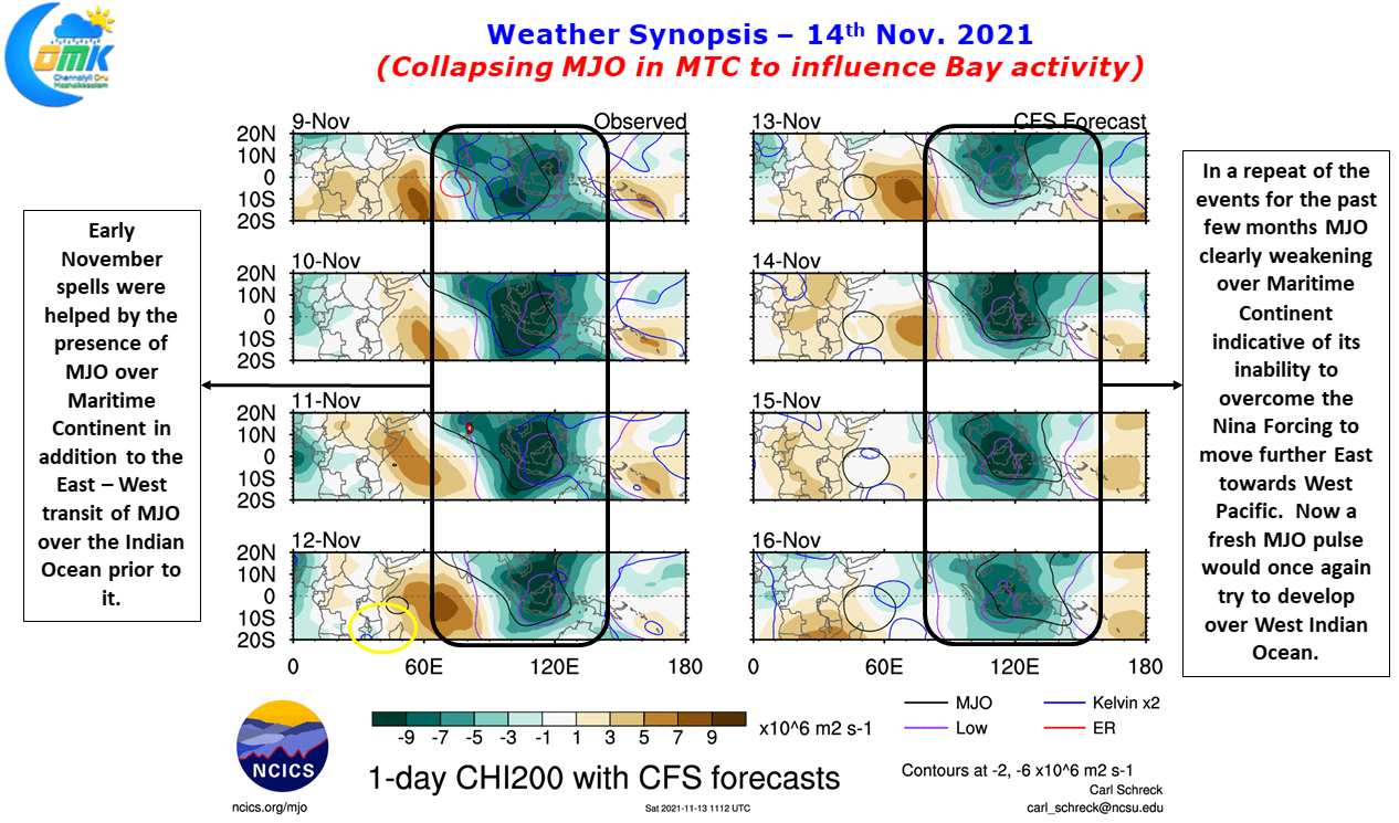
Today’s update is an attempt to give a perspective on what is ahead of us and why the panic is an over reaction the announcement by IMD. The consistent rains since the start of November owes a lot to favorable transit of Tropical waves over the Indian Ocean. A fresh pulse of MJO moved West to East enhancing the rainfall activity over Peninsular India while it reached MTC. In a pattern that has been repeating for the past few months unable to overcome the Nina forcing MJO is now once again giving up at Maritime continent in order to try once again as a fresh pulse from West Indian Ocean in its efforts to restart its Globe Trotting.
This is also reflecting in how models have been gradually reducing the intensity of what the current LPA will evolve into. But irrespective of the intensity the genesis location of the LPA also gives us an indication on how this pulse may behave in its journey towards Indian Mainland. In all this one should not forget there is already an Upper Air Cyclonic circulation in elongated form over Peninsular India from the earlier Depression remnant. It appears as the pulse from Bay moves the circulation over Peninsular India will move into Arabian Sea in its own NW path. Crucially this NW movement over Arabian Sea will also force the Bay pulse to move NW towards Coastal AP irrespective of the intensity as both the pulses sing in the same tune.
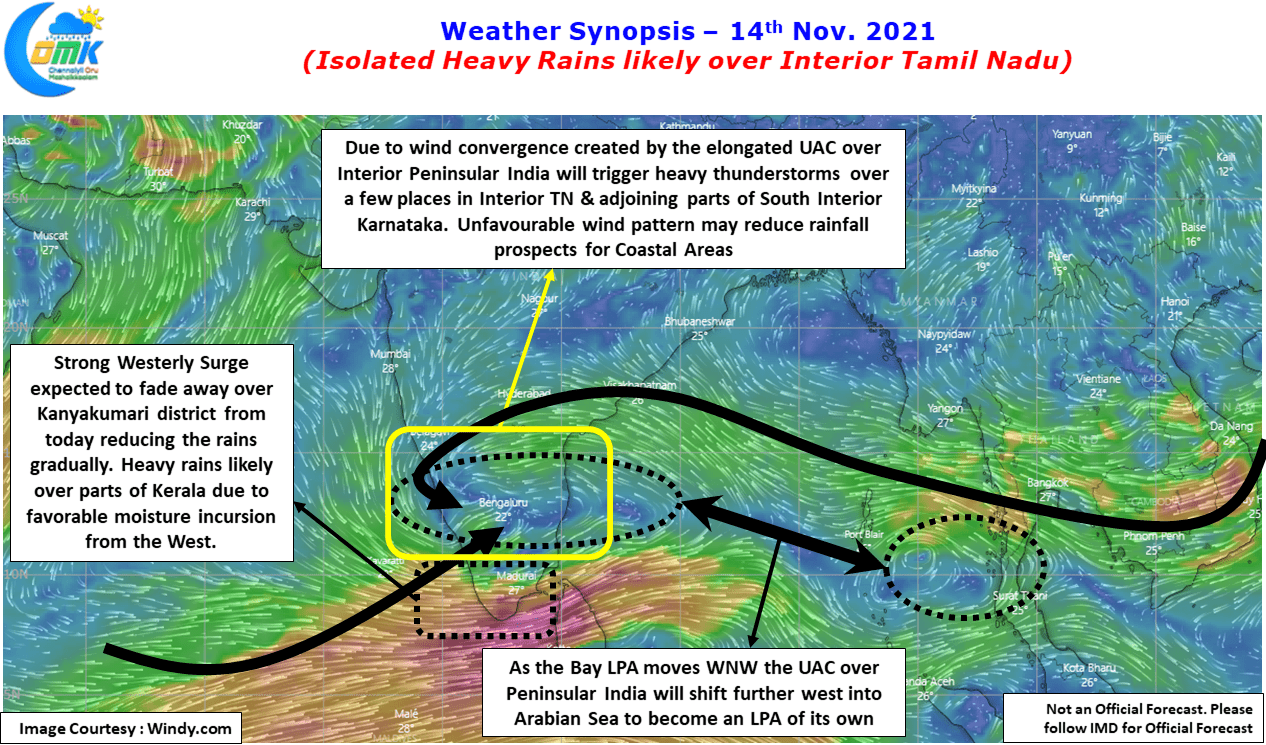
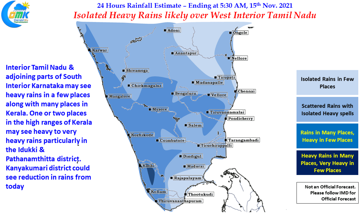
Keeping all this in mind it appears the upcoming week may be benevolent for Tamil Nadu in terms of heavy / extreme rainfall episodes. While rains are unlikely to stop the chance for extreme rainfall episodes during the course of this week over Tamil Nadu looks less as things stand though parts of Interior Tamil Nadu may see heavy rains today / tomorrow under the influence of the circulation currently persisting over Peninsular India.
This circulation is also going to bring heavy rains over many places in Kerala today with few places in the high ranges of Idukki & Patthanamthitta district in the state coming under heavy to very heavy rains today. On account of the circulation winds may not completely favor coastal areas of Tamil Nadu though a few places along the coast including Chennai & suburbs may see light to moderate rains in a few areas.
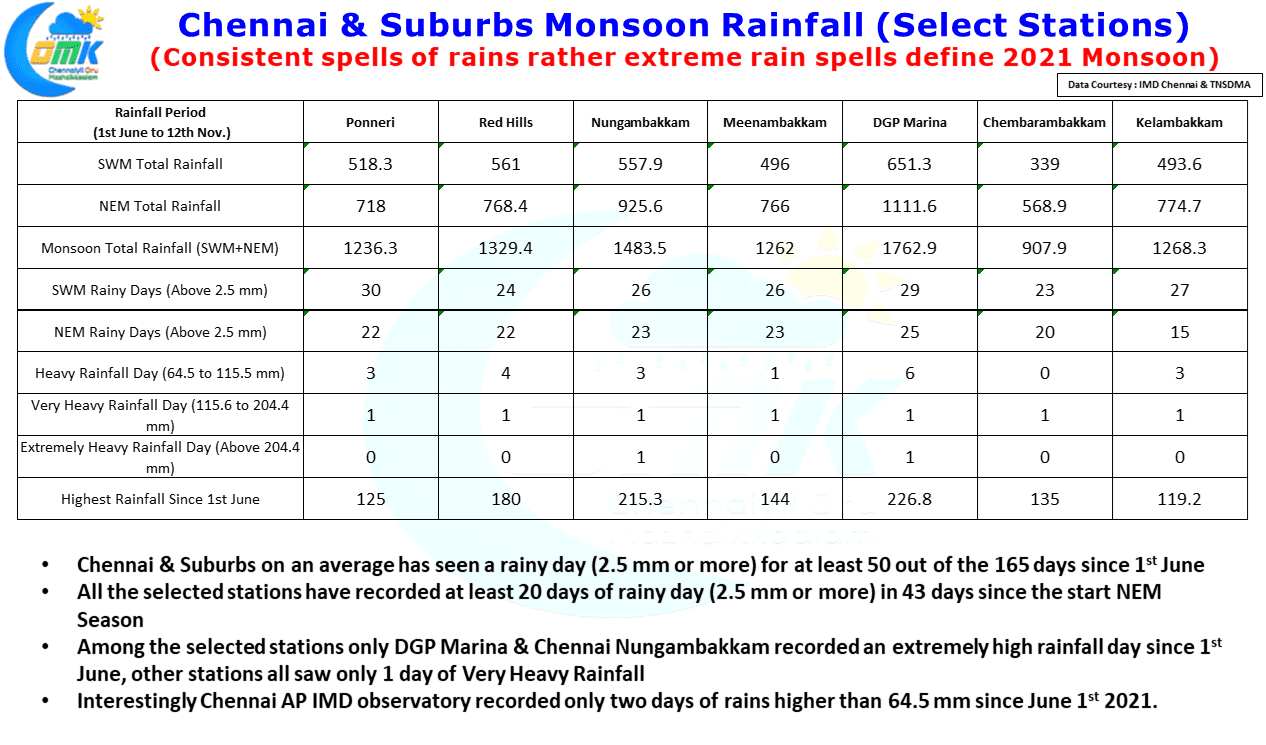
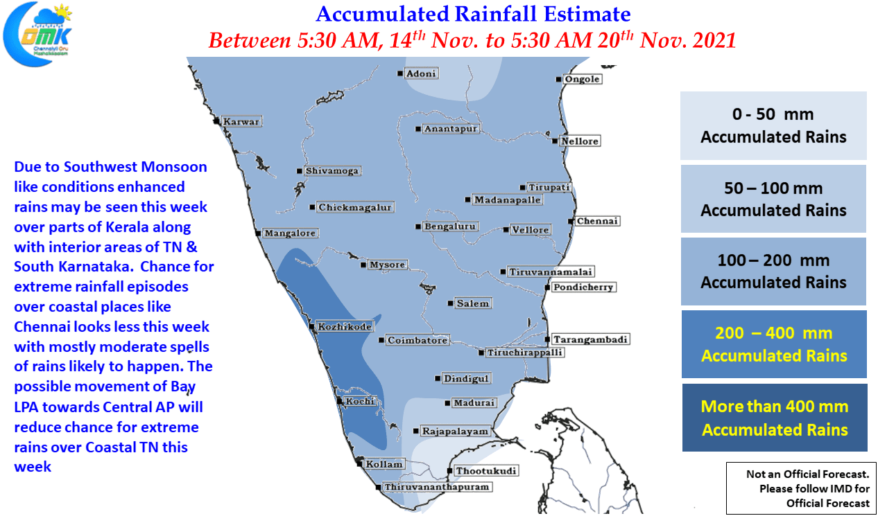
Before we sign off today’s post we are giving a chart for the reader’s judgement in terms of what could have triggered the localized flooding / water logging over many parts of Chennai the past few days. With comparisons to 2015 happening everywhere the larger question is “Was extreme Rains over Chennai the reason for flooding / water logging?”