
On 14th May both the IMD observatories of Chennai recorded the first 40°C of the year just as Cyclone Mocha was making landfall over the Myanmar coast as an Extremely Severe Cyclonic Storm. Yesterday once again both the observatories recorded 40+ in the process recording the hottest day of the year. Interestingly for the past few years the early part of Summer has been relatively better off for Chennai and surrounding North Coastal Tamil Nadu. Since the year 2019 when Chennai AP recorded 40+ temperatures for 7 days during the first fortnight of May the first half of May has been mostly average or in some cases below average as well in many instances.
It is pertinent to point here the harshest phase of summer for Chennai happens only when the Westerlies strengthen and prevents the sea breeze benefit getting available for the citizens of the capital. The development and subsequent movement of Cyclone Mocha has strengthened the Westerlies over Peninsular India bringing dry continental winds from interior Peninsular India like Rayalaseema towards North Tamil Nadu. While sea breeze made a marginal impact on Sunday with westerlies maintaining a stranglehold yesterday saw the arrival of sea breeze around late afternoon bringing some respite to the coastal areas. Clear skies on Monday meant a very early spike in heat allowing for a strong temperature gradient to build between land and sea giving an opportunity for sea breeze to sneak in and bring relief.
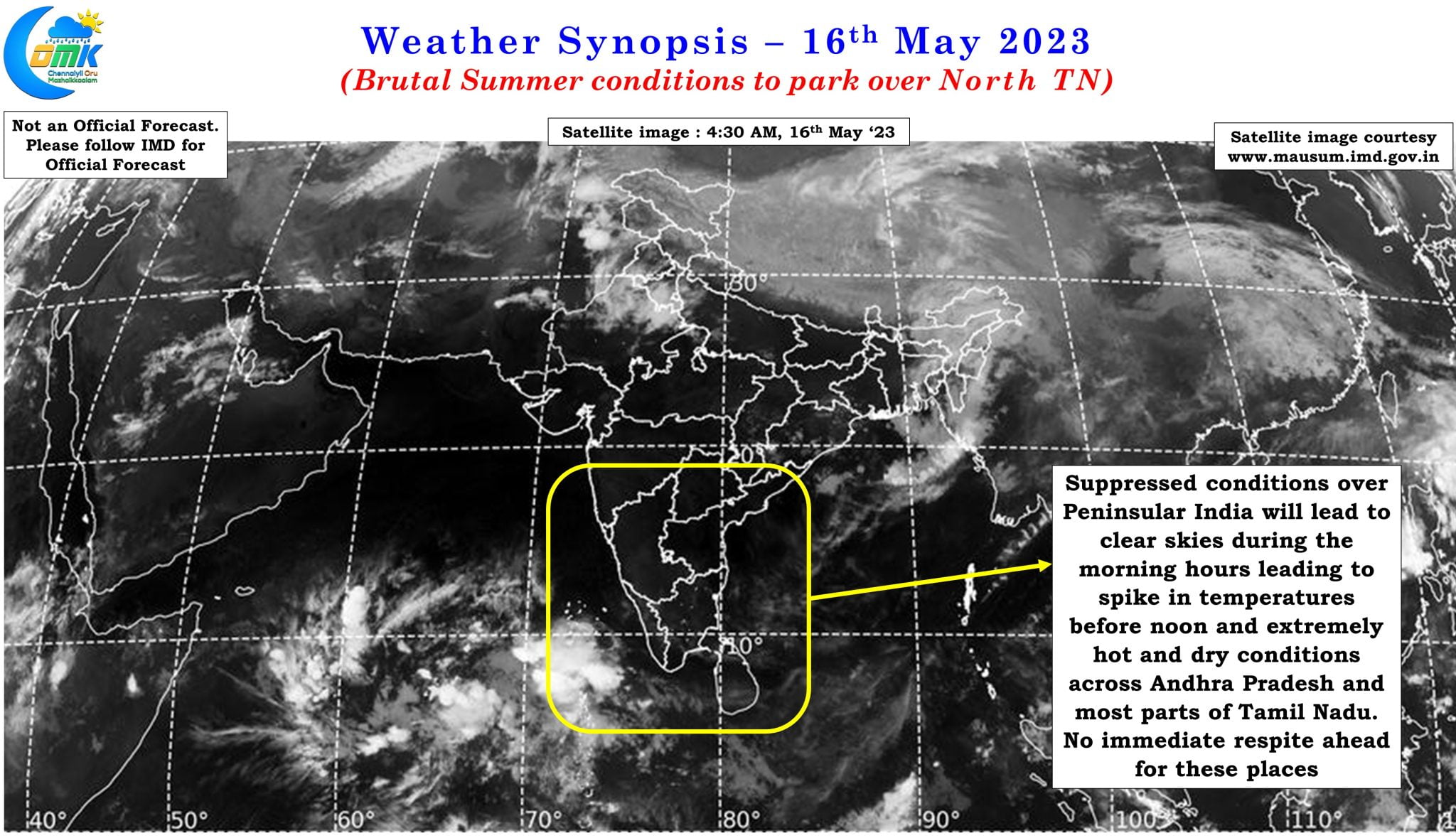
Satellite image once again confirms the dry weather conditions that is likely to prevail over Peninsular India now that the influence of Cyclone Mocha has completely vanished over Peninsular India. In a way the MJO currently parked over West Pacific is also responsible for the suppressed conditions over Peninsular India bringing clear skies along with it. Models indicate the next couple of weeks the trailing edge, responsible for suppressed atmospheric conditions, is likely to be a major factor over Peninsular India leading to a spell of brutal summer conditions over Andhra Pradesh and adjoining areas of North Tamil Nadu.
While it is unlikely we may see temperatures over Tamil Nadu touch 43 / 44°C, which places in Andhra Pradesh are likely to see almost on a daily basis, the western suburbs of Chennai is likely to see max temperatures stay around 40 / 41°C for the rest of the days this month. It may not come as a surprise if the Chennai AP IMD observatory records 40°C or more for at least 10 more days in the remaining fortnight. With westerly winds here to stay for the season Chennai and suburbs may not have much luck with thunderstorms as well due to unfavorable wind pattern. All in all the second fortnight of Agni Nakshathiram will stay true to form for districts like Vellore, Tirupathur, Tiruvannamalai, Chennai, Kanchipuram, Chengalpattu, Tiruvallur, Villupuram and Cuddalore along with some parts of Central TN around the delta dts.