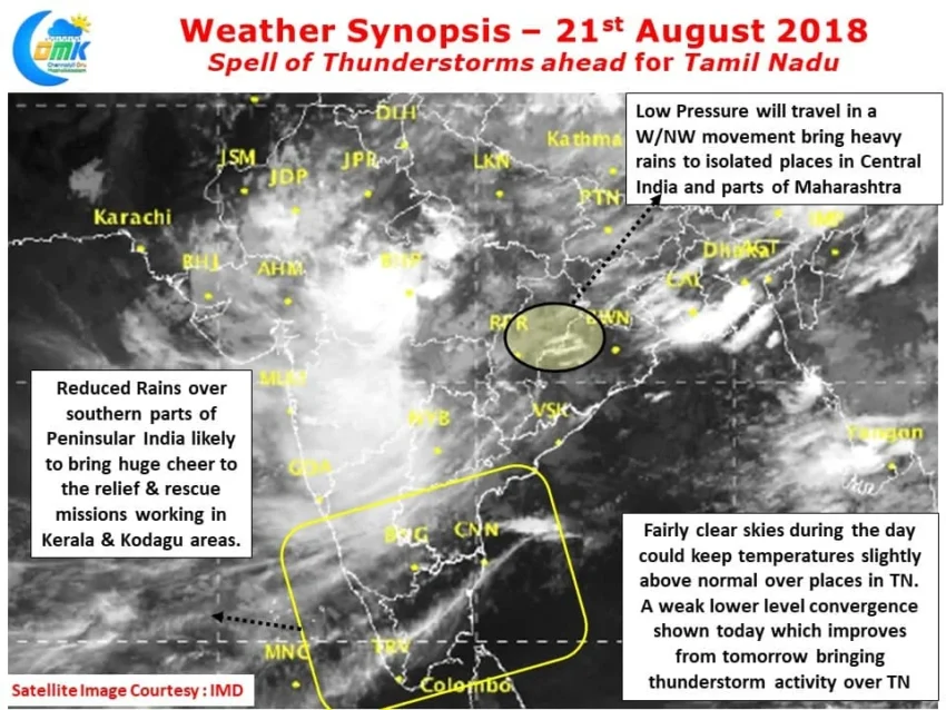
Last night saw isolated rains in Chennai and surrounding areas after what was a fairly hot day with Chennai AP recording 38.0°C, 3.3 degrees above normal and Chennai Nungambakkam recording 37.1°C, 2.3 degrees above normal for an August day. The IMD observatory at Nungambakkam recorded 14 mm bulk of it fell between 7 & 9…
Author: Chennaiyil Oru Mazhaikkaalam
Active Monsoon in West Coast increases Flood Risk
Active Monsoon in West Coast triggered by the west travelling monsoon disturbance over Central India. After maintaining its depression status for more than 48 hours, currently lying as a Well Marked Low over North Chhattisgarh & East Madhya Pradesh has indeed brought back Monsoon in West Coast after a lull of nearly fortnight. As mentioned…
Depression to bring Monsoon Mojo back
The Monsoon Depression currently lying just along the shores of North Odisha / West Bengal is likely to bring some of the Mojo back into Southwest Monsoon after a spell of weak Monsoon dynamics since the turn of August. Yesterday morning saw heavy rains lash coastal Odisha under the influence of this disturbance with Puri…
Slight Suppression in Thunderstorm activity over TN
After few days of fairly active thunderstorm activity over many parts of Tamil Nadu things are likely to go through a slightly weak phase over the next couple of days under the influence of the developing Low Pressure in North Bay area. Currently lying as an Upper Air Cyclonic Circulation & expected to deepen over…
Developing UAC provides conducive conditions for thunderstorms
The last few days have seen thunderstorms not only improve spatially but also increase in intensity providing heavy spells of rains late in the afternoon / evening to many places of Tamil Nadu. The thunderstorms have particularly intensified closer to the coast as an interplay with sea breeze front. Thursday saw some places about 40…


