
Coffee Showers, Cherry Blossom Showers, Mango Showers are some of the names associated with pre monsoon or summer thunderstorms. These rains typically start from March and continue till mid May before monsoon dynamics arrive. Over the East India these pre monsoon thunderstorms are called Norwesters or Kaalbaishakis while further East these summer thunderstorms are called Bordoisila in Assam. RMC Chennai has devised a wonderful term in Tamil “வெப்பசலன மழை” which has now attained iconic status.
In some parts of Peninsular India the end of summer often coincides with the start of summer thunderstorms. Places like Kerala, South Interior Karnataka have a pronounced relationship between Summer coming to an end as thunderstorms pick up. Over the past few weeks Peninsular India was firmly under the grip of abnormally hot temperatures during afternoons. Some pockets like Rayalaseema region in AP, West & NW Interior TN also saw heatwave conditions . Even hill stations like Udhagamandalam did not escape recording 29.4°C the highest in more than half a century.
The good news though is since 2nd May we are seeing summer thunderstorms gradually establish after much delay. Yesterday saw widespread thunderstorms that stretched from parts of Rayalaseema in AP to parts of Kerala adjoining West TN. Ensembles were consistent about this spell of increased thunderstorm activity. Our posts on 30th April which talked about heatwave coming to and end and on 5th May about Bengaluru Rains were based on the consistent indication by ensembles.
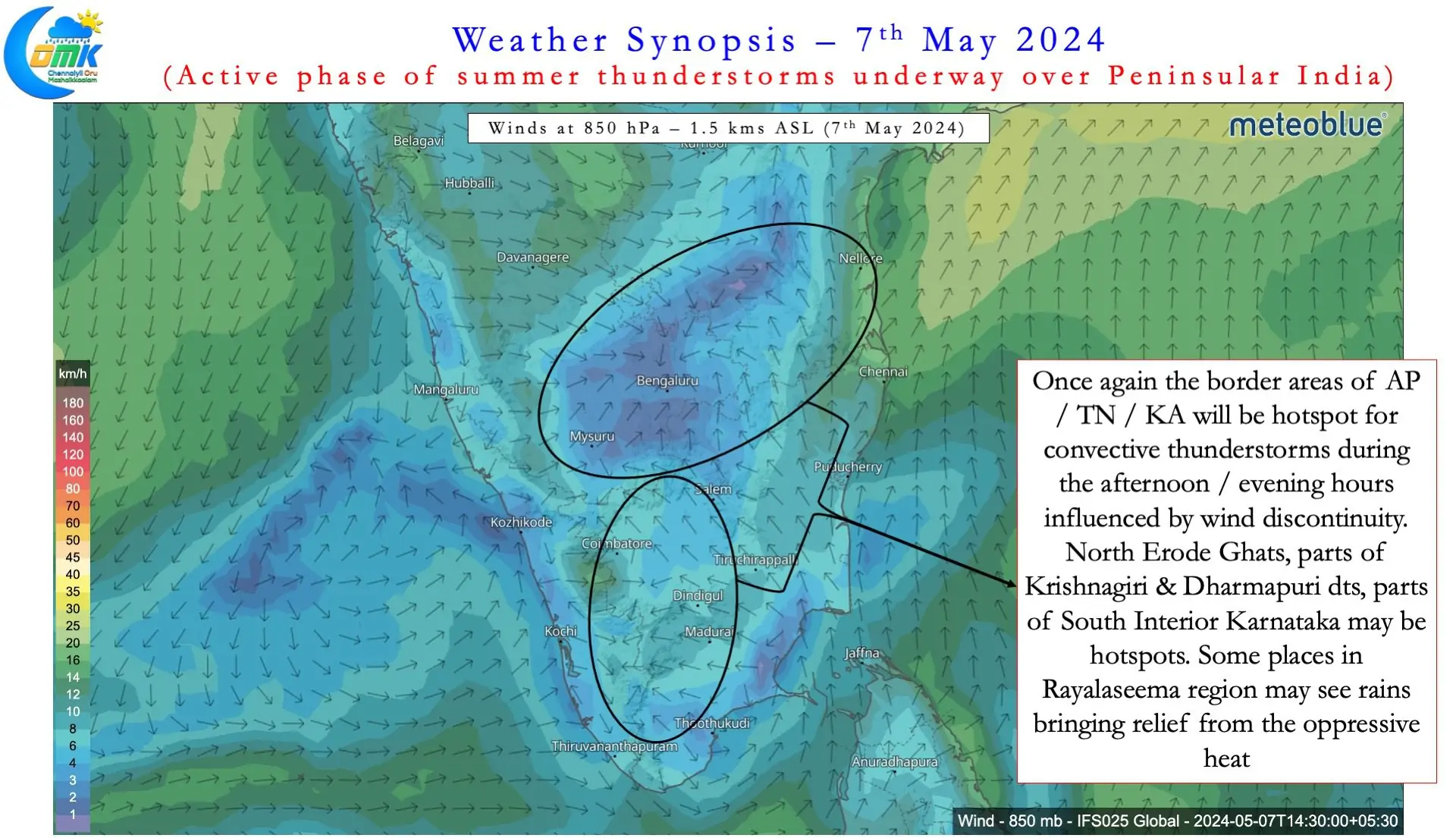
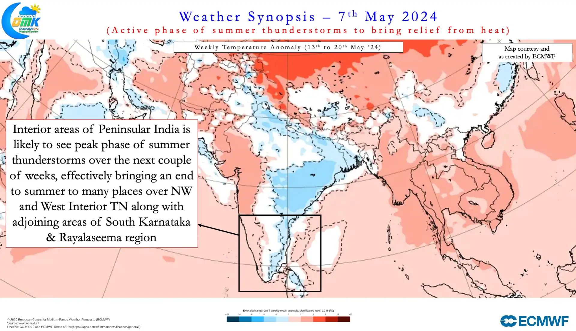
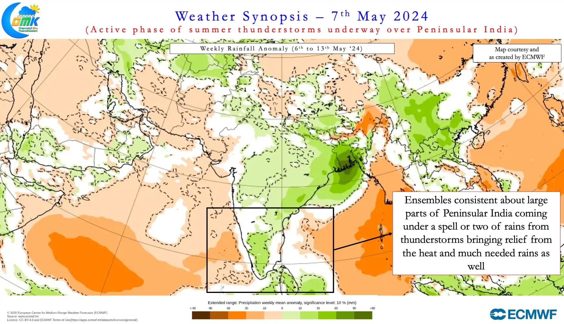
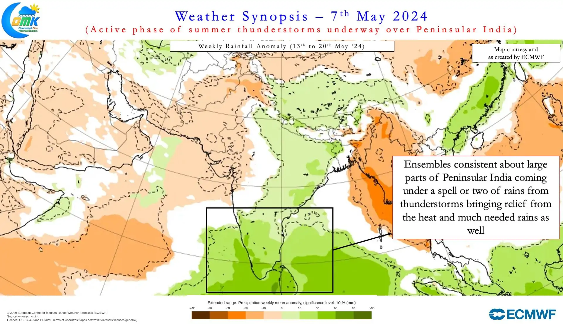
Ensembles now indicate the next couple of weeks will see an active phase of summer thunderstorms over Peninsular India. This effectively would mean not only regular rains over the interior areas of Peninsular India but also reduction in temperatures. There is increasing confidence interior areas have seen the end of heatwaves as well. Temperatures may continue to stay around 40 / 41°C for the next couple of days. A combination of wind instability and possibly an upper air cyclonic circulation is likely to make conditions conducive for thunderstorms in the coming days.
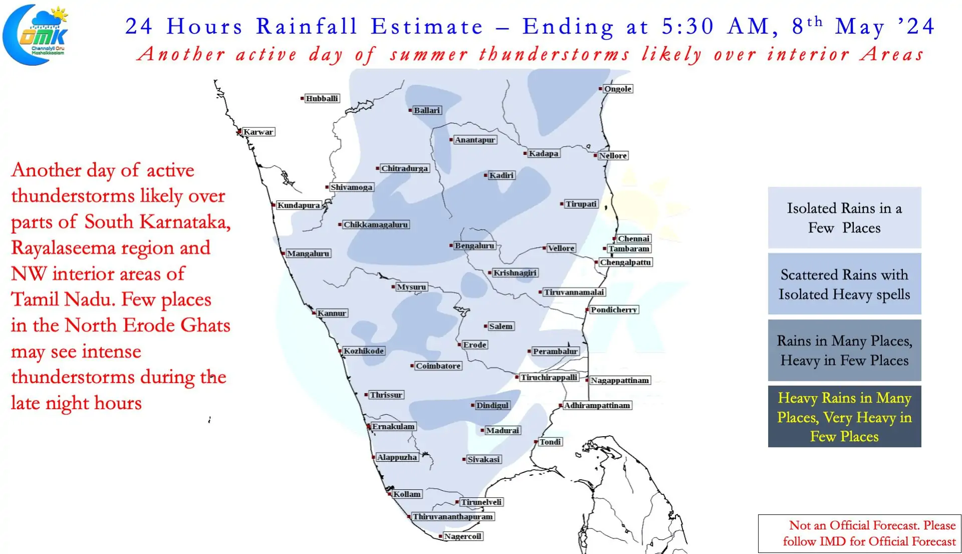
It becomes essential though to point out places in North Coastal TN like Chennai is less likely to benefit from these summer thunderstorms. But certainly there is likely to be a reduction in temperatures as winds from the East influence weather conditions. Parts of Rayalaseema, South Interior Karnataka and adjoining areas of West & NW Interior Karnataka may benefit the most. As the circulation moves further west from GOM / Comorin Sea Kerala & South TN may also receive fairly widespread rains on a few days.
As of now ensembles indicate less probability for the cyclonic circulation to descend into surface level. Models are not indicating the development of any strong disturbance either. But it may be prudent to keep a watch considering the abnormally hot sea surface temperatures over North Indian Ocean.